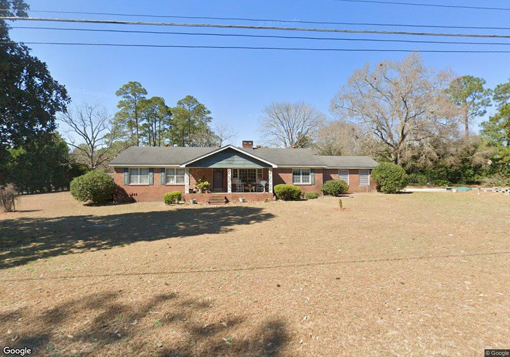
94 Seventh Ave Mc Rae, GA 31055
Estimated Value: $180,971 - $217,000
--
Bed
2
Baths
2,068
Sq Ft
$99/Sq Ft
Est. Value
About This Home
This home is located at 94 Seventh Ave, Mc Rae, GA 31055 and is currently estimated at $203,743, approximately $98 per square foot. 94 Seventh Ave is a home located in Telfair County with nearby schools including Telfair County Elementary School, Telfair County Middle School, and Telfair County High School.
Ownership History
Date
Name
Owned For
Owner Type
Purchase Details
Closed on
Jan 1, 2013
Sold by
Macdonald Shannon
Bought by
Macdonald Shannon
Current Estimated Value
Purchase Details
Closed on
Mar 14, 2003
Sold by
Secretary Of Housing
Bought by
Macdonald Shannon
Purchase Details
Closed on
Apr 2, 2002
Sold by
Gmac Mortgage
Bought by
Secretary Of Housing
Purchase Details
Closed on
Jun 5, 2000
Sold by
Dennis Mark
Bought by
Davis Mark Lawson
Purchase Details
Closed on
Jan 3, 1997
Sold by
Altman Aubrey J
Bought by
Dennis Mark
Purchase Details
Closed on
Jan 31, 1996
Bought by
Altman Aubrey J
Create a Home Valuation Report for This Property
The Home Valuation Report is an in-depth analysis detailing your home's value as well as a comparison with similar homes in the area
Home Values in the Area
Average Home Value in this Area
Purchase History
| Date | Buyer | Sale Price | Title Company |
|---|---|---|---|
| Macdonald Shannon | $117,300 | -- | |
| Macdonald Shannon | -- | -- | |
| Secretary Of Housing | $99,500 | -- | |
| Gmac Mortgage | $99,500 | -- | |
| Davis Mark Lawson | $93,500 | -- | |
| Dennis Mark | $80,000 | -- | |
| Altman Aubrey J | $92,000 | -- |
Source: Public Records
Tax History Compared to Growth
Tax History
| Year | Tax Paid | Tax Assessment Tax Assessment Total Assessment is a certain percentage of the fair market value that is determined by local assessors to be the total taxable value of land and additions on the property. | Land | Improvement |
|---|---|---|---|---|
| 2024 | $2,534 | $64,246 | $4,234 | $60,012 |
| 2023 | $2,423 | $61,344 | $4,234 | $57,110 |
| 2022 | $1,767 | $61,344 | $4,234 | $57,110 |
| 2021 | $1,263 | $42,366 | $4,234 | $38,132 |
| 2020 | $1,174 | $38,923 | $4,234 | $34,689 |
| 2019 | $1,181 | $38,923 | $4,234 | $34,689 |
| 2018 | $1,699 | $39,422 | $4,234 | $35,188 |
| 2017 | $1,176 | $38,923 | $4,234 | $34,689 |
| 2016 | $1,176 | $38,923 | $4,234 | $34,689 |
| 2015 | -- | $38,923 | $4,234 | $34,689 |
| 2014 | -- | $41,510 | $3,881 | $37,629 |
| 2013 | -- | $44,348 | $5,292 | $39,056 |
Source: Public Records
Map
Nearby Homes
- 160 W Willow Creek Ln
- 177 W Brewton St
- 15 Ben Ave
- 61 W Bruce St
- 210 W Graham St
- 78 S Second Ave
- 125 Fifth Ave
- 141 S First Ave
- 27 E Bruce St
- 0 Jackson Ave Unit 10548102
- 40 4th Ave
- 43 3rd Ave
- 36 Strozier St
- 12 Forsyth Ave
- Lot 126 Pansy Ln
- 76 E Grant St
- 22 Spring Ave
- 0 Golden Isles Pkwy Unit 10538855
- 0 Golden Isles Pkwy Unit 23395
- 0 U S 23
- 94 Seventh Ave
- 810 7th Ave
- 158 W Bruce St
- 136 W Bruce St
- 88 7th Ave
- 0 W Willow Creek Ln Unit 7022016
- 0 W Willow Creek Ln
- 122 W Willow Creek Ln
- 155 W Brewton St
- 710 W Willow Creek Ln
- 135 W Brewton St
- 101 Seventh Ave
- 2 Williams St
- 163 W Brewton St
- 128 W Bruce St
- 0 W Brewton St Unit 7188665
- W W Brewton St
- 129 W Bruce St
- 111 W Willow Creek Ln
- 705 W Willow Creek Ln