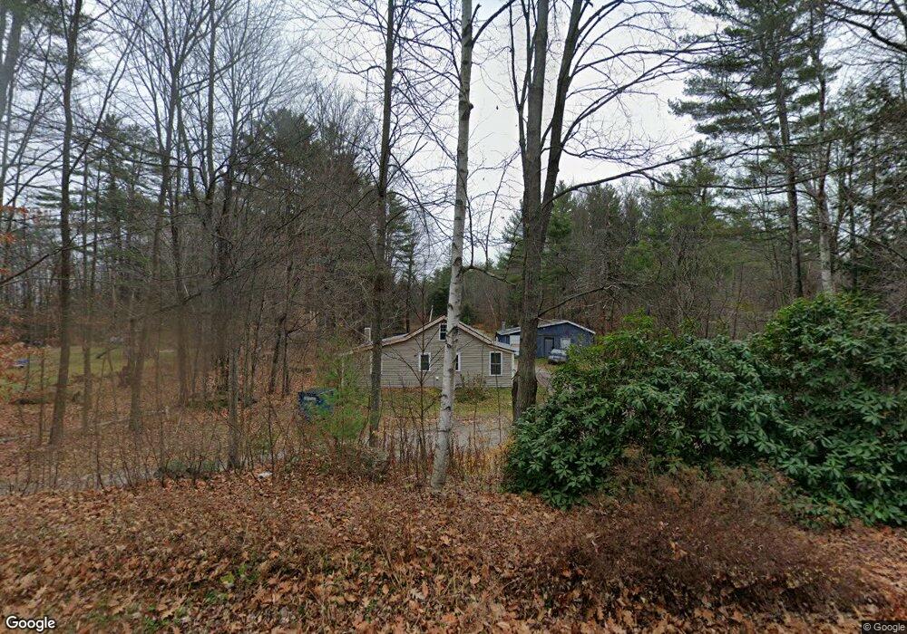
94 Whitcher Rd Newport, NH 03773
Estimated Value: $216,000 - $266,793
2
Beds
1
Bath
1,183
Sq Ft
$212/Sq Ft
Est. Value
About This Home
This home is located at 94 Whitcher Rd, Newport, NH 03773 and is currently estimated at $251,198, approximately $212 per square foot. 94 Whitcher Rd is a home located in Sullivan County with nearby schools including Richards Elementary School, Newport High School, and Newport Montessori School.
Ownership History
Date
Name
Owned For
Owner Type
Purchase Details
Closed on
Mar 1, 2006
Sold by
Blaney Jessica M
Bought by
White Michael W
Current Estimated Value
Home Financials for this Owner
Home Financials are based on the most recent Mortgage that was taken out on this home.
Original Mortgage
$80,000
Interest Rate
6.16%
Mortgage Type
Purchase Money Mortgage
Purchase Details
Closed on
Dec 16, 2003
Sold by
Chapman Norman D and Chapman Sarai
Bought by
Key Bk
Home Financials for this Owner
Home Financials are based on the most recent Mortgage that was taken out on this home.
Original Mortgage
$72,000
Interest Rate
5.9%
Mortgage Type
Purchase Money Mortgage
Create a Home Valuation Report for This Property
The Home Valuation Report is an in-depth analysis detailing your home's value as well as a comparison with similar homes in the area
Home Values in the Area
Average Home Value in this Area
Purchase History
| Date | Buyer | Sale Price | Title Company |
|---|---|---|---|
| White Michael W | $100,000 | -- | |
| Key Bk | $72,000 | -- |
Source: Public Records
Mortgage History
| Date | Status | Borrower | Loan Amount |
|---|---|---|---|
| Open | Key Bk | $104,500 | |
| Closed | Key Bk | $80,000 | |
| Previous Owner | Key Bk | $72,000 |
Source: Public Records
Tax History Compared to Growth
Tax History
| Year | Tax Paid | Tax Assessment Tax Assessment Total Assessment is a certain percentage of the fair market value that is determined by local assessors to be the total taxable value of land and additions on the property. | Land | Improvement |
|---|---|---|---|---|
| 2024 | $4,633 | $190,600 | $97,700 | $92,900 |
| 2023 | $4,494 | $190,600 | $97,700 | $92,900 |
| 2022 | $3,984 | $190,600 | $97,700 | $92,900 |
| 2021 | $3,528 | $106,900 | $49,700 | $57,200 |
| 2020 | $3,538 | $106,900 | $49,700 | $57,200 |
| 2019 | $3,477 | $106,900 | $49,700 | $57,200 |
| 2018 | $3,250 | $106,900 | $49,700 | $57,200 |
| 2017 | $3,211 | $106,900 | $49,700 | $57,200 |
| 2016 | $2,744 | $95,500 | $45,400 | $50,100 |
| 2015 | $2,793 | $95,500 | $45,400 | $50,100 |
| 2014 | $3,022 | $95,500 | $45,400 | $50,100 |
| 2013 | $2,858 | $95,300 | $45,400 | $49,900 |
Source: Public Records
Map
Nearby Homes
- 146 Elm St
- 12 4th St
- 430 John Stark Hwy
- 680-2 John Stark Hwy
- 39 Myrtle St
- 9 Depot St
- 140 and 146 N Main St
- 37 Park St
- 0 Unity Rd
- 150 S Main St
- 95-97 Cheney St
- 38 River St
- 13 Fairbanks Rd
- 736 John Stark Hwy
- 151 Cheney St
- 8 Prospect St
- 11 Putnam Rd
- 4 River View Rd Unit Lot 4 Phase II
- 44 Brook View Rd
- 45 Brook View Rd
- 90 Whitcher Rd
- 78 Whitcher Rd
- 102 Whitcher Rd
- 93 Whitcher Rd
- 74 Whitcher Rd
- 118 Whitcher Rd
- 55 Whitcher Rd
- 56 Whitcher Rd
- 126 Whitcher Rd
- 42 Whitcher Rd
- 49 Whitcher Rd
- 317 Bascom Rd
- 11 Whitcher Rd
- 359 Bascom Rd
- 310 Bascom Rd
- 342 Bascom Rd
- 358 Bascom Rd
- 0 Whitcher Rd Unit 4254704
- 371 Bascom Rd
- 351 John Stark Hwy