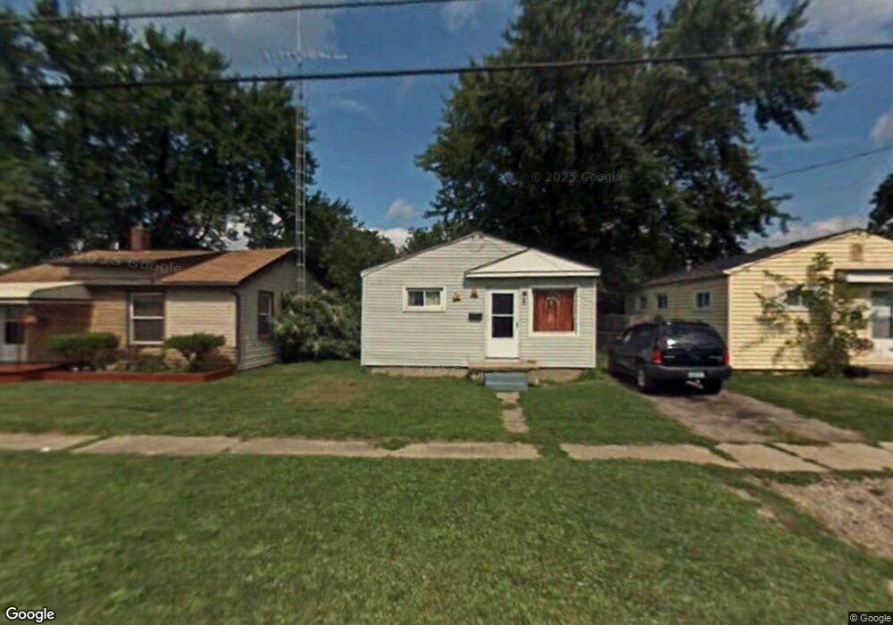
940 Markham St Flint, MI 48507
South Side NeighborhoodEstimated Value: $40,709 - $49,000
2
Beds
1
Bath
664
Sq Ft
$66/Sq Ft
Est. Value
About This Home
This home is located at 940 Markham St, Flint, MI 48507 and is currently estimated at $43,927, approximately $66 per square foot. 940 Markham St is a home located in Genesee County with nearby schools including Neithercut Elementary School, Flint Southwestern Classical Academy, and International Academy of Flint (K-12).
Ownership History
Date
Name
Owned For
Owner Type
Purchase Details
Closed on
Jul 6, 2020
Sold by
Genesee County Land Bank Authority
Bought by
Johnson Mitchell Todd
Current Estimated Value
Purchase Details
Closed on
Dec 18, 2018
Sold by
Cherry Deborah L
Bought by
Genesee County Land Bank Authority
Purchase Details
Closed on
Mar 23, 2012
Sold by
The Michael J & Jodeen R Neuhohr Joint R
Bought by
Thrower Marcs and Davis Thrower Rolanda
Purchase Details
Closed on
Oct 4, 2001
Sold by
Neurohr Michael J and Neurohr Jodeen R
Bought by
Revoc Michael J and Revoc Jodeen R Neurohr Joint
Create a Home Valuation Report for This Property
The Home Valuation Report is an in-depth analysis detailing your home's value as well as a comparison with similar homes in the area
Home Values in the Area
Average Home Value in this Area
Purchase History
| Date | Buyer | Sale Price | Title Company |
|---|---|---|---|
| Johnson Mitchell Todd | -- | None Available | |
| Genesee County Land Bank Authority | -- | None Available | |
| Thrower Marcs | $5,000 | Cislo Title Co | |
| Revoc Michael J | -- | -- |
Source: Public Records
Tax History
| Year | Tax Paid | Tax Assessment Tax Assessment Total Assessment is a certain percentage of the fair market value that is determined by local assessors to be the total taxable value of land and additions on the property. | Land | Improvement |
|---|---|---|---|---|
| 2025 | $786 | $10,800 | $0 | $0 |
| 2024 | $736 | $11,100 | $0 | $0 |
| 2023 | $726 | $8,900 | $0 | $0 |
| 2022 | $0 | $7,100 | $0 | $0 |
| 2021 | $463 | $6,400 | $0 | $0 |
| 2020 | $0 | $0 | $0 | $0 |
| 2019 | $542 | $0 | $0 | $0 |
| 2018 | $556 | $5,100 | $0 | $0 |
| 2017 | $545 | $0 | $0 | $0 |
| 2016 | $542 | $0 | $0 | $0 |
| 2015 | -- | $0 | $0 | $0 |
| 2014 | -- | $0 | $0 | $0 |
| 2012 | -- | $6,100 | $0 | $0 |
Source: Public Records
Map
Nearby Homes
- 939 Ingleside Ave
- 846 W Hemphill Rd
- 912 Huron St
- 1122 Markham St
- 3322 Fenton Rd
- 1015 Alvord Ave
- 1125 Ingleside Ave
- 1210 Pinehurst Ave
- 845 Alvord Ave
- 805 Alvord Ave
- 1234 Huron St
- 806 Alvord Ave
- 925 Leland St
- 1318 Ingleside Ave
- 1310 Huron St
- 1216 E Hemphill Rd
- 1310 Alvord Ave
- 842 Leland St
- 3902 Brunswick Ave
- 1028 Campbell St
Your Personal Tour Guide
Ask me questions while you tour the home.