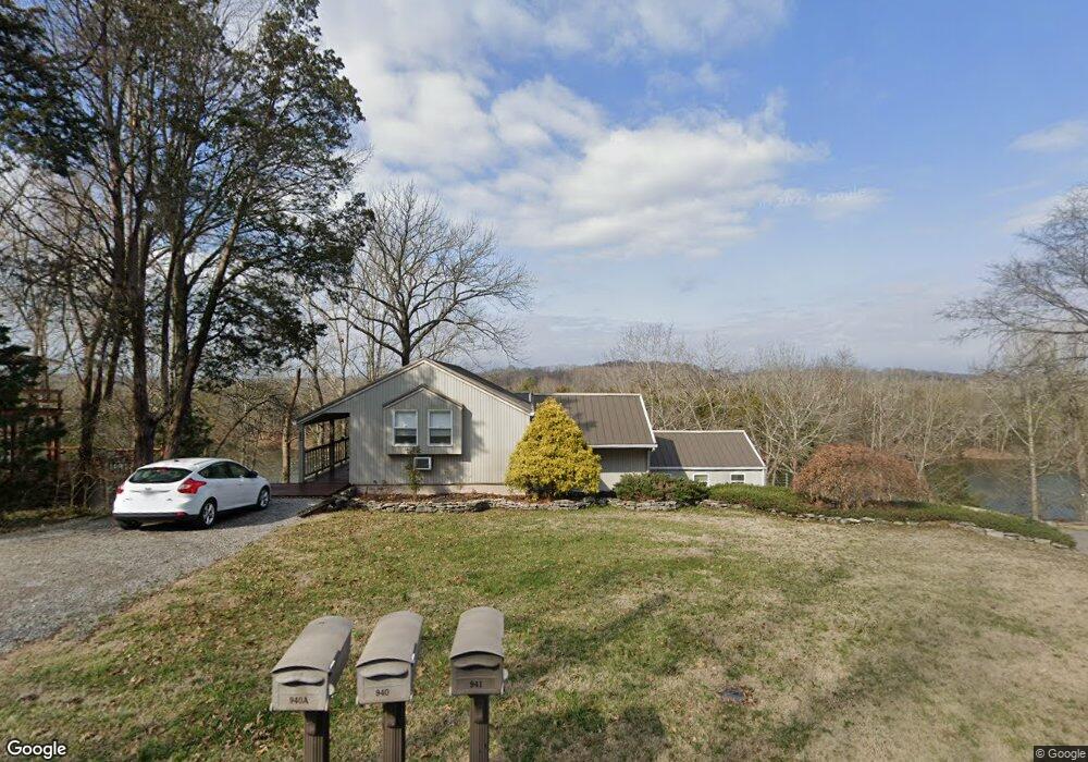
940 Misty Lake Dr Lebanon, TN 37087
Estimated Value: $572,982 - $785,000
--
Bed
2
Baths
3,436
Sq Ft
$209/Sq Ft
Est. Value
About This Home
This home is located at 940 Misty Lake Dr, Lebanon, TN 37087 and is currently estimated at $717,996, approximately $208 per square foot. 940 Misty Lake Dr is a home located in Wilson County with nearby schools including Carroll Oakland Elementary School and Lebanon High School.
Ownership History
Date
Name
Owned For
Owner Type
Purchase Details
Closed on
Jun 12, 2009
Sold by
Oliver Susan
Bought by
Perry Carol B
Current Estimated Value
Home Financials for this Owner
Home Financials are based on the most recent Mortgage that was taken out on this home.
Original Mortgage
$289,656
Outstanding Balance
$183,206
Interest Rate
4.79%
Estimated Equity
$534,790
Purchase Details
Closed on
Jun 7, 1999
Sold by
Oliver Thomas L
Bought by
Kenneth Dillard
Purchase Details
Closed on
Oct 23, 1985
Bought by
Oliver Thomas L and Oliver Susan H
Create a Home Valuation Report for This Property
The Home Valuation Report is an in-depth analysis detailing your home's value as well as a comparison with similar homes in the area
Home Values in the Area
Average Home Value in this Area
Purchase History
| Date | Buyer | Sale Price | Title Company |
|---|---|---|---|
| Perry Carol B | $295,000 | -- | |
| Kenneth Dillard | -- | -- | |
| Oliver Thomas L | -- | -- |
Source: Public Records
Mortgage History
| Date | Status | Borrower | Loan Amount |
|---|---|---|---|
| Open | Oliver Thomas L | $289,656 |
Source: Public Records
Tax History Compared to Growth
Tax History
| Year | Tax Paid | Tax Assessment Tax Assessment Total Assessment is a certain percentage of the fair market value that is determined by local assessors to be the total taxable value of land and additions on the property. | Land | Improvement |
|---|---|---|---|---|
| 2024 | $1,839 | $96,325 | $31,250 | $65,075 |
| 2022 | $1,839 | $96,325 | $31,250 | $65,075 |
| 2021 | $1,839 | $96,325 | $31,250 | $65,075 |
| 2020 | $2,505 | $96,325 | $31,250 | $65,075 |
| 2019 | $2,505 | $99,450 | $18,575 | $80,875 |
| 2018 | $2,505 | $99,450 | $18,575 | $80,875 |
| 2017 | $2,505 | $99,450 | $18,575 | $80,875 |
| 2016 | $2,491 | $98,900 | $18,575 | $80,325 |
| 2015 | $2,542 | $98,900 | $18,575 | $80,325 |
| 2014 | $1,837 | $71,456 | $0 | $0 |
Source: Public Records
Map
Nearby Homes
- 310 Ramsey Rd
- 2700 Canoe Branch Rd
- 2960 Canoe Branch Rd
- 222 Preacher Robertson Rd
- 1959 Burford Rd
- 0 Rivercrest Estates
- 140 Robertson Ln
- 95 Breeze Inn Rd
- 250 Breeze Inn Rd
- 998 Corum Hill Rd
- 690 Burford Rd
- 369 Burford Rd
- 1190 Corum Hill Rd
- 2510 Highway 231 S
- 653 Flippen Rd
- 580 Carr Rd
- 100 Philadelphia Rd
- 910 Campsite Rd
- 2022 Mann Rd
- 455 Macedonia Rd
- 970 Misty Lake Dr
- 941 Misty Lake Dr
- 900 Misty Lake Dr
- 1000 Misty Lake Dr
- 870 Misty Lake Dr
- 1020 Misty Lake Dr
- 114 North St
- 1030 Misty Lake Dr
- 1055 Misty Lake Dr
- 134 North St
- 1040 Misty Lake Dr
- 111 North St
- 375 N Lakeview Dr
- 1060 Misty Lake Dr
- 1064 Misty Lake Dr
- 1070 Misty Lake Dr
- 810 Misty Lake Dr
- 1080 Misty Lake Dr
- 1 Misty Lake Dr