Estimated Value: $434,000 - $492,000
3
Beds
1
Bath
1,300
Sq Ft
$354/Sq Ft
Est. Value
About This Home
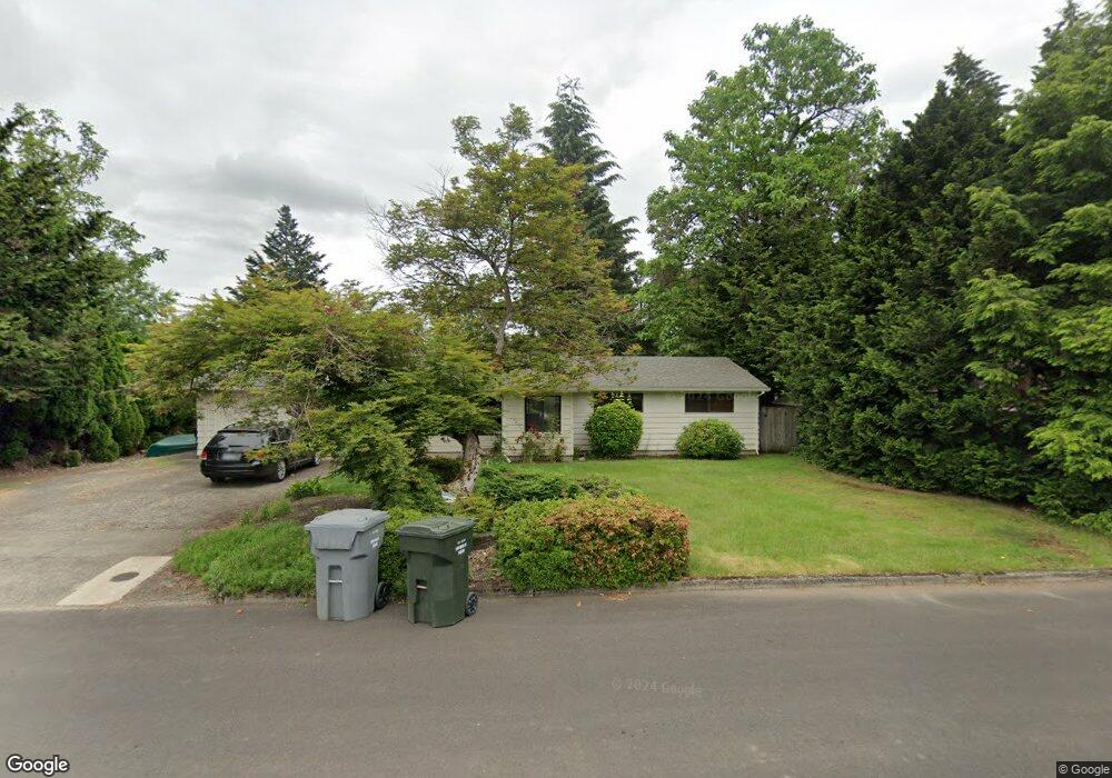
This home is located at 940 N Maple Ln, Canby, OR 97013 and is currently estimated at $460,324, approximately $354 per square foot. 940 N Maple Ln is a home located in Clackamas County with nearby schools including William Knight Elementary School, Baker Prairie Middle School, and Canby High School.
Ownership History
Date
Name
Owned For
Owner Type
Purchase Details
Closed on
Oct 3, 2011
Sold by
Carrier Sandra M
Bought by
Williamson Adam W and Williamson Sandra D
Current Estimated Value
Purchase Details
Closed on
Nov 29, 2004
Sold by
Chapman Marci A
Bought by
Carrier Sandra M
Home Financials for this Owner
Home Financials are based on the most recent Mortgage that was taken out on this home.
Original Mortgage
$146,400
Interest Rate
5.64%
Mortgage Type
Purchase Money Mortgage
Purchase Details
Closed on
Mar 12, 1998
Sold by
Johnson Angella R
Bought by
Chapman Marci A
Home Financials for this Owner
Home Financials are based on the most recent Mortgage that was taken out on this home.
Original Mortgage
$94,800
Interest Rate
7.11%
Purchase Details
Closed on
Jan 24, 1997
Sold by
Johnson Dale K
Bought by
Johnson Angella R
Create a Home Valuation Report for This Property
The Home Valuation Report is an in-depth analysis detailing your home's value as well as a comparison with similar homes in the area
Home Values in the Area
Average Home Value in this Area
Purchase History
| Date | Buyer | Sale Price | Title Company |
|---|---|---|---|
| Williamson Adam W | $167,900 | First Amer Title Ins Co Or | |
| Carrier Sandra M | $184,000 | Chicago Title Insurance Comp | |
| Chapman Marci A | $118,500 | Chicago Title Insurance Co | |
| Johnson Angella R | -- | -- |
Source: Public Records
Mortgage History
| Date | Status | Borrower | Loan Amount |
|---|---|---|---|
| Previous Owner | Carrier Sandra M | $146,400 | |
| Previous Owner | Chapman Marci A | $94,800 | |
| Closed | Carrier Sandra M | $36,600 |
Source: Public Records
Tax History Compared to Growth
Tax History
| Year | Tax Paid | Tax Assessment Tax Assessment Total Assessment is a certain percentage of the fair market value that is determined by local assessors to be the total taxable value of land and additions on the property. | Land | Improvement |
|---|---|---|---|---|
| 2025 | $3,578 | $201,938 | -- | -- |
| 2024 | $3,477 | $196,057 | -- | -- |
| 2023 | $3,477 | $190,347 | $0 | $0 |
| 2022 | $3,198 | $184,803 | $0 | $0 |
| 2021 | $3,080 | $179,421 | $0 | $0 |
| 2020 | $3,025 | $174,196 | $0 | $0 |
| 2019 | $2,881 | $169,123 | $0 | $0 |
| 2018 | $2,816 | $164,197 | $0 | $0 |
| 2017 | $2,745 | $159,415 | $0 | $0 |
| 2016 | $2,653 | $154,772 | $0 | $0 |
| 2015 | $2,562 | $150,264 | $0 | $0 |
| 2014 | $2,488 | $145,887 | $0 | $0 |
Source: Public Records
Map
Nearby Homes
- 464 NE 3rd Ave
- 184 NE 10th Ave
- 312 NE 14th Ave
- 187 NE 14th Ave
- 853 NE 17th Ave
- 835 SE 1st Ave Unit 64
- 835 SE 1st Ave Unit 14
- 835 SE 1st Ave Unit 12
- 835 SE 1st Ave Unit 17
- 844 NE 17th Ave
- 832 NE 17th Ave
- 1009 NE 17th Ave
- 620 SE 2nd Ave
- 620 SE 2nd Ave Unit 44
- 878 NE 17th Ave
- 1753 N Oak St
- 1750 N Oak St
- 1558 NE 10th Place
- 1111 SE 3rd Ave Unit 74
- 1346 NE 16th Ave
- 922 N Maple Ln
- 673 NE 10th Ave
- 713 NE 10th Ave
- 715 NE 10th Ave
- 941 N Maple Ln
- 912 N Maple Ln
- 919 N Maple Ln
- 619 NE 10th Ave
- 725 NE 10th Ave
- 658 NE 10th Ave
- 601 NE 10th Ave
- 929 N Maple Ln
- 672 NE 10th Ave
- 739 NE 10th Ave
- 911 N Maple Ln
- 723 NE 10th Ave
- 650 NE 10th Ave
- 718 NE 10th Ave
- 602 NE 10th Ave
- 751 NE 10th Ave