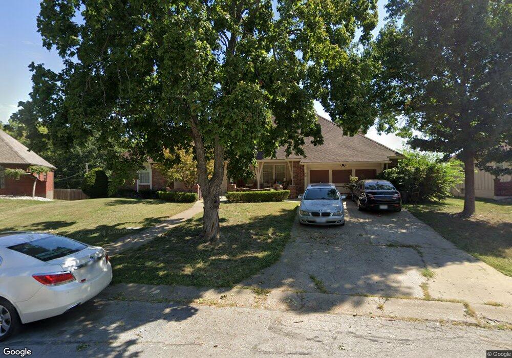
9401 Ralston Ave Kansas City, MO 64138
Highview Estates NeighborhoodEstimated Value: $282,000 - $363,000
3
Beds
3
Baths
2,716
Sq Ft
$116/Sq Ft
Est. Value
About This Home
This home is located at 9401 Ralston Ave, Kansas City, MO 64138 and is currently estimated at $315,728, approximately $116 per square foot. 9401 Ralston Ave is a home located in Jackson County with nearby schools including Truman Elementary School, St Regis School, and Islamic School of Greater Kansas City.
Ownership History
Date
Name
Owned For
Owner Type
Purchase Details
Closed on
Jun 28, 2007
Sold by
Hines Roland R and Hines Ruth A
Bought by
Porter Harold L and Porter Danielle L
Current Estimated Value
Home Financials for this Owner
Home Financials are based on the most recent Mortgage that was taken out on this home.
Original Mortgage
$207,288
Outstanding Balance
$126,838
Interest Rate
6.19%
Mortgage Type
Purchase Money Mortgage
Estimated Equity
$188,890
Purchase Details
Closed on
Sep 13, 2000
Sold by
Friedley Aubrey L
Bought by
Friedley Aubrey L
Create a Home Valuation Report for This Property
The Home Valuation Report is an in-depth analysis detailing your home's value as well as a comparison with similar homes in the area
Home Values in the Area
Average Home Value in this Area
Purchase History
| Date | Buyer | Sale Price | Title Company |
|---|---|---|---|
| Porter Harold L | -- | Stewart Title Of Kansas City | |
| Friedley Aubrey L | -- | -- |
Source: Public Records
Mortgage History
| Date | Status | Borrower | Loan Amount |
|---|---|---|---|
| Open | Porter Harold L | $207,288 |
Source: Public Records
Tax History Compared to Growth
Tax History
| Year | Tax Paid | Tax Assessment Tax Assessment Total Assessment is a certain percentage of the fair market value that is determined by local assessors to be the total taxable value of land and additions on the property. | Land | Improvement |
|---|---|---|---|---|
| 2025 | $4,800 | $58,044 | $6,259 | $51,785 |
| 2024 | $4,713 | $55,448 | $4,387 | $51,061 |
| 2023 | $4,713 | $55,448 | $5,493 | $49,955 |
| 2022 | $4,346 | $43,890 | $6,099 | $37,791 |
| 2021 | $3,749 | $43,890 | $6,099 | $37,791 |
| 2020 | $3,769 | $41,708 | $6,099 | $35,609 |
| 2019 | $3,564 | $41,708 | $6,099 | $35,609 |
| 2018 | $3,322 | $36,299 | $5,308 | $30,991 |
| 2017 | $3,335 | $36,299 | $5,308 | $30,991 |
| 2016 | $3,335 | $35,390 | $4,820 | $30,570 |
| 2014 | $3,234 | $34,696 | $4,725 | $29,971 |
Source: Public Records
Map
Nearby Homes
- 9420 Ralston Ave
- 10500 E Bannister Rd
- 10321 E 95th Terrace
- 10907 E 98th Terrace
- 9425 E 90th Terrace
- 9721 Elm Ave
- 9525 Manning Ave
- 8512 Maywood Ave
- 8505 Pershing Rd
- 8618 Arlington Ave
- 9033 E 90th Terrace
- 8827 Larson Ave
- 9109 E 89th St
- 8400 Willow Way
- 9901 E 85th St
- 8531 Vassar Ave
- 8421 Hawthorne Place
- 8324 Hedges Ave
- 8324 Pershing Rd
- 8529 Crescent Ave
- 10512 E 94th St
- 9405 Ralston Ave
- 10505 E 94th St
- 10508 E 94th St
- 9404 Ralston Ave
- 9409 Ralston Ave
- 10504 E 94th St
- 9408 Ralston Ave
- 9413 Ralston Ave
- 9401 Olmstead Rd
- 10500 E 94th St
- 9412 Ralston Ave
- 9405 Olmstead Rd
- 9409 Olmstead Rd
- 9417 Ralston Ave
- 9416 Ralston Ave
- 9341 Olmstead Rd
- 9413 Olmstead Rd
- 9421 Ralston Ave
- 9332 Stubbs Rd