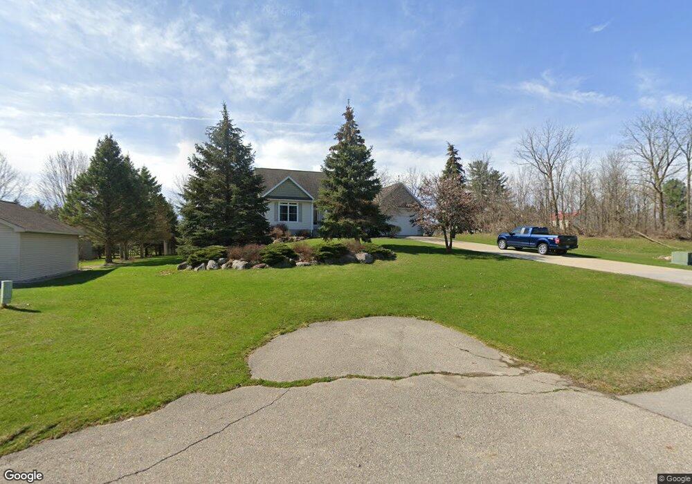
9402 W Pierson Rd Flushing, MI 48433
Estimated Value: $335,850 - $423,000
Studio
1
Bath
2,030
Sq Ft
$187/Sq Ft
Est. Value
About This Home
This home is located at 9402 W Pierson Rd, Flushing, MI 48433 and is currently estimated at $379,463, approximately $186 per square foot. 9402 W Pierson Rd is a home located in Genesee County with nearby schools including Central Elementary School, Flushing Middle School, and Flushing High School.
Ownership History
Date
Name
Owned For
Owner Type
Purchase Details
Closed on
Aug 27, 2021
Sold by
Whitcomb Robert G
Bought by
Militello Barbara A
Current Estimated Value
Purchase Details
Closed on
Dec 15, 2020
Sold by
Whitcomb Robert G
Bought by
Whitcomb Barbara A
Home Financials for this Owner
Home Financials are based on the most recent Mortgage that was taken out on this home.
Original Mortgage
$203,000
Interest Rate
2.7%
Mortgage Type
New Conventional
Create a Home Valuation Report for This Property
The Home Valuation Report is an in-depth analysis detailing your home's value as well as a comparison with similar homes in the area
Home Values in the Area
Average Home Value in this Area
Purchase History
| Date | Buyer | Sale Price | Title Company |
|---|---|---|---|
| Militello Barbara A | -- | None Listed On Document | |
| Whitcomb Barbara A | -- | Bell Title Company |
Source: Public Records
Mortgage History
| Date | Status | Borrower | Loan Amount |
|---|---|---|---|
| Previous Owner | Whitcomb Barbara A | $203,000 |
Source: Public Records
Tax History
| Year | Tax Paid | Tax Assessment Tax Assessment Total Assessment is a certain percentage of the fair market value that is determined by local assessors to be the total taxable value of land and additions on the property. | Land | Improvement |
|---|---|---|---|---|
| 2025 | $4,330 | $215,100 | $0 | $0 |
| 2024 | $2,367 | $209,300 | $0 | $0 |
| 2023 | $2,259 | $192,300 | $0 | $0 |
| 2022 | $3,855 | $169,900 | $0 | $0 |
| 2021 | $3,813 | $159,700 | $0 | $0 |
| 2020 | $2,102 | $151,500 | $0 | $0 |
| 2019 | $2,079 | $140,100 | $0 | $0 |
| 2018 | $3,573 | $115,600 | $0 | $0 |
| 2017 | $1,841 | $115,600 | $0 | $0 |
| 2016 | $3,267 | $110,300 | $0 | $0 |
| 2015 | $3,099 | $107,300 | $0 | $0 |
| 2014 | $1,811 | $102,200 | $0 | $0 |
| 2012 | -- | $95,600 | $95,600 | $0 |
Source: Public Records
Map
Nearby Homes
- 219 Primrose Ln
- 3500 Woodridge Ct
- 100 Aberdeen Dr Unit 36
- 229 Aberdeen Ct
- 241 Aberdeen Ct Unit 11 bldg 6
- 6289 W River Rd
- 315 N Maple St
- 501 Spring Ln
- 0 W Pierson Rd Unit 50141989
- 0 Winters Eave Dr Unit 50117986
- 0 E River Rd Unit 50180952
- 113 N Mckinley Rd
- 608 Autumn Dr
- 3155 Beech Tree Ln
- 10101 Carpenter Rd
- 527 Oakbrook Cir Unit 14
- 000 Potter Rd
- 530 Coutant St
- 516 Sunnyslope Dr
- 200 Boman St
- 9402 W Pierson Rd
- 224 Primrose Ln
- 218 Primrose Ln
- 228 Primrose Ln
- 9420 W Pierson Rd
- 6122 W Pierson - Unit 7 Rd
- 214 Primrose Ln
- 232 Primrose Ln
- 9436 W Pierson Rd
- 210 Primrose Ln
- 223 Primrose Ln
- 4418 W Pierson Rd
- 215 Primrose Ln
- 229 Primrose Ln
- 206 Primrose Ln
- 211 Primrose Ln
- 9446 W Pierson Rd
- 233 Primrose Ln
- 705 W Pierson Rd
- 207 Primrose Ln
Your Personal Tour Guide
Ask me questions while you tour the home.