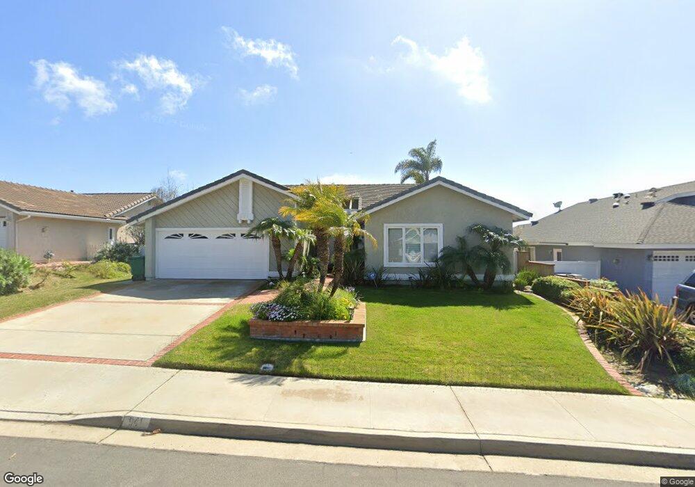
941 Daisy Ave Carlsbad, CA 92011
Poinsettia NeighborhoodEstimated Value: $1,575,000 - $1,752,000
3
Beds
2
Baths
1,766
Sq Ft
$945/Sq Ft
Est. Value
About This Home
This home is located at 941 Daisy Ave, Carlsbad, CA 92011 and is currently estimated at $1,668,041, approximately $944 per square foot. 941 Daisy Ave is a home located in San Diego County with nearby schools including Aviara Oaks Elementary, Aviara Oaks Middle, and Carlsbad High School.
Ownership History
Date
Name
Owned For
Owner Type
Purchase Details
Closed on
Mar 24, 2009
Sold by
Beeal Frank S
Bought by
Law Gary H and Law Yvonne M
Current Estimated Value
Purchase Details
Closed on
Jun 1, 2005
Sold by
Beeal Frank S and Beeal Nancy E
Bought by
Beeal Frank S and Beeal Nancy E
Purchase Details
Closed on
Oct 19, 1993
Sold by
Arnold Victor E and Arnold Patty E
Bought by
Beeal Frank S and Beeal Nancy E
Home Financials for this Owner
Home Financials are based on the most recent Mortgage that was taken out on this home.
Original Mortgage
$171,850
Interest Rate
3.75%
Purchase Details
Closed on
Sep 5, 1986
Create a Home Valuation Report for This Property
The Home Valuation Report is an in-depth analysis detailing your home's value as well as a comparison with similar homes in the area
Home Values in the Area
Average Home Value in this Area
Purchase History
We collect this data history from publicly available records. To have your information removed, we recommend requesting removal directly through your county’s website.
| Date | Buyer | Sale Price | Title Company |
|---|---|---|---|
| Law Gary H | $590,000 | First American Title | |
| Beeal Frank S | -- | -- | |
| Beeal Frank S | $245,500 | South Coast Title | |
| -- | $155,000 | -- |
Source: Public Records
Mortgage History
We collect this data history from publicly available records. To have your information removed, we recommend requesting removal directly through your county’s website.
| Date | Status | Borrower | Loan Amount |
|---|---|---|---|
| Previous Owner | Beeal Frank S | $171,850 |
Source: Public Records
Tax History
| Year | Tax Paid | Tax Assessment Tax Assessment Total Assessment is a certain percentage of the fair market value that is determined by local assessors to be the total taxable value of land and additions on the property. | Land | Improvement |
|---|---|---|---|---|
| 2025 | $8,368 | $793,367 | $547,291 | $246,076 |
| 2024 | $8,368 | $777,811 | $536,560 | $241,251 |
| 2023 | $8,326 | $762,561 | $526,040 | $236,521 |
| 2022 | $8,198 | $747,610 | $515,726 | $231,884 |
| 2021 | $8,137 | $732,952 | $505,614 | $227,338 |
| 2020 | $8,083 | $725,437 | $500,430 | $225,007 |
| 2019 | $7,937 | $711,214 | $490,618 | $220,596 |
| 2018 | $7,604 | $697,270 | $480,999 | $216,271 |
| 2017 | $90 | $683,599 | $471,568 | $212,031 |
| 2016 | $7,179 | $670,196 | $462,322 | $207,874 |
| 2015 | $7,151 | $660,130 | $455,378 | $204,752 |
| 2014 | $7,032 | $647,200 | $446,458 | $200,742 |
Source: Public Records
Map
Nearby Homes
- 1005 Canvasback Ct
- 7053 Snapdragon Dr
- 7102 Primrose Way
- 7205 Daffodil Place
- 917 Anatra Ct
- 7302 Lantana Terrace
- 957 Fir Tree Place
- 1312 Corvidae St
- 7327 Linden Terrace
- 6859 Pear Tree Dr
- 7041 Crane Ct Unit 6
- 7104 Aviara Dr
- 7180 Aviara Dr
- 7206 Aviara Dr
- 7521 Navigator Cir
- 7100 Surfbird Cir
- 7073 Surfbird Cir
- 7209 San Luis St Unit 169
- 7025 San Bartolo St Unit 42
- 7026 San Bartolo St Unit 18
Your Personal Tour Guide
Ask me questions while you tour the home.