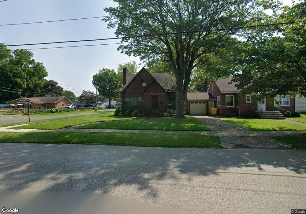
941 Main St Conneaut, OH 44030
Estimated Value: $167,000 - $187,000
3
Beds
2
Baths
1,240
Sq Ft
$139/Sq Ft
Est. Value
About This Home
This home is located at 941 Main St, Conneaut, OH 44030 and is currently estimated at $172,282, approximately $138 per square foot. 941 Main St is a home located in Ashtabula County with nearby schools including Lakeshore Primary Elementary School, Gateway Elementary School, and Conneaut Middle School.
Ownership History
Date
Name
Owned For
Owner Type
Purchase Details
Closed on
Feb 10, 2017
Sold by
Wojtowicz Stanley and Wojtowicz Marcheta V
Bought by
Bartone Christopher R and Bartone Michelle
Current Estimated Value
Home Financials for this Owner
Home Financials are based on the most recent Mortgage that was taken out on this home.
Original Mortgage
$85,025
Outstanding Balance
$70,239
Interest Rate
4.12%
Mortgage Type
New Conventional
Estimated Equity
$102,043
Purchase Details
Closed on
Aug 25, 2005
Sold by
Landis Larry Paul and Landis Anita Lynne
Bought by
Wojtowicz Stanley and Wojtowicz Marcheta
Home Financials for this Owner
Home Financials are based on the most recent Mortgage that was taken out on this home.
Original Mortgage
$88,800
Interest Rate
5.8%
Mortgage Type
Fannie Mae Freddie Mac
Create a Home Valuation Report for This Property
The Home Valuation Report is an in-depth analysis detailing your home's value as well as a comparison with similar homes in the area
Home Values in the Area
Average Home Value in this Area
Purchase History
| Date | Buyer | Sale Price | Title Company |
|---|---|---|---|
| Bartone Christopher R | $89,500 | Venture Title | |
| Wojtowicz Stanley | $93,500 | Cleveland Home Title Agency |
Source: Public Records
Mortgage History
| Date | Status | Borrower | Loan Amount |
|---|---|---|---|
| Open | Bartone Christopher R | $85,025 | |
| Closed | Wojtowicz Stanley | $88,800 |
Source: Public Records
Tax History Compared to Growth
Tax History
| Year | Tax Paid | Tax Assessment Tax Assessment Total Assessment is a certain percentage of the fair market value that is determined by local assessors to be the total taxable value of land and additions on the property. | Land | Improvement |
|---|---|---|---|---|
| 2024 | $3,306 | $45,190 | $4,730 | $40,460 |
| 2023 | $2,097 | $45,190 | $4,730 | $40,460 |
| 2022 | $1,772 | $33,600 | $3,640 | $29,960 |
| 2021 | $1,803 | $33,600 | $3,640 | $29,960 |
| 2020 | $1,802 | $33,600 | $3,640 | $29,960 |
| 2019 | $1,433 | $26,220 | $1,930 | $24,290 |
| 2018 | $1,367 | $26,220 | $1,930 | $24,290 |
| 2017 | $905 | $26,220 | $1,930 | $24,290 |
| 2016 | $889 | $27,340 | $1,930 | $25,410 |
| 2015 | $898 | $27,340 | $1,930 | $25,410 |
| 2014 | $791 | $27,340 | $1,930 | $25,410 |
| 2013 | $726 | $26,290 | $2,870 | $23,420 |
Source: Public Records
Map
Nearby Homes
- 855 Spring St Unit S9
- 247 Whitney St
- 18 Hillcrest Ct
- 589 Main St
- 210 W Main Rd
- 202 W Main Rd Unit 49
- 202 W Main Rd Unit Lot 150
- 202 W Main Rd Unit 33
- 202 W Main Rd Unit 16
- 536 Madison St
- 455 Main St
- 251 St Rt 7
- 474 Sherman St
- VL Center Rd
- 220 Daniels Ave
- 429 Depot St
- 459 Mill St
- 1145 Lake Rd
- 0 Chestnut St Unit 5120761
- 405 Bliss Ave