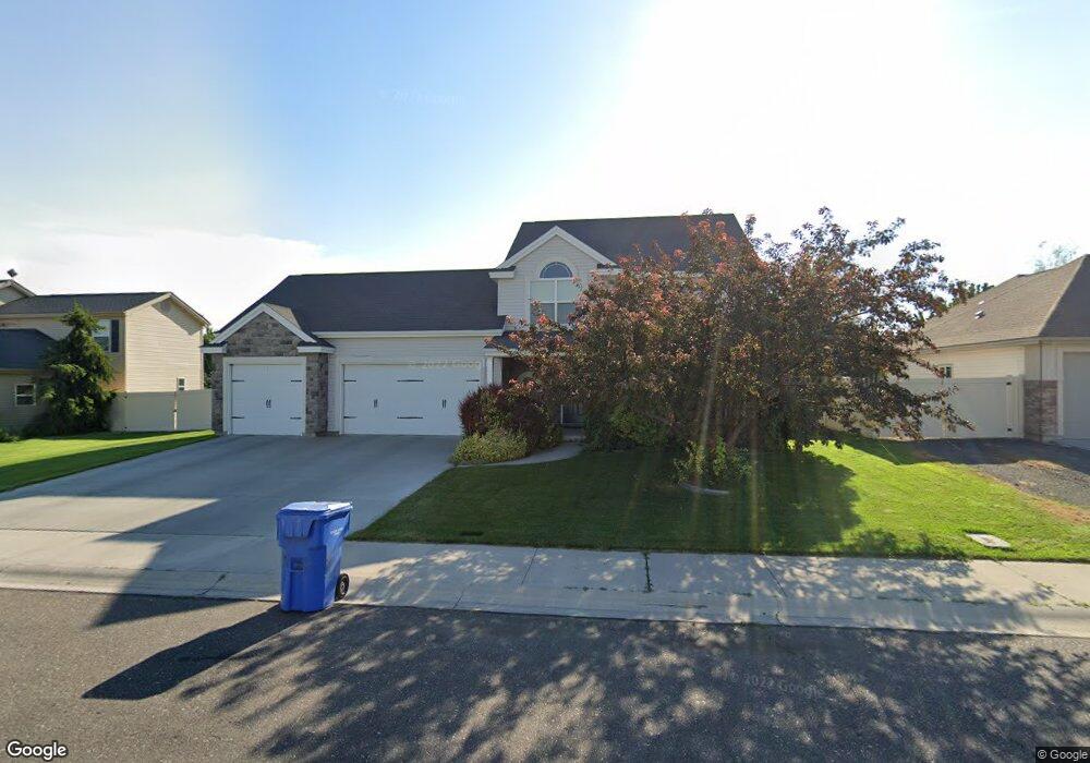
941 Misty Meadows Trail Twin Falls, ID 83301
Estimated Value: $480,298 - $505,000
4
Beds
3
Baths
2,347
Sq Ft
$212/Sq Ft
Est. Value
About This Home
This home is located at 941 Misty Meadows Trail, Twin Falls, ID 83301 and is currently estimated at $497,575, approximately $212 per square foot. 941 Misty Meadows Trail is a home located in Twin Falls County with nearby schools including Rock Creek Elementary School, Robert Stuart Junior High School, and Canyon Ridge High School.
Ownership History
Date
Name
Owned For
Owner Type
Purchase Details
Closed on
May 14, 2021
Sold by
Bondelid Nate A and Bondelid Anna M
Bought by
Iron Estate Llc
Current Estimated Value
Purchase Details
Closed on
Apr 22, 2020
Sold by
Bondelid Nathaniel and Bondelid Anna Marie
Bought by
Bondelid Nate A and Bondelid Anna M
Home Financials for this Owner
Home Financials are based on the most recent Mortgage that was taken out on this home.
Original Mortgage
$204,500
Interest Rate
3.3%
Mortgage Type
New Conventional
Purchase Details
Closed on
Feb 29, 2008
Sold by
Wills Inc
Bought by
Bondelid Nathaniel and Bondelid Anna Marie
Home Financials for this Owner
Home Financials are based on the most recent Mortgage that was taken out on this home.
Original Mortgage
$262,010
Interest Rate
5.37%
Mortgage Type
Adjustable Rate Mortgage/ARM
Create a Home Valuation Report for This Property
The Home Valuation Report is an in-depth analysis detailing your home's value as well as a comparison with similar homes in the area
Home Values in the Area
Average Home Value in this Area
Purchase History
| Date | Buyer | Sale Price | Title Company |
|---|---|---|---|
| Iron Estate Llc | -- | Accommodation | |
| Bondelid Nate A | -- | Twinone | |
| Bondelid Nathaniel | -- | Twin Falls Title |
Source: Public Records
Mortgage History
| Date | Status | Borrower | Loan Amount |
|---|---|---|---|
| Previous Owner | Bondelid Nate A | $204,500 | |
| Previous Owner | Bondelid Nathaniel | $262,010 |
Source: Public Records
Tax History Compared to Growth
Tax History
| Year | Tax Paid | Tax Assessment Tax Assessment Total Assessment is a certain percentage of the fair market value that is determined by local assessors to be the total taxable value of land and additions on the property. | Land | Improvement |
|---|---|---|---|---|
| 2025 | $4,573 | $425,977 | $75,117 | $350,860 |
| 2024 | $4,574 | $425,977 | $75,117 | $350,860 |
| 2023 | $4,681 | $447,631 | $75,117 | $372,514 |
| 2022 | $5,133 | $448,311 | $72,145 | $376,166 |
| 2021 | $5,269 | $349,977 | $72,145 | $277,832 |
| 2020 | $4,536 | $297,313 | $61,711 | $235,602 |
| 2019 | $5,297 | $296,687 | $67,065 | $229,622 |
| 2018 | $5,112 | $272,986 | $41,528 | $231,458 |
| 2017 | $4,671 | $249,190 | $41,528 | $207,662 |
| 2016 | $4,353 | $217,141 | $0 | $0 |
| 2015 | $4,235 | $217,141 | $41,528 | $175,613 |
| 2012 | -- | $199,553 | $0 | $0 |
Source: Public Records
Map
Nearby Homes
- 831 Grace Dr W
- 1378 Misty Meadows Ct
- 805 Drayton Ave
- 1085 Easy Ave
- 1087 Easy Ave
- 1143 Langford Way
- 1605 Grandview Dr N
- 612 Northern Pine Ct
- 916 Kenbrook Loop
- 1139 Frank Henry Rd
- 1207 Frank Henry Rd
- 905 Birchton Loop
- 1295 Terra Ave
- 551 Park Meadows Cir
- 1228 Creekside Way
- 1196 Creekside Way
- 946 Kenbrook Loop
- 1295 Starlight Loop
- 973 Kenbrook Loop
- 1146 Creekside Way
- 931 Misty Meadows Trail
- 949 Misty Meadows Trail
- 919 Misty Meadows Trail
- 957 Misty Meadows Trail
- 932 Misty Meadows Trail
- 944 Misty Meadows Trail
- 879 N Pointe Dr
- 891 N Pointe Dr
- 920 Misty Meadows Trail
- 965 Misty Meadows Trail
- 1336 Silver Creek Way
- 982 Misty Meadows Trail
- 890 N Pointe Dr
- 973 Misty Meadows Trail
- 1364 Silver Creek Way
- 873 N Pointe Dr
- 1326 Grandview Dr N
- 912 River Mist Path
- 867 N Pointe Dr
- 1372 Silver Creek Way