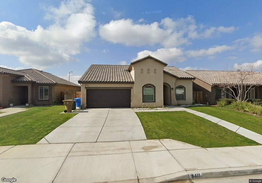
9411 Wellfleet Dr Bakersfield, CA 93313
Panama NeighborhoodEstimated Value: $419,974 - $463,000
4
Beds
2
Baths
1,780
Sq Ft
$249/Sq Ft
Est. Value
About This Home
This home is located at 9411 Wellfleet Dr, Bakersfield, CA 93313 and is currently estimated at $443,494, approximately $249 per square foot. 9411 Wellfleet Dr is a home with nearby schools including Bill L. Williams Elementary School, Stonecreek Junior High School, and Ridgeview High School.
Ownership History
Date
Name
Owned For
Owner Type
Purchase Details
Closed on
Aug 3, 2016
Sold by
Lennar Fresno Inc
Bought by
Mirzai Victor Fatollah
Current Estimated Value
Home Financials for this Owner
Home Financials are based on the most recent Mortgage that was taken out on this home.
Original Mortgage
$253,792
Outstanding Balance
$202,627
Interest Rate
3.5%
Mortgage Type
FHA
Estimated Equity
$240,867
Create a Home Valuation Report for This Property
The Home Valuation Report is an in-depth analysis detailing your home's value as well as a comparison with similar homes in the area
Home Values in the Area
Average Home Value in this Area
Purchase History
| Date | Buyer | Sale Price | Title Company |
|---|---|---|---|
| Mirzai Victor Fatollah | $258,500 | North American Title Company |
Source: Public Records
Mortgage History
| Date | Status | Borrower | Loan Amount |
|---|---|---|---|
| Open | Mirzai Victor Fatollah | $253,792 |
Source: Public Records
Tax History
| Year | Tax Paid | Tax Assessment Tax Assessment Total Assessment is a certain percentage of the fair market value that is determined by local assessors to be the total taxable value of land and additions on the property. | Land | Improvement |
|---|---|---|---|---|
| 2025 | $4,238 | $299,425 | $58,026 | $241,399 |
| 2024 | $4,162 | $293,555 | $56,889 | $236,666 |
| 2023 | $4,162 | $287,800 | $55,774 | $232,026 |
| 2022 | $3,993 | $282,158 | $54,681 | $227,477 |
| 2021 | $3,863 | $276,626 | $53,609 | $223,017 |
| 2020 | $3,807 | $273,791 | $53,060 | $220,731 |
| 2019 | $3,756 | $273,791 | $53,060 | $220,731 |
| 2018 | $3,496 | $263,160 | $51,000 | $212,160 |
| 2017 | $3,494 | $258,000 | $50,000 | $208,000 |
| 2016 | $389 | $23,047 | $23,047 | $0 |
Source: Public Records
Map
Nearby Homes
- 6405 Thorton Ave
- 6225 Thorton Ave
- 9000 Farmington Way
- 5918 Esmerelda Ave
- 10000 Fitchburg Dr
- 5831 Mardal Ave
- 5808 Esmerelda Ave
- 6009 Moonstone Peak Dr
- 5805 Moonstone Peak Dr
- 5612 Mckee Rd
- 5414 Red Wheat Ave
- 8216 Coral Point Ct
- 9506 Orchard Grass Ct
- 6003 Vespucci Ave
- 5917 Vespucci Ave
- 6203 Caruso Ave
- 6113 Caruso Ave
- 9113 Miranda Garden St
- 8519 March Violets Ave
- 8525 March Violets Ave
- 9407 Wellfleet Dr
- 9403 Wellfleet Dr
- 9419 Wellfleet Dr
- 9410 Wellfleet Dr
- 9406 Wellfleet Dr
- 9414 Wellfleet Dr
- 9402 Wellfleet Dr
- 9423 Wellfleet Dr
- 9319 Wellfleet Dr
- 6320 Hathaway Ave
- 6315 Provincetown Ave
- 6405 Hathaway Ave
- 6408 Provincetown Ave
- 9313 Wellfleet Dr
- 6401 Hathaway Ave
- 6314 Hathaway Ave
- 6402 Provincetown Ave
- 6309 Provincetown Ave
- 6317 Hathaway Ave
- 9307 Wellfleet Dr
Your Personal Tour Guide
Ask me questions while you tour the home.