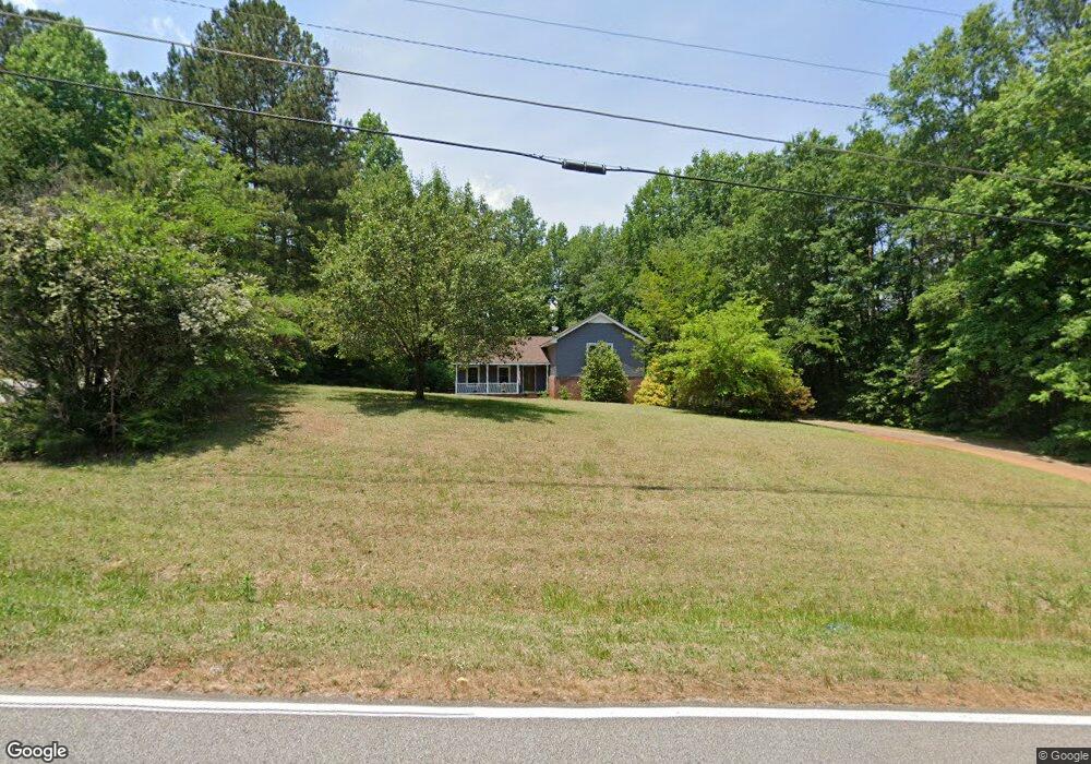
942 Fernside Dr Toccoa, GA 30577
Estimated Value: $276,000 - $310,000
2
Beds
3
Baths
1,788
Sq Ft
$166/Sq Ft
Est. Value
About This Home
This home is located at 942 Fernside Dr, Toccoa, GA 30577 and is currently estimated at $296,061, approximately $165 per square foot. 942 Fernside Dr is a home located in Stephens County with nearby schools including Stephens County High School.
Ownership History
Date
Name
Owned For
Owner Type
Purchase Details
Closed on
Nov 5, 2021
Sold by
Hartwell Stephen Anson Estate
Bought by
Hartwell Catharine
Current Estimated Value
Purchase Details
Closed on
Aug 15, 2001
Bought by
Hartwell Stephen and Hartwell Catharine
Purchase Details
Closed on
Jun 1, 1998
Bought by
<Buyer Info Not Present>
Create a Home Valuation Report for This Property
The Home Valuation Report is an in-depth analysis detailing your home's value as well as a comparison with similar homes in the area
Purchase History
| Date | Buyer | Sale Price | Title Company |
|---|---|---|---|
| Hartwell Catharine | -- | -- | |
| Hartwell Stephen | $108,000 | -- | |
| <Buyer Info Not Present> | $77,500 | -- |
Source: Public Records
Tax History
| Year | Tax Paid | Tax Assessment Tax Assessment Total Assessment is a certain percentage of the fair market value that is determined by local assessors to be the total taxable value of land and additions on the property. | Land | Improvement |
|---|---|---|---|---|
| 2025 | $1,113 | $88,778 | $5,672 | $83,106 |
| 2024 | $1,044 | $59,242 | $5,672 | $53,570 |
| 2023 | $921 | $55,394 | $5,672 | $49,722 |
| 2022 | $526 | $52,564 | $5,672 | $46,892 |
| 2021 | $440 | $48,956 | $5,672 | $43,284 |
| 2020 | $437 | $48,739 | $5,672 | $43,067 |
| 2019 | $428 | $48,367 | $5,672 | $42,695 |
| 2018 | $428 | $48,367 | $5,672 | $42,695 |
| 2017 | $1,493 | $48,367 | $5,672 | $42,695 |
| 2016 | $1,470 | $48,366 | $5,671 | $42,694 |
| 2015 | $1,542 | $48,420 | $5,671 | $42,748 |
| 2014 | $1,602 | $49,444 | $5,672 | $43,773 |
| 2013 | -- | $51,294 | $6,534 | $44,760 |
Source: Public Records
Map
Nearby Homes
- 297 Ayers Creek Dr
- 327 Ayers Creek Dr
- 1292 Fernside Dr
- 0 E Currahee St Unit 10544607
- 110 Valley Rd
- 81 Boulder Dr
- 668 Brookdale Rd
- 148 Moreland Dr
- 0 Brookhaven Cir Unit 10616964
- 337 Rock Creek Rd
- 45 Hayes St
- 0 Hwy 17 Alt Unit 10577119
- 29 Mountain View Dr
- 43 Mountain View Dr
- 694 Lovers Ln
- 122 King St
- 0 Stephen Dr Unit 10662201
- 43 Sycamore Dr
- 117 Glencrest Dr
- 593 Cross Creek Dr
- 0 (.69 ACRES) Fernside Dr
- 0 (9.87 ACRES) Fernside Dr
- 68 Foxdale Ct
- 1046 Fernside Dr
- 896 Fernside Dr
- 965 Fernside Dr
- 97 Foxdale Ct
- 881 Fernside Dr
- 125 Foxdale Ct
- 1019 Fernside Dr
- 299 Foxdale Dr
- 550 Fern Valley Dr
- 129 Foxdale Ct
- 290 Foxdale Dr
- 568 Fern Valley Dr
- 853 Fernside Dr
- 1047 Fernside Dr
- 618 Fern Valley Dr
- 241 Foxdale Dr
- 1081 Fernside Dr
Your Personal Tour Guide
Ask me questions while you tour the home.