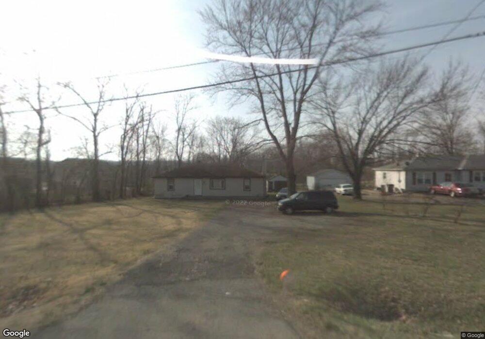
943 E Us Highway 22 and 3 Morrow, OH 45152
Hamilton Township NeighborhoodEstimated Value: $172,000 - $242,000
2
Beds
1
Bath
1,170
Sq Ft
$172/Sq Ft
Est. Value
About This Home
This home is located at 943 E Us Highway 22 and 3, Morrow, OH 45152 and is currently estimated at $201,673, approximately $172 per square foot. 943 E Us Highway 22 and 3 is a home located in Warren County with nearby schools including Little Miami Early Childhood Center, Little Miami Intermediate Middle School, and Little Miami Middle School.
Ownership History
Date
Name
Owned For
Owner Type
Purchase Details
Closed on
Sep 3, 2024
Sold by
Francini Ralph E
Bought by
Francini Ralph E and Francini Barbara Ann
Current Estimated Value
Purchase Details
Closed on
Jan 23, 1985
Sold by
Carmack Carmack and Carmack Charles Edward
Bought by
Francini Francini and Francini Ralph E
Create a Home Valuation Report for This Property
The Home Valuation Report is an in-depth analysis detailing your home's value as well as a comparison with similar homes in the area
Home Values in the Area
Average Home Value in this Area
Purchase History
| Date | Buyer | Sale Price | Title Company |
|---|---|---|---|
| Francini Ralph E | -- | None Listed On Document | |
| Francini Francini | $35,000 | -- |
Source: Public Records
Tax History Compared to Growth
Tax History
| Year | Tax Paid | Tax Assessment Tax Assessment Total Assessment is a certain percentage of the fair market value that is determined by local assessors to be the total taxable value of land and additions on the property. | Land | Improvement |
|---|---|---|---|---|
| 2024 | $1,798 | $50,140 | $16,580 | $33,560 |
| 2023 | $1,568 | $40,127 | $10,195 | $29,932 |
| 2022 | $1,549 | $40,128 | $10,196 | $29,932 |
| 2021 | $1,477 | $40,128 | $10,196 | $29,932 |
| 2020 | $1,317 | $32,624 | $8,288 | $24,336 |
| 2019 | $1,339 | $32,624 | $8,288 | $24,336 |
| 2018 | $1,301 | $32,624 | $8,288 | $24,336 |
| 2017 | $1,137 | $29,565 | $7,623 | $21,942 |
| 2016 | $1,164 | $29,565 | $7,623 | $21,942 |
| 2015 | $582 | $29,565 | $7,623 | $21,942 |
| 2014 | $1,138 | $26,880 | $6,930 | $19,950 |
| 2013 | $1,119 | $32,150 | $8,290 | $23,860 |
Source: Public Records
Map
Nearby Homes
- 723 Grande Oaks Dr
- 792 Oak Forest Dr
- 668 Thornton Dr
- 5234 Highmeadow Place
- 6186 Silver Wood Dr
- 857 Emerald Dr
- 6270 Pine Cove
- 6143 Maple Grove
- 6250 Avebury Ct
- 809 Emerald Dr
- 5079 Ross Ridge
- 5810 Turning Leaf Way
- 721 Kingly Terrace
- 616 Crabapple Ct
- 5079 Ross Ridge Rd
- 920 Pondside Ln
- 5830 Turning Leaf Way
- 6328 Maple Grove
- 2.4 acres E US 22 & 3
- 5004 Ross Ridge Rd
- 5799 Wedgwood Dr
- 5817 Wedgwood Dr
- 913 E Us Highway 22 and 3
- 972 Tyndale Ct
- 5837 Wedgwood Dr
- 899 St Rt 22 & 3
- 899 U S 22
- 899 E Us Rt 22 & 3
- 899 E Us Highway 22 and 3
- 899 E Us Highway 22 and 3
- 5800 Wedgwood Dr
- 5820 Wedgwood Dr
- 887 U S 22
- 887 E Us Highway 22 and 3
- 968 Tyndale Ct
- 5846 Wedgwood Dr
- 892 Grande Oaks Dr
- 983 Tyndale Ct
- 880 Grande Oaks Dr
- 904 Grande Oaks Dr