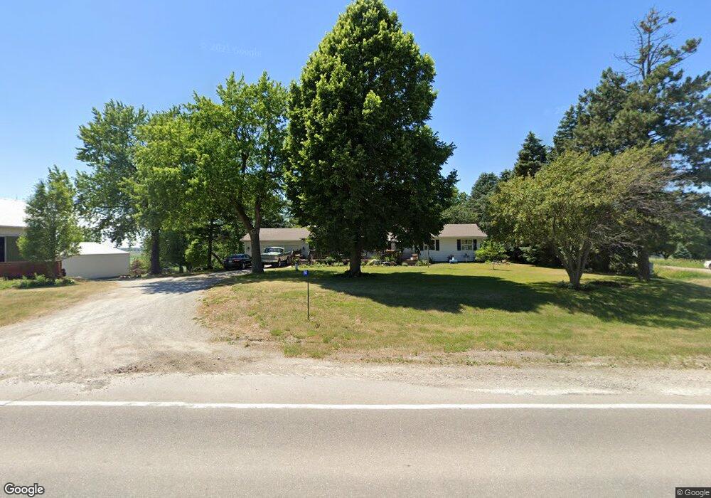
943 N Raymond Rd Waterloo, IA 50703
Estimated Value: $360,000 - $439,000
3
Beds
4
Baths
1,852
Sq Ft
$213/Sq Ft
Est. Value
About This Home
This home is located at 943 N Raymond Rd, Waterloo, IA 50703 and is currently estimated at $393,671, approximately $212 per square foot. 943 N Raymond Rd is a home located in Black Hawk County with nearby schools including Dunkerton Elementary School and Dunkerton High School.
Ownership History
Date
Name
Owned For
Owner Type
Purchase Details
Closed on
Dec 21, 2009
Sold by
Steege Ronald L and Steege Betty J
Bought by
Rindels Tad J and Rindels Jennifer L
Current Estimated Value
Home Financials for this Owner
Home Financials are based on the most recent Mortgage that was taken out on this home.
Original Mortgage
$184,000
Outstanding Balance
$120,384
Interest Rate
4.96%
Mortgage Type
New Conventional
Estimated Equity
$273,287
Create a Home Valuation Report for This Property
The Home Valuation Report is an in-depth analysis detailing your home's value as well as a comparison with similar homes in the area
Home Values in the Area
Average Home Value in this Area
Purchase History
| Date | Buyer | Sale Price | Title Company |
|---|---|---|---|
| Rindels Tad J | $230,000 | None Available |
Source: Public Records
Mortgage History
| Date | Status | Borrower | Loan Amount |
|---|---|---|---|
| Open | Rindels Tad J | $184,000 |
Source: Public Records
Tax History Compared to Growth
Tax History
| Year | Tax Paid | Tax Assessment Tax Assessment Total Assessment is a certain percentage of the fair market value that is determined by local assessors to be the total taxable value of land and additions on the property. | Land | Improvement |
|---|---|---|---|---|
| 2025 | $4,192 | $357,170 | $78,000 | $279,170 |
| 2024 | $4,192 | $345,000 | $65,000 | $280,000 |
| 2023 | $3,862 | $345,000 | $65,000 | $280,000 |
| 2022 | $3,784 | $271,710 | $52,000 | $219,710 |
| 2021 | $3,858 | $271,710 | $52,000 | $219,710 |
| 2020 | $3,806 | $260,710 | $41,000 | $219,710 |
| 2019 | $3,806 | $260,710 | $41,000 | $219,710 |
| 2018 | $3,726 | $260,710 | $41,000 | $219,710 |
| 2017 | $3,774 | $253,620 | $41,000 | $212,620 |
| 2016 | $3,578 | $253,620 | $41,000 | $212,620 |
| 2015 | $3,578 | $253,620 | $41,000 | $212,620 |
| 2014 | $3,718 | $253,620 | $41,000 | $212,620 |
Source: Public Records
Map
Nearby Homes
- 0 Newell St Unit NBR20241901
- 6418 Independence Ave Unit 6440
- TBD E Donald St
- 5955 Osage Rd
- 1827 N Pilot Grove Rd
- 6611 Lafayette Rd
- 6513 Lafayette Rd
- LOT 40 Cloverdale
- 6616 Lafayette Rd
- 229 Landmark Dr
- 2836 Independence Ave
- 0 Dubuque Rd Unit NBR20242713
- 000 Gray St
- 000 Lafayette Rd
- 641 Amber Ln
- 1733 Cottage Grove Ave
- 100 Corliss Ave
- Lot 5 Lafayette Rd
- Lot 1 Lafayette Rd
- 0000 Lafayette Rd
- 938 N Raymond Rd
- 5915 Newell St
- 5903 Newell St
- 5839 Newell St
- 5831 Newell St
- 5815 Newell St
- 1121 N Raymond Rd
- 5743 Newell St
- 1145 N Raymond Rd
- 5729 Newell St
- 615 N Raymond Rd
- 5549 Newell St
- 1405 N Raymond Rd
- 6411 Newell St
- 1427 N Raymond Rd
- 1436 N Raymond Rd
- 437 N Raymond Rd
- 1443 N Raymond Rd
- 5421 Newell St
- 6515 Newell St
