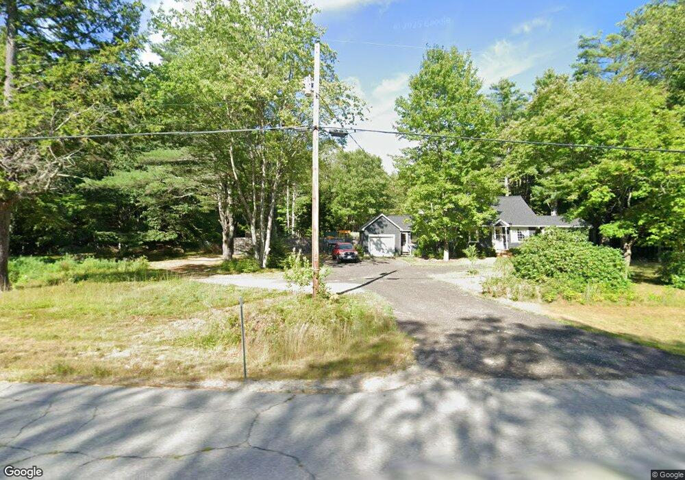
943 Nh Route 12 S Fitzwilliam, NH 03447
Estimated Value: $271,000 - $389,000
3
Beds
1
Bath
1,300
Sq Ft
$272/Sq Ft
Est. Value
About This Home
This home is located at 943 Nh Route 12 S, Fitzwilliam, NH 03447 and is currently estimated at $354,186, approximately $272 per square foot. 943 Nh Route 12 S is a home located in Cheshire County with nearby schools including Dr. George S. Emerson Elementary School, Monadnock Regional High School, and The Winchendon School.
Ownership History
Date
Name
Owned For
Owner Type
Purchase Details
Closed on
Aug 12, 2011
Sold by
Kuchta Matthew J
Bought by
Oneal Justin D and Crandall Jennifer K
Current Estimated Value
Home Financials for this Owner
Home Financials are based on the most recent Mortgage that was taken out on this home.
Original Mortgage
$122,130
Outstanding Balance
$84,324
Interest Rate
4.51%
Estimated Equity
$269,862
Create a Home Valuation Report for This Property
The Home Valuation Report is an in-depth analysis detailing your home's value as well as a comparison with similar homes in the area
Home Values in the Area
Average Home Value in this Area
Purchase History
| Date | Buyer | Sale Price | Title Company |
|---|---|---|---|
| Oneal Justin D | $118,000 | -- |
Source: Public Records
Mortgage History
| Date | Status | Borrower | Loan Amount |
|---|---|---|---|
| Open | Oneal Justin D | $122,130 | |
| Previous Owner | Oneal Justin D | $28,000 |
Source: Public Records
Tax History Compared to Growth
Tax History
| Year | Tax Paid | Tax Assessment Tax Assessment Total Assessment is a certain percentage of the fair market value that is determined by local assessors to be the total taxable value of land and additions on the property. | Land | Improvement |
|---|---|---|---|---|
| 2024 | $5,010 | $274,200 | $76,700 | $197,500 |
| 2023 | $4,639 | $274,200 | $76,700 | $197,500 |
| 2022 | $4,500 | $274,200 | $76,700 | $197,500 |
| 2021 | $3,991 | $154,500 | $49,100 | $105,400 |
| 2020 | $1,197 | $155,300 | $49,100 | $106,200 |
| 2019 | $1,197 | $155,400 | $49,100 | $106,300 |
| 2018 | $1,797 | $155,400 | $49,100 | $106,300 |
| 2016 | $3,603 | $129,900 | $39,700 | $90,200 |
| 2015 | $3,398 | $127,200 | $39,700 | $87,500 |
| 2014 | $3,769 | $127,100 | $39,700 | $87,400 |
| 2013 | $3,602 | $127,100 | $39,700 | $87,400 |
Source: Public Records
Map
Nearby Homes
- 115 Brook Side Rd Unit 2-12
- 801 Rt 12 S
- 257 Lakeside Dr
- 45 Camp Cir
- 74 Fern Cir
- 60 Fern Cir Unit 1-59
- 22 Daria Dr
- 239 Abel Rd
- 108 Royalston Rd N
- 759 Brown St
- 706 Brown St
- 0 Thomas Rd Unit 10 5014817
- 156 Bayberry Cir
- 42 Cromwell Dr Unit 19
- 31 Willow Ln
- 37 Willow Ln
- 39 Willow Ln
- 41 Willow Ln
- 53 Laurel Lake Rd
- 26 Weidner Dr
- 943 Nh Route 12 S
- 889 Highway 12
- 941 Nh Route 12 S
- 34 Cross Rd
- 924 Nh Route 12 S
- 722 Fullam Hill Rd
- 933 Nh Route 12 S
- 748 Fullam Hill Rd
- 48 Cross Rd
- 718 Fullam Hill Rd
- 977 Nh Route 12 S
- - Cross Rd
- 719 Fullam Hill Rd
- 43 Old Turnpike Rd
- 54 Cross Rd
- 71 Old Turnpike Rd
- 760 Fullam Hill Rd
- 889 Nh Route 12 S
- 0 Cross Rd
- 0 Cross Rd Unit 4011912