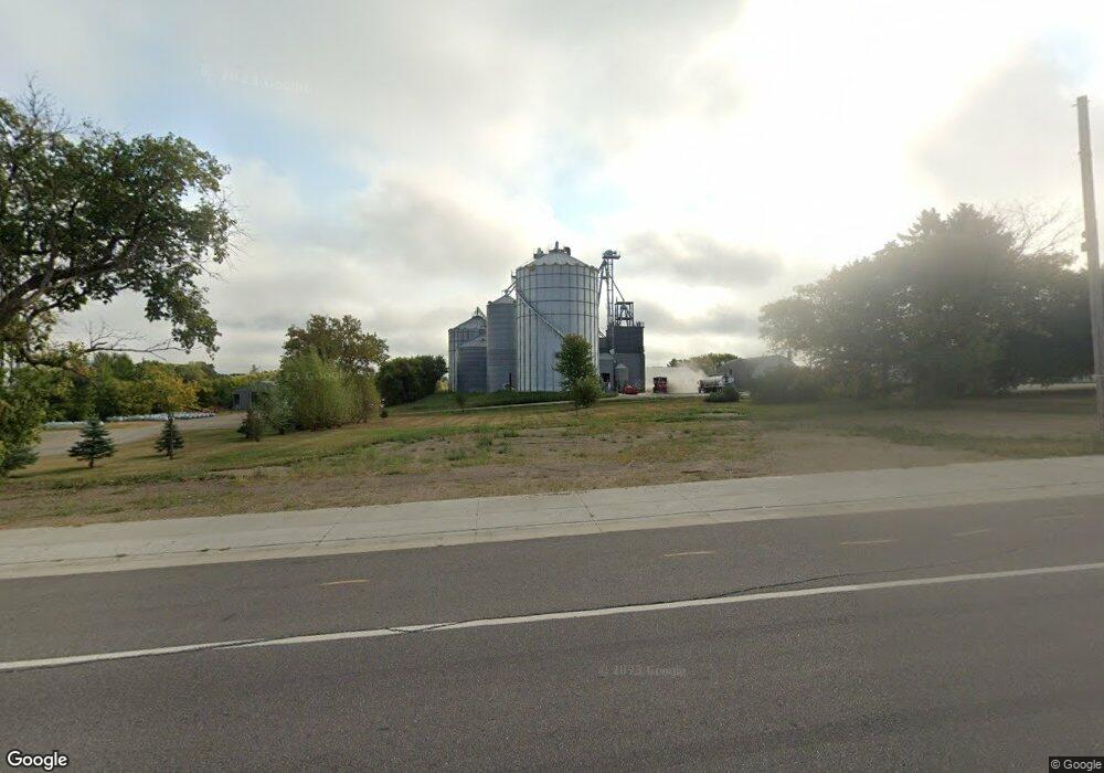
Estimated Value: $240,556
--
Bed
--
Bath
2,254
Sq Ft
$107/Sq Ft
Est. Value
About This Home
This home is located at 9438 Highway 25, Pierz, MN 56364 and is currently estimated at $240,556, approximately $106 per square foot. 9438 Highway 25 is a home with nearby schools including Pioneer Elementary School and Healy Secondary School.
Ownership History
Date
Name
Owned For
Owner Type
Purchase Details
Closed on
Oct 25, 2021
Sold by
Seelen Thomas S and Seelen Colleen E
Bought by
Sunrise Ag Cooperative
Current Estimated Value
Purchase Details
Closed on
Aug 30, 2012
Sold by
Gangl Bernard U and Gangl Geraldine M
Bought by
Popp Kevin L and Popp Lisa M
Home Financials for this Owner
Home Financials are based on the most recent Mortgage that was taken out on this home.
Original Mortgage
$149,000
Interest Rate
3.56%
Mortgage Type
Seller Take Back
Create a Home Valuation Report for This Property
The Home Valuation Report is an in-depth analysis detailing your home's value as well as a comparison with similar homes in the area
Home Values in the Area
Average Home Value in this Area
Purchase History
| Date | Buyer | Sale Price | Title Company |
|---|---|---|---|
| Sunrise Ag Cooperative | $182,500 | Larson Abstract Co Inc | |
| Seelen Thomas S | $34,000 | Larson Abstract Co Inc | |
| Popp Kevin L | $189,000 | None Available |
Source: Public Records
Mortgage History
| Date | Status | Borrower | Loan Amount |
|---|---|---|---|
| Previous Owner | Popp Kevin L | $149,000 |
Source: Public Records
Tax History Compared to Growth
Tax History
| Year | Tax Paid | Tax Assessment Tax Assessment Total Assessment is a certain percentage of the fair market value that is determined by local assessors to be the total taxable value of land and additions on the property. | Land | Improvement |
|---|---|---|---|---|
| 2025 | $250 | $17,400 | $17,400 | $0 |
| 2024 | $368 | $17,400 | $17,400 | $0 |
| 2023 | $478 | $25,300 | $14,900 | $10,400 |
| 2022 | $332 | $29,400 | $14,900 | $14,500 |
| 2021 | $322 | $26,500 | $12,000 | $14,500 |
| 2020 | $364 | $79,200 | $36,000 | $43,200 |
| 2019 | $358 | $27,200 | $12,000 | $15,200 |
| 2018 | $328 | $27,200 | $12,000 | $15,200 |
| 2017 | $324 | $26,400 | $11,200 | $15,200 |
| 2016 | $316 | $0 | $0 | $0 |
| 2014 | $1,122 | $0 | $0 | $0 |
| 2013 | $1,122 | $0 | $0 | $0 |
Source: Public Records
Map
Nearby Homes
- 25723 103rd St
- 624 Park Ave SE
- 119 1st Ave NE
- TBD-PID 04.00106.00 155th St NE
- 35142 93rd St
- 15821 75th Ave NE
- TBD PID 75th Ave NE
- 8462 355th Ave
- TBD-72AC 355th Ave
- TBD-72+/- Acres
- 18755 Highway 25
- 302 N Hickory St
- 632 N Pine St
- 120 125th St NE
- 1xx N. Hickory St. & N Linden St
- XXXX S Hawthorn St
- X S Hawthorn St
- TBD 73rd St
- 10904 Harvest Rd
- 10961 Harvest Rd
- 9422 Highway 25
- 9431 Highway 25
- 9404 Highway 25
- 9471 Minnesota 25
- 9446 Highway 25
- 9395 Highway 25
- 26982 Park St
- 9793 Highway 25
- 9351 Highway 25
- 9351 Minnesota 25
- 9346 Highway 25
- 9791 Minnesota 25
- 26975 Park St
- 26975 Park St
- 9789 Minnesota 25
- 9789 Highway 25
- 9787 Minnesota 25
- 9787 Highway 25
- 26956 Park St
- 9485 Highway 25
