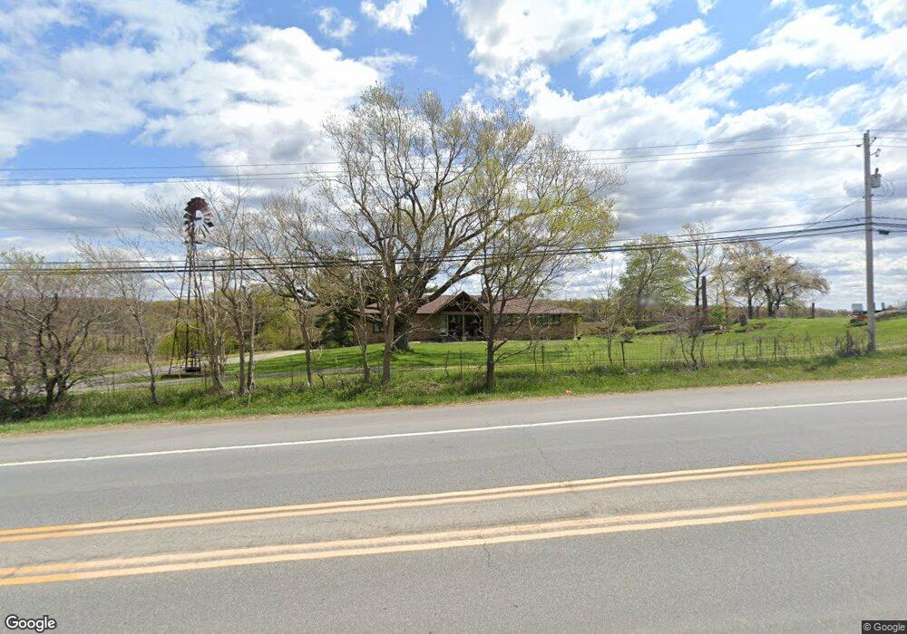
9446 State Route 44 Mantua, OH 44255
Estimated Value: $271,000 - $355,000
3
Beds
2
Baths
2,058
Sq Ft
$155/Sq Ft
Est. Value
About This Home
This home is located at 9446 State Route 44, Mantua, OH 44255 and is currently estimated at $319,145, approximately $155 per square foot. 9446 State Route 44 is a home located in Portage County with nearby schools including Crestwood Primary School, Crestwood Intermediate School, and Crestwood Middle School.
Ownership History
Date
Name
Owned For
Owner Type
Purchase Details
Closed on
Feb 15, 2024
Sold by
Bandrosky Charles Pete
Bought by
Charles Pete Bandrosky Trust and Bandrosky
Current Estimated Value
Purchase Details
Closed on
Jul 7, 2017
Sold by
Bandrosky Eva B
Bought by
Michael Lee Gerardi and Kay Brenda
Purchase Details
Closed on
Aug 31, 2016
Sold by
Bandrosky Eva B and Bandrosky Eva B
Bought by
Ohio Turnpike Commission
Purchase Details
Closed on
Jul 25, 2016
Sold by
Bandrosky Eva and Bandrosky Eva B
Bought by
Bandrosky Eva B and The Eva B Bandrosky Trust
Purchase Details
Closed on
Jan 29, 2001
Sold by
Fant John F and Bandrosky Eva B
Bought by
Bandrosky Eva B
Purchase Details
Closed on
Dec 20, 2000
Sold by
Estate Of Gertrude Dezort
Bought by
Bandrosky Eva B
Purchase Details
Closed on
Dec 19, 2000
Sold by
Fant John F and Bandrosky Eva B
Bought by
Bandrosky Eva
Purchase Details
Closed on
Jul 30, 1987
Bought by
Dezort Gertrude L and Dezort John
Create a Home Valuation Report for This Property
The Home Valuation Report is an in-depth analysis detailing your home's value as well as a comparison with similar homes in the area
Home Values in the Area
Average Home Value in this Area
Purchase History
| Date | Buyer | Sale Price | Title Company |
|---|---|---|---|
| Charles Pete Bandrosky Trust | -- | None Listed On Document | |
| Michael Lee Gerardi | -- | -- | |
| Ohio Turnpike Commission | -- | None Available | |
| Bandrosky Eva B | -- | None Available | |
| Bandrosky Eva B | $32,900 | -- | |
| Bandrosky Eva B | -- | -- | |
| Bandrosky Eva | -- | -- | |
| Fant John F | -- | -- | |
| Dezort Gertrude L | -- | -- |
Source: Public Records
Tax History Compared to Growth
Tax History
| Year | Tax Paid | Tax Assessment Tax Assessment Total Assessment is a certain percentage of the fair market value that is determined by local assessors to be the total taxable value of land and additions on the property. | Land | Improvement |
|---|---|---|---|---|
| 2024 | $3,845 | $99,410 | $16,140 | $83,270 |
| 2023 | $3,294 | $77,670 | $11,310 | $66,360 |
| 2022 | $3,331 | $77,670 | $11,310 | $66,360 |
| 2021 | $3,289 | $76,130 | $11,310 | $64,820 |
| 2020 | $2,405 | $52,570 | $5,040 | $47,530 |
| 2019 | $2,429 | $52,570 | $5,040 | $47,530 |
| 2018 | $2,309 | $44,630 | $5,780 | $38,850 |
| 2017 | $2,099 | $44,630 | $5,780 | $38,850 |
| 2016 | $2,188 | $46,660 | $7,810 | $38,850 |
| 2015 | $2,192 | $46,660 | $7,810 | $38,850 |
| 2014 | $2,237 | $46,660 | $7,810 | $38,850 |
| 2013 | $2,213 | $46,660 | $7,810 | $38,850 |
Source: Public Records
Map
Nearby Homes
- 9091 State Route 44
- 4278 Dudley Rd
- 10115 Infirmary Rd
- 5248 State Route 303
- 3599 Beck Rd
- 4196 Webb Rd
- 8856 Coit Rd
- 4596 W Prospect St
- 3161 Denny Rd
- 10791 Reservoir Dr
- 8119 State Route 44
- 10787 Park St
- 3065 Polly Rd
- 5961 Streeter Rd
- 8121 Cooley Rd
- 0 Ambler Ln Unit 5142203
- 5372 Mennonite Rd
- 2972 Douglas St
- 4364 Pioneer Trail
- 2926 Frost Rd
- 9289 State Route 44
- 9252 State Route 44
- 9294 State Route 44
- 9294 State Route 44
- 9294 State Route 44
- 4527 Streeter Rd
- 4623 Streeter Rd
- 4601 Streeter Rd
- 4654 Streeter Rd
- 4587 Streeter Rd
- 9205 State Route 44
- 9195 State Route 44
- 4692 Streeter Rd
- 9192 State Route 44
- 4737 Streeter Rd
- 9173 State Route 44
- 4689 Streeter Rd
- 4740 Streeter Rd
- 4703 Streeter Rd
- 9153 State Route 44