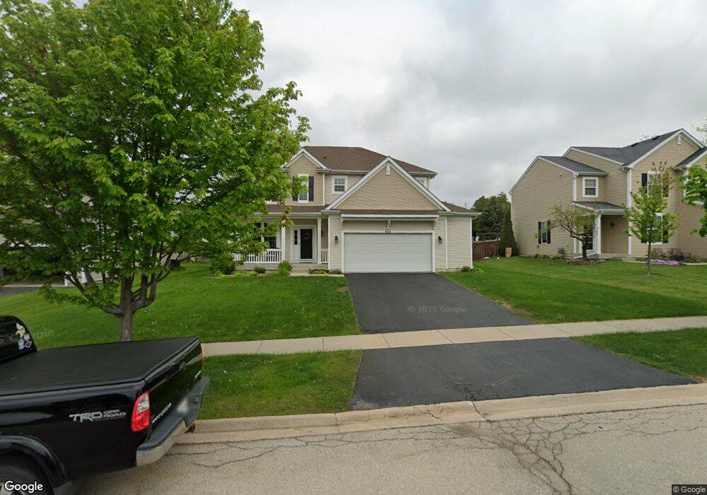
945 Avalon Way Minooka, IL 60447
North Minooka NeighborhoodEstimated Value: $389,910 - $416,000
--
Bed
1
Bath
2,967
Sq Ft
$136/Sq Ft
Est. Value
About This Home
This home is located at 945 Avalon Way, Minooka, IL 60447 and is currently estimated at $403,978, approximately $136 per square foot. 945 Avalon Way is a home located in Kendall County with nearby schools including Jones Elementary School, Minooka Junior High School, and Minooka Intermediate School.
Ownership History
Date
Name
Owned For
Owner Type
Purchase Details
Closed on
Apr 1, 2009
Sold by
Centex Homes
Bought by
Hubbard Ross D and Hubbard Lydia May
Current Estimated Value
Home Financials for this Owner
Home Financials are based on the most recent Mortgage that was taken out on this home.
Original Mortgage
$265,403
Outstanding Balance
$170,017
Interest Rate
5.19%
Mortgage Type
FHA
Estimated Equity
$233,961
Create a Home Valuation Report for This Property
The Home Valuation Report is an in-depth analysis detailing your home's value as well as a comparison with similar homes in the area
Home Values in the Area
Average Home Value in this Area
Purchase History
| Date | Buyer | Sale Price | Title Company |
|---|---|---|---|
| Hubbard Ross D | $270,500 | None Available |
Source: Public Records
Mortgage History
| Date | Status | Borrower | Loan Amount |
|---|---|---|---|
| Open | Hubbard Ross D | $265,403 |
Source: Public Records
Tax History Compared to Growth
Tax History
| Year | Tax Paid | Tax Assessment Tax Assessment Total Assessment is a certain percentage of the fair market value that is determined by local assessors to be the total taxable value of land and additions on the property. | Land | Improvement |
|---|---|---|---|---|
| 2024 | $9,238 | $117,098 | $15,425 | $101,673 |
| 2023 | $8,063 | $107,019 | $14,690 | $92,329 |
| 2022 | $8,063 | $100,841 | $13,990 | $86,851 |
| 2021 | $7,889 | $96,180 | $14,203 | $81,977 |
| 2020 | $7,819 | $91,866 | $13,566 | $78,300 |
| 2019 | $7,877 | $90,188 | $13,318 | $76,870 |
| 2018 | $7,864 | $88,220 | $13,027 | $75,193 |
| 2017 | $7,969 | $88,220 | $13,027 | $75,193 |
| 2016 | $7,399 | $81,719 | $12,866 | $68,853 |
| 2015 | $7,052 | $77,554 | $12,210 | $65,344 |
| 2014 | -- | $75,023 | $12,210 | $62,813 |
| 2013 | -- | $75,023 | $12,210 | $62,813 |
Source: Public Records
Map
Nearby Homes
- 819 Daniel Dr
- 1510 Balboa Dr
- 2050 Isabella Ln
- 194 acres W Holt Rd
- 2041 Isabella Ln
- Lot 1 Minooka Ridge & Jones Rd
- LOT 1 Bob Blair Rd
- 201 W Church St
- 405 W Mondamin St
- 1133 Coneflower Ct
- 104 S Osceola St
- 2037 Isabella Ln
- 6010-6060 E Minooka Rd
- 0 County Line Rd
- 00 County Line Rd
- LOT 28 O Toole Dr
- 225 Sibley Dr
- 21037 Coventry Cir
- 817 Casey Dr
- 21208 S Meadowview Ln
- 941 Avalon Way
- 949 Avalon Way
- 937 Avalon Way
- 1621 Elysium Dr
- 933 Avalon Way
- 1617 Elysium Dr
- 929 Avalon Way
- 859 Daniel Dr Unit 2A
- 1620 Balboa Dr
- 857 Daniel Dr
- 857 Daniel Dr Unit 1
- 1613 Elysium Dr
- 1616 Balboa Dr
- 925 Avalon Way
- 855 Daniel Dr
- 1612 Balboa Dr Unit 2B
- 853 Daniel Dr
- 1604 Elysium Dr
- 921 Avalon Way
- 851 Daniel Dr