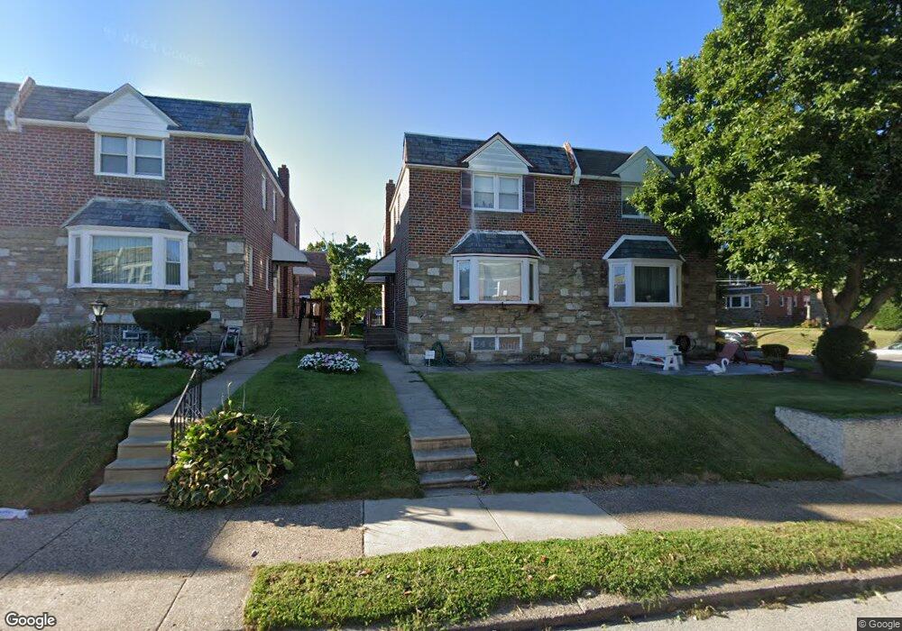
945 E Durard St Philadelphia, PA 19150
Cedarbrook NeighborhoodEstimated Value: $361,066 - $383,000
3
Beds
2
Baths
1,720
Sq Ft
$214/Sq Ft
Est. Value
About This Home
This home is located at 945 E Durard St, Philadelphia, PA 19150 and is currently estimated at $368,267, approximately $214 per square foot. 945 E Durard St is a home with nearby schools including Franklin S Edmonds School, Martin Luther King High School, and St. Raymond Of Penafort Catholic School.
Ownership History
Date
Name
Owned For
Owner Type
Purchase Details
Closed on
Mar 6, 2009
Sold by
Younger Don and Younger Barry
Bought by
Younger Don and Younger Donald
Current Estimated Value
Purchase Details
Closed on
Jun 20, 2005
Sold by
Younger Don
Bought by
Younger Don and Younger Barry
Purchase Details
Closed on
Aug 12, 1999
Sold by
Younger Don and Younger Sylvia A
Bought by
Younger Don
Create a Home Valuation Report for This Property
The Home Valuation Report is an in-depth analysis detailing your home's value as well as a comparison with similar homes in the area
Home Values in the Area
Average Home Value in this Area
Purchase History
| Date | Buyer | Sale Price | Title Company |
|---|---|---|---|
| Younger Don | -- | None Available | |
| Younger Don | -- | -- | |
| Younger Don | -- | -- |
Source: Public Records
Tax History Compared to Growth
Tax History
| Year | Tax Paid | Tax Assessment Tax Assessment Total Assessment is a certain percentage of the fair market value that is determined by local assessors to be the total taxable value of land and additions on the property. | Land | Improvement |
|---|---|---|---|---|
| 2026 | $3,618 | $309,900 | $61,980 | $247,920 |
| 2025 | $3,618 | $309,900 | $61,980 | $247,920 |
| 2024 | $3,618 | $309,900 | $61,980 | $247,920 |
| 2023 | $3,618 | $258,500 | $51,700 | $206,800 |
| 2022 | $2,739 | $258,500 | $51,700 | $206,800 |
| 2021 | $2,739 | $0 | $0 | $0 |
| 2020 | $2,739 | $0 | $0 | $0 |
| 2019 | $2,860 | $0 | $0 | $0 |
| 2018 | $2,755 | $0 | $0 | $0 |
| 2017 | $2,755 | $0 | $0 | $0 |
| 2016 | $2,755 | $0 | $0 | $0 |
| 2015 | $2,637 | $0 | $0 | $0 |
| 2014 | -- | $196,800 | $38,631 | $158,169 |
| 2012 | -- | $24,960 | $2,582 | $22,378 |
Source: Public Records
Map
Nearby Homes
- 932 E Ellet St
- 937 E Gorgas Ln
- 1038 E Mount Pleasant Ave
- 8038 Lowber Ave
- 933 E Slocum St
- 1007 Dorset St
- 940 E Allens Ln
- 8309 Lynnewood Rd
- 725 E Vernon Rd
- 506 E Gorgas Ln
- 1148 E Slocum St
- 501 E Sedgwick St
- 1151 E Dorset St
- 1167 E Dorset St
- 1122 E Phil Ellena St
- 715 E Dorset St
- 8004 Gilbert St
- 1204 E Mount Airy Ave
- 802 E Phil Ellena St
- 1159 E Hortter St
- 943 E Durard St
- 947 E Durard St
- 941 E Durard St
- 939 E Durard St
- 946 E Sedgwick St
- 944 E Sedgwick St
- 942 E Sedgwick St
- 944 E Durard St
- 940 E Sedgwick St
- 944 AKA 946 E Durard St
- 8034 Mansfield Ave
- 8034 Mansfield Ave Unit B 2bedroom 1bat
- 8034 Mansfield Ave
- 8034 Mansfield Ave Unit B
- 935 E Durard St
- 938 E Sedgwick St
- 933 E Durard St
- 936 E Sedgwick St
- 8032 Mansfield Ave
- 8049 Mansfield Ave