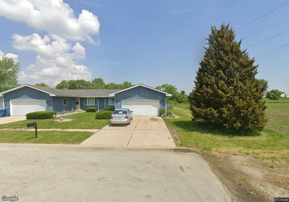
945 Edwin Dr Bourbonnais, IL 60914
Estimated Value: $140,000 - $200,000
2
Beds
1
Bath
1,008
Sq Ft
$172/Sq Ft
Est. Value
About This Home
This home is located at 945 Edwin Dr, Bourbonnais, IL 60914 and is currently estimated at $173,819, approximately $172 per square foot. 945 Edwin Dr is a home located in Kankakee County with nearby schools including Shabbona Elementary School, Liberty Intermediate School, and Bourbonnais Upper Grade Center.
Ownership History
Date
Name
Owned For
Owner Type
Purchase Details
Closed on
Aug 3, 2022
Sold by
Sampognaro and Heather
Bought by
Sampognaro Eric and Sampognaro Heather
Current Estimated Value
Purchase Details
Closed on
Jan 19, 2022
Sold by
Sampognaro Eric
Bought by
Sampognaro Eric A and Sampognaro Tracy
Home Financials for this Owner
Home Financials are based on the most recent Mortgage that was taken out on this home.
Original Mortgage
$98,000
Interest Rate
4.72%
Mortgage Type
New Conventional
Purchase Details
Closed on
Nov 7, 2017
Sold by
Cook Ardath R
Bought by
Sampognaro Eric A
Home Financials for this Owner
Home Financials are based on the most recent Mortgage that was taken out on this home.
Original Mortgage
$95,000
Interest Rate
3.25%
Mortgage Type
New Conventional
Create a Home Valuation Report for This Property
The Home Valuation Report is an in-depth analysis detailing your home's value as well as a comparison with similar homes in the area
Home Values in the Area
Average Home Value in this Area
Purchase History
| Date | Buyer | Sale Price | Title Company |
|---|---|---|---|
| Sampognaro Eric | -- | Chicago Title | |
| Sampognaro Eric A | -- | Burnet Title | |
| Sampognaro Eric A | $100,000 | Standard Title |
Source: Public Records
Mortgage History
| Date | Status | Borrower | Loan Amount |
|---|---|---|---|
| Previous Owner | Sampognaro Eric A | $98,000 | |
| Previous Owner | Sampognaro Eric A | $95,000 |
Source: Public Records
Tax History
| Year | Tax Paid | Tax Assessment Tax Assessment Total Assessment is a certain percentage of the fair market value that is determined by local assessors to be the total taxable value of land and additions on the property. | Land | Improvement |
|---|---|---|---|---|
| 2024 | $3,476 | $47,973 | $6,465 | $41,508 |
| 2023 | $3,161 | $44,419 | $5,986 | $38,433 |
| 2022 | $2,928 | $40,161 | $5,770 | $34,391 |
| 2021 | $2,870 | $39,277 | $5,643 | $33,634 |
| 2020 | $2,751 | $37,273 | $5,492 | $31,781 |
| 2019 | $2,608 | $35,334 | $5,332 | $30,002 |
| 2018 | $2,569 | $34,812 | $5,253 | $29,559 |
| 2017 | $3,049 | $33,963 | $5,125 | $28,838 |
| 2016 | $3,049 | $34,041 | $5,049 | $28,992 |
| 2015 | $2,901 | $31,980 | $2,536 | $29,444 |
| 2014 | $1,621 | $29,603 | $2,536 | $27,067 |
| 2013 | -- | $31,980 | $2,536 | $29,444 |
Source: Public Records
Map
Nearby Homes
- 675 Washington Ave
- 473 Mohawk Dr
- 261 Mohawk Dr
- 269 Harvard Ave
- 1063 Yale Ave
- 206 Meadows Rd S
- 899 Armour Rd
- 375 Meadows Rd N
- Lot 5 Larry Power Rd
- 260 W Country Ct
- 490 Meadows Rd N
- 250 N Levasseur Ave
- 1533 Stefanie Ln
- 179 N Levasseur Ave
- 1565 Stefanie Ln
- 9 Hilltop Dr
- 417 E Beaudoin St
- 22 Emery Dr
- 609 Ivy Ln
- 172 Anita Dr
Your Personal Tour Guide
Ask me questions while you tour the home.