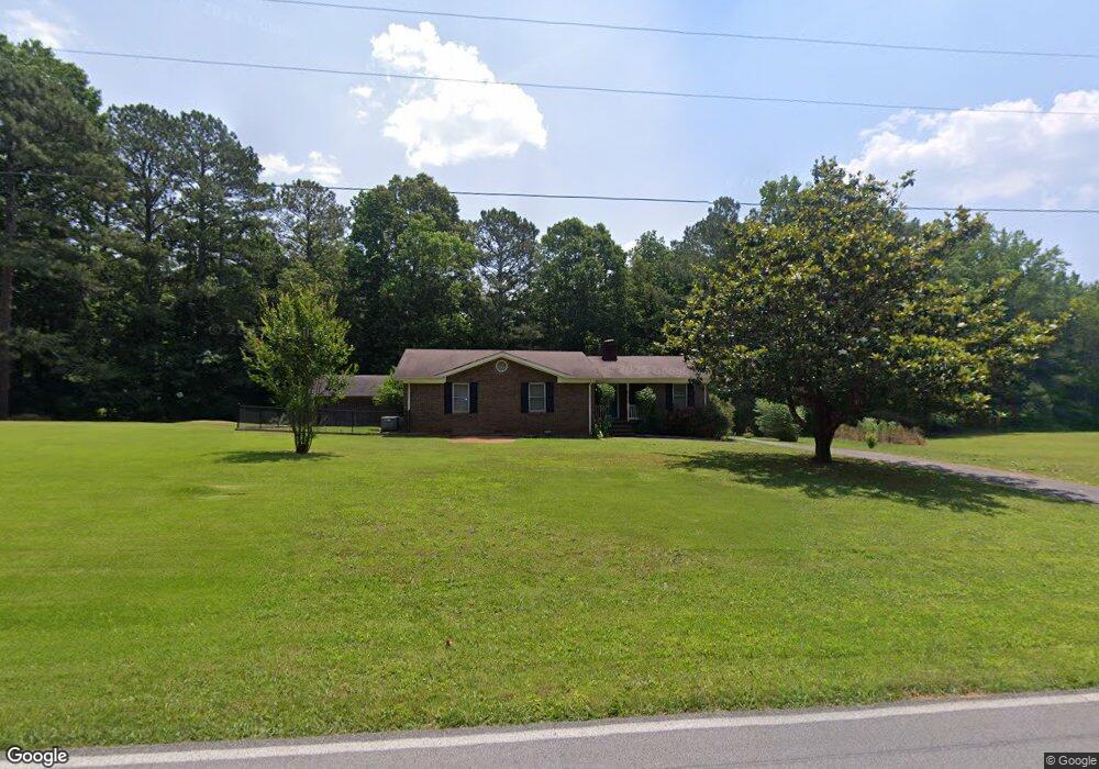
945 Hankins Rd Rock Spring, GA 30739
Rock Spring NeighborhoodEstimated Value: $260,000 - $320,000
3
Beds
2
Baths
1,519
Sq Ft
$188/Sq Ft
Est. Value
About This Home
This home is located at 945 Hankins Rd, Rock Spring, GA 30739 and is currently estimated at $285,920, approximately $188 per square foot. 945 Hankins Rd is a home located in Walker County with nearby schools including Rock Spring Elementary School, Lafayette High School, and Alice M Daley Adventist School.
Ownership History
Date
Name
Owned For
Owner Type
Purchase Details
Closed on
Aug 26, 2020
Sold by
Grant Michael
Bought by
Grant Cynthia L
Current Estimated Value
Purchase Details
Closed on
Apr 5, 2010
Sold by
Cox Bradford Franklin
Bought by
Grant Michael
Home Financials for this Owner
Home Financials are based on the most recent Mortgage that was taken out on this home.
Original Mortgage
$123,469
Interest Rate
4.97%
Mortgage Type
New Conventional
Purchase Details
Closed on
Feb 22, 2005
Sold by
Not Provided
Bought by
Grant Michael and Grant Cynthia L
Home Financials for this Owner
Home Financials are based on the most recent Mortgage that was taken out on this home.
Original Mortgage
$58,821
Interest Rate
5.6%
Mortgage Type
New Conventional
Purchase Details
Closed on
Dec 17, 1976
Bought by
Hill John W and Hill Billie N
Create a Home Valuation Report for This Property
The Home Valuation Report is an in-depth analysis detailing your home's value as well as a comparison with similar homes in the area
Home Values in the Area
Average Home Value in this Area
Purchase History
| Date | Buyer | Sale Price | Title Company |
|---|---|---|---|
| Grant Cynthia L | -- | -- | |
| Grant Michael | $115,000 | -- | |
| Grant Michael | $108,000 | -- | |
| Hill John W | -- | -- |
Source: Public Records
Mortgage History
| Date | Status | Borrower | Loan Amount |
|---|---|---|---|
| Previous Owner | Grant Michael | $123,469 | |
| Previous Owner | Grant Michael | $58,821 |
Source: Public Records
Tax History Compared to Growth
Tax History
| Year | Tax Paid | Tax Assessment Tax Assessment Total Assessment is a certain percentage of the fair market value that is determined by local assessors to be the total taxable value of land and additions on the property. | Land | Improvement |
|---|---|---|---|---|
| 2024 | $1,771 | $78,711 | $7,733 | $70,978 |
| 2023 | $1,691 | $73,340 | $6,137 | $67,203 |
| 2022 | $1,608 | $62,652 | $4,996 | $57,656 |
| 2021 | $1,462 | $50,920 | $4,996 | $45,924 |
| 2020 | $1,236 | $40,610 | $4,996 | $35,614 |
| 2019 | $1,257 | $40,610 | $4,996 | $35,614 |
| 2018 | $1,075 | $40,610 | $4,996 | $35,614 |
| 2017 | $1,368 | $40,610 | $4,996 | $35,614 |
| 2016 | $1,124 | $40,610 | $4,996 | $35,614 |
| 2015 | $1,240 | $42,600 | $9,296 | $33,304 |
| 2014 | $1,140 | $42,600 | $9,296 | $33,304 |
| 2013 | -- | $42,600 | $9,296 | $33,304 |
Source: Public Records
Map
Nearby Homes
- 0 Tarvin Rd Unit 1523862
- 0 Veeler Rd Unit 1522679
- 0 Veeler Rd Unit 10628696
- 0 Clyde Byrd Rd
- 0 Colbert Hollow Rd Unit 1513202
- 10180 Us Highway 27
- 5602 Georgia 95
- 00 Georgia 95
- 0 Cheshire Crossing Dr Unit 1387793
- 15 Willow Cir
- 23 Willow Cir
- 16 Willow Cir
- 11 Willow Cir
- The Pearson Plan at Laurel Ridge
- The Benson II Plan at Laurel Ridge
- The Langford Plan at Laurel Ridge
- The Lawson Plan at Laurel Ridge
- The Piedmont Plan at Laurel Ridge
- 1677 Center Grove Rd
- 950 Hankins Rd
- 1703 Center Grove Rd
- 1618 Center Grove Rd
- 851 Hankins Rd
- 1720 Center Grove Rd
- 737 Hankins Rd
- 1839 Center Grove Rd
- 778 Hankins Rd
- 1786 Center Grove Rd
- 819 Hankins Rd
- 95 Highway
- 1509 Center Grove Rd
- 1656 Center Grove Rd
- 1480 Center Grove Rd
- 1871 Center Grove Rd
- 1910 Center Grove Rd
- 1910 Center Grove Rd
- 692 Hankins Rd
- 1993 Center Grove Rd