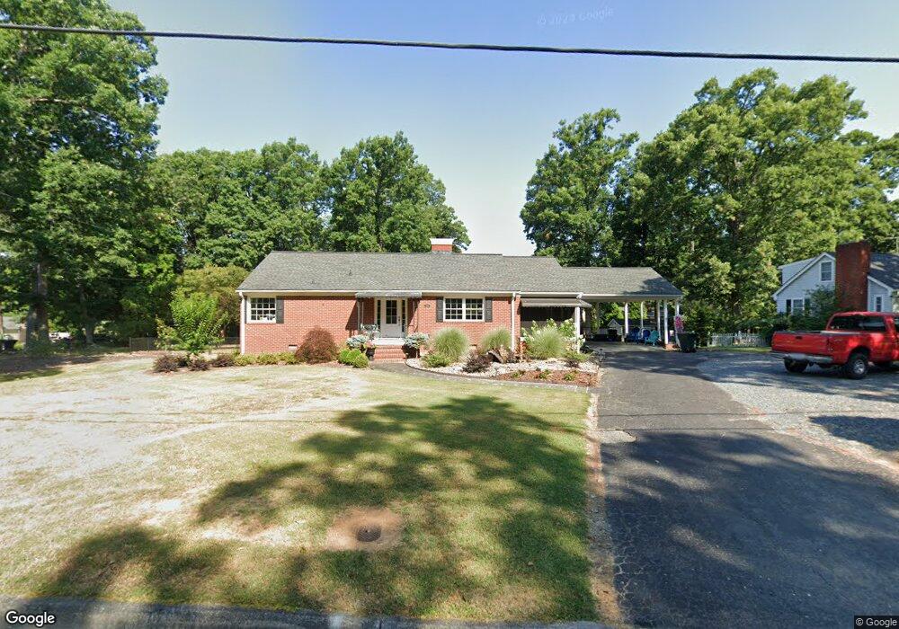
946 Shamrock Rd Asheboro, NC 27203
Estimated Value: $191,000 - $232,000
--
Bed
2
Baths
1,347
Sq Ft
$159/Sq Ft
Est. Value
About This Home
This home is located at 946 Shamrock Rd, Asheboro, NC 27203 and is currently estimated at $213,981, approximately $158 per square foot. 946 Shamrock Rd is a home located in Randolph County with nearby schools including Lindley Park Elementary School, South Asheboro Middle School, and Asheboro High School.
Ownership History
Date
Name
Owned For
Owner Type
Purchase Details
Closed on
Dec 17, 2014
Sold by
Smith Betty Dale and Ritter Jean S
Bought by
Whitehead Coley Glen Rankin and Whitehead Coley Lisa
Current Estimated Value
Home Financials for this Owner
Home Financials are based on the most recent Mortgage that was taken out on this home.
Original Mortgage
$68,400
Outstanding Balance
$52,721
Interest Rate
4.09%
Mortgage Type
New Conventional
Estimated Equity
$161,260
Purchase Details
Closed on
Dec 31, 1991
Bought by
Coley Glen Rankincoley Lisa White
Purchase Details
Closed on
May 31, 1991
Bought by
Coley Glen Rankincoley Lisa White
Create a Home Valuation Report for This Property
The Home Valuation Report is an in-depth analysis detailing your home's value as well as a comparison with similar homes in the area
Home Values in the Area
Average Home Value in this Area
Purchase History
| Date | Buyer | Sale Price | Title Company |
|---|---|---|---|
| Whitehead Coley Glen Rankin | $72,000 | None Available | |
| Coley Glen Rankincoley Lisa White | $68,900 | -- | |
| Coley Glen Rankincoley Lisa White | $63,000 | -- |
Source: Public Records
Mortgage History
| Date | Status | Borrower | Loan Amount |
|---|---|---|---|
| Open | Whitehead Coley Glen Rankin | $68,400 |
Source: Public Records
Tax History Compared to Growth
Tax History
| Year | Tax Paid | Tax Assessment Tax Assessment Total Assessment is a certain percentage of the fair market value that is determined by local assessors to be the total taxable value of land and additions on the property. | Land | Improvement |
|---|---|---|---|---|
| 2024 | $2,227 | $167,250 | $43,040 | $124,210 |
| 2023 | $2,227 | $167,250 | $43,040 | $124,210 |
| 2022 | $1,706 | $117,680 | $32,530 | $85,150 |
| 2021 | $1,701 | $117,680 | $32,530 | $85,150 |
| 2020 | $1,701 | $117,680 | $32,530 | $85,150 |
| 2019 | $1,701 | $117,680 | $32,530 | $85,150 |
| 2018 | $1,586 | $108,090 | $32,030 | $76,060 |
| 2016 | $1,590 | $108,086 | $32,990 | $75,096 |
| 2015 | $1,592 | $108,086 | $32,990 | $75,096 |
| 2014 | -- | $108,086 | $32,990 | $75,096 |
Source: Public Records
Map
Nearby Homes
- 0 U S Highway 64
- 815 Trollinger Rd
- 741 Kildare Rd
- 603 Shamrock Rd
- 822 Glenwood Rd
- 1008 Mackie Ave
- 500 E Kivett St
- 640 Hemlock Dr
- 604 Hemlock Dr
- 604 Dublin Rd
- 0 Sequoia Ave
- 842 Parkview St
- 223 Rich Ave
- 643 Cypress Dr
- 310 S High St
- 222 Gardiner Rd
- 830 Cool Springs Rd
- 243 S Elm St
- 209 Armfield Ave
- 211 Armfield Ave
- 938 Shamrock Rd
- 1006 Shamrock Rd
- 949 Trollinger Rd
- 939 Trollinger Rd
- 955 Trollinger Rd
- 931 Trollinger Rd
- 930 Shamrock Rd
- 646 Dellwood Ave
- 0 Shamrock Rd Unit 1194988
- 0 Shamrock Rd Unit 808461
- 0 Shamrock Rd
- 943 Shamrock Rd
- 1011 Shamrock Rd
- 951 Shamrock Rd
- 1012 Shamrock Rd
- 937 Shamrock Rd
- 923 Trollinger Rd
- 922 Shamrock Rd
- 638 Dellwood Ave
- 931 Shamrock Rd