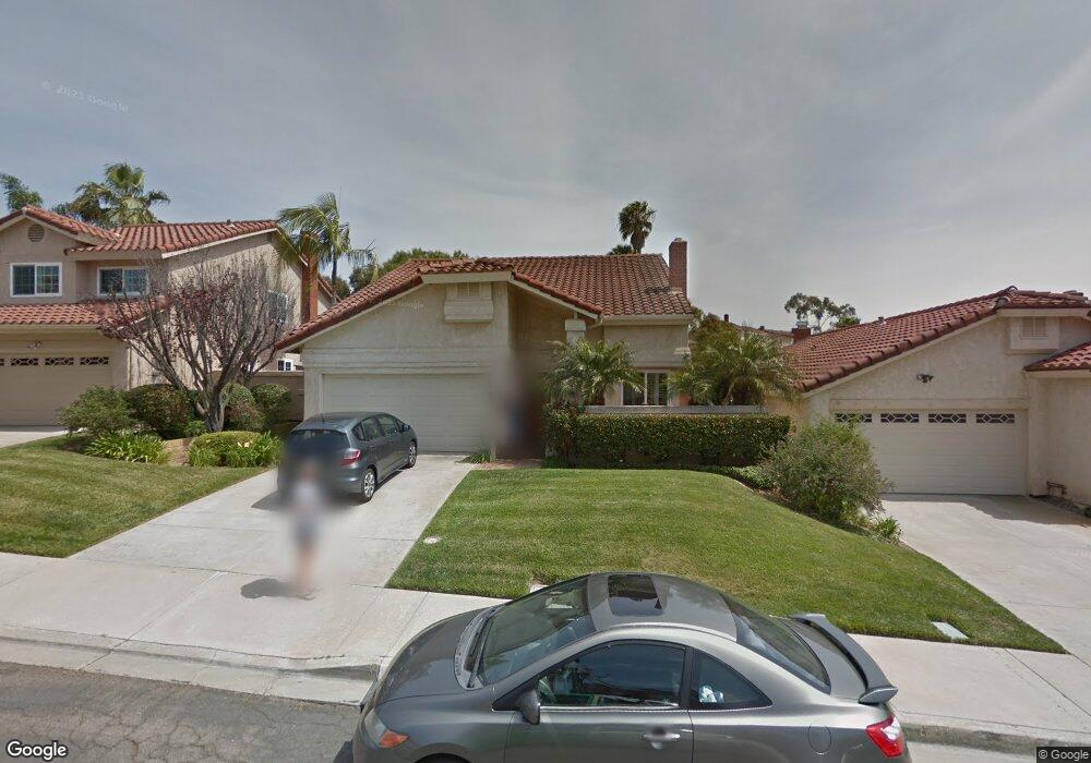
947 Alyssum Rd Carlsbad, CA 92011
Poinsettia NeighborhoodEstimated Value: $1,215,533 - $1,355,000
3
Beds
3
Baths
1,617
Sq Ft
$795/Sq Ft
Est. Value
About This Home
This home is located at 947 Alyssum Rd, Carlsbad, CA 92011 and is currently estimated at $1,284,883, approximately $794 per square foot. 947 Alyssum Rd is a home located in San Diego County with nearby schools including Aviara Oaks Elementary, Aviara Oaks Middle, and Carlsbad High School.
Ownership History
Date
Name
Owned For
Owner Type
Purchase Details
Closed on
Oct 8, 2025
Sold by
Theodossi Jill A
Bought by
Jill A Theodossi Family Trust and Theodossi
Current Estimated Value
Purchase Details
Closed on
Nov 12, 2001
Sold by
Theodossi Jill
Bought by
Theodossi Athos G
Home Financials for this Owner
Home Financials are based on the most recent Mortgage that was taken out on this home.
Original Mortgage
$147,700
Interest Rate
6.62%
Purchase Details
Closed on
Aug 26, 1993
Sold by
Theodossi Charalambos G
Bought by
Theodossi Athos G
Home Financials for this Owner
Home Financials are based on the most recent Mortgage that was taken out on this home.
Original Mortgage
$168,000
Interest Rate
7.2%
Purchase Details
Closed on
Nov 17, 1989
Purchase Details
Closed on
Apr 30, 1985
Create a Home Valuation Report for This Property
The Home Valuation Report is an in-depth analysis detailing your home's value as well as a comparison with similar homes in the area
Home Values in the Area
Average Home Value in this Area
Purchase History
| Date | Buyer | Sale Price | Title Company |
|---|---|---|---|
| Jill A Theodossi Family Trust | -- | None Listed On Document | |
| Theodossi Athos G | -- | Commonwealth Land Title | |
| Theodossi Athos G | -- | Union Land Title Co | |
| -- | $253,000 | -- | |
| -- | $137,800 | -- |
Source: Public Records
Mortgage History
| Date | Status | Borrower | Loan Amount |
|---|---|---|---|
| Previous Owner | Theodossi Athos G | $147,700 | |
| Previous Owner | Theodossi Athos G | $168,000 |
Source: Public Records
Tax History Compared to Growth
Tax History
| Year | Tax Paid | Tax Assessment Tax Assessment Total Assessment is a certain percentage of the fair market value that is determined by local assessors to be the total taxable value of land and additions on the property. | Land | Improvement |
|---|---|---|---|---|
| 2025 | $4,842 | $465,431 | $182,385 | $283,046 |
| 2024 | $4,842 | $456,306 | $178,809 | $277,497 |
| 2023 | $4,816 | $447,359 | $175,303 | $272,056 |
| 2022 | $4,816 | $438,588 | $171,866 | $266,722 |
| 2021 | $4,780 | $757,769 | $525,387 | $232,382 |
| 2020 | $4,671 | $425,582 | $166,770 | $258,812 |
| 2019 | $4,586 | $417,238 | $163,500 | $253,738 |
| 2018 | $4,392 | $409,058 | $160,295 | $248,763 |
| 2017 | $4,318 | $401,038 | $157,152 | $243,886 |
| 2016 | $4,143 | $393,175 | $154,071 | $239,104 |
| 2015 | $4,126 | $387,270 | $151,757 | $235,513 |
| 2014 | $4,056 | $379,685 | $148,785 | $230,900 |
Source: Public Records
Map
Nearby Homes
- 6915 Pear Tree Dr
- 6777 Lonicera St
- 874 Marigold Ct
- 7013 Lavender Way
- 6951 Quiet Cove Dr
- 7219 Linden Terrace
- 7089 Tatler Rd
- 802 Spindrift Ln
- 839 Skysail Ave
- 6557 Coneflower Dr
- 6497 Wayfinders Ct
- 803 Skysail Ave
- 7124 Aviara Dr Unit D
- 907 Caminito Estrada Unit E
- 6925 Waters End Dr
- 7025 San Bartolo St Unit 42
- 7207 Santa Barbara St Unit 154
- 7016 San Carlos St Unit 61
- 7002 San Bartolo St Unit 30
- 7205 Santa Barbara St Unit 153
- 945 Alyssum Rd
- 949 Alyssum Rd
- 7017 Snapdragon Dr
- 943 Alyssum Rd
- 7014 Ivy St
- 7021 Snapdragon Dr
- 941 Alyssum Rd
- 946 Alyssum Rd
- 7016 Ivy St
- 944 Alyssum Rd
- 7023 Snapdragon Dr
- 948 Alyssum Rd
- 942 Alyssum Rd
- 7012 Snapdragon Dr
- 7010 Snapdragon Dr Unit 1
- 940 Alyssum Rd
- 7025 Snapdragon Dr
- 7018 Ivy St
- 938 Alyssum Rd
- 950 Alyssum Rd