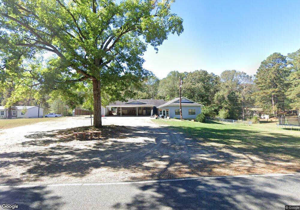
947 Strozier Rd West Monroe, LA 71291
Estimated Value: $251,796 - $382,000
4
Beds
1
Bath
2,246
Sq Ft
$143/Sq Ft
Est. Value
About This Home
This home is located at 947 Strozier Rd, West Monroe, LA 71291 and is currently estimated at $320,449, approximately $142 per square foot. 947 Strozier Rd is a home located in Ouachita Parish with nearby schools including Drew Elementary School and West Monroe High School.
Ownership History
Date
Name
Owned For
Owner Type
Purchase Details
Closed on
Feb 21, 2005
Sold by
Reno Gary Norwood and Reno Kelley Ann Baker
Bought by
Henderson Bruce Roger
Current Estimated Value
Home Financials for this Owner
Home Financials are based on the most recent Mortgage that was taken out on this home.
Original Mortgage
$200,000
Outstanding Balance
$101,389
Interest Rate
5.71%
Mortgage Type
Purchase Money Mortgage
Estimated Equity
$219,060
Create a Home Valuation Report for This Property
The Home Valuation Report is an in-depth analysis detailing your home's value as well as a comparison with similar homes in the area
Home Values in the Area
Average Home Value in this Area
Purchase History
| Date | Buyer | Sale Price | Title Company |
|---|---|---|---|
| Henderson Bruce Roger | $105,000 | None Available |
Source: Public Records
Mortgage History
| Date | Status | Borrower | Loan Amount |
|---|---|---|---|
| Open | Henderson Bruce Roger | $200,000 |
Source: Public Records
Tax History Compared to Growth
Tax History
| Year | Tax Paid | Tax Assessment Tax Assessment Total Assessment is a certain percentage of the fair market value that is determined by local assessors to be the total taxable value of land and additions on the property. | Land | Improvement |
|---|---|---|---|---|
| 2024 | $1,235 | $20,908 | $3,000 | $17,908 |
| 2023 | $1,235 | $17,681 | $3,000 | $14,681 |
| 2022 | $1,573 | $17,681 | $3,000 | $14,681 |
| 2021 | $1,592 | $17,728 | $3,000 | $14,728 |
| 2020 | $1,610 | $17,920 | $3,000 | $14,920 |
| 2019 | $1,176 | $13,125 | $1,894 | $11,231 |
| 2018 | $504 | $13,125 | $1,894 | $11,231 |
| 2017 | $1,176 | $13,125 | $1,894 | $11,231 |
| 2016 | $1,175 | $10,500 | $1,680 | $8,820 |
| 2015 | $268 | $10,500 | $1,680 | $8,820 |
| 2014 | $268 | $10,500 | $1,680 | $8,820 |
| 2013 | $267 | $10,500 | $1,680 | $8,820 |
Source: Public Records
Map
Nearby Homes
- 171 Chimney Hill Rd
- 158 Rex Robertson Rd
- 108 Comanche Trail
- 149 Comanche Trail
- 000 Strozier Rd
- 107 Sioux Dr
- 110 Fox Run Unit 110 Fox run
- 1119 Comanche Trail
- 107 Bonnabel Place
- 0 Bonnabel Place
- 100 Aspen Cir
- 201 Glen Acres Rd
- 865 Johnson Rd
- 0 (A) Carter Rd
- 0 (B) Carter Rd
- 000 C Carter Rd
- 159 Chapel Ln
- 127 Henry Rd
- 205 Chapel Hill Place
- 830 Ole Highway 15
- 932 Strozier Rd
- 950 Strozier Rd
- 975 Strozier Rd
- 913 Strozier Rd
- 974 Strozier Rd
- 157 Antley Rd
- 908 Strozier Rd
- 1008 Strozier Rd
- 187 Antley Rd
- 850 Strozier Rd
- 111 Lake Lindsay Dr
- 823 Strozier Rd
- 832 Strozier Rd
- 112 Lake Lindsay Dr
- 204 Barnes Rd
- 154 Chimney Hill Rd
- 199 Antley Rd
- 172 Chimney Hill Rd
- 213 Antley Rd
- 149 Barnes Rd