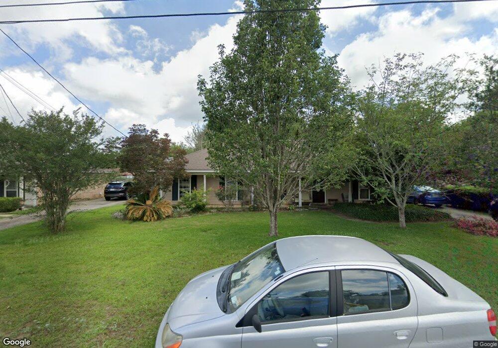
9480 Signal Ct Mobile, AL 36695
Baker NeighborhoodEstimated Value: $218,000 - $253,000
4
Beds
2
Baths
1,643
Sq Ft
$141/Sq Ft
Est. Value
About This Home
This home is located at 9480 Signal Ct, Mobile, AL 36695 and is currently estimated at $230,997, approximately $140 per square foot. 9480 Signal Ct is a home located in Mobile County with nearby schools including Elsie Collier Elementary School, Bernice J Causey Middle School, and Baker High School.
Ownership History
Date
Name
Owned For
Owner Type
Purchase Details
Closed on
Aug 28, 2017
Sold by
Keller Curtis L and Moragne Jacqueline Breland
Bought by
Boyd Sara
Current Estimated Value
Home Financials for this Owner
Home Financials are based on the most recent Mortgage that was taken out on this home.
Original Mortgage
$152,192
Outstanding Balance
$127,532
Interest Rate
4.03%
Mortgage Type
FHA
Estimated Equity
$103,465
Purchase Details
Closed on
Oct 24, 2003
Sold by
Robertson Jesse Ollie and Robertson Cathy D
Bought by
Moragne Jacqueline Breland
Home Financials for this Owner
Home Financials are based on the most recent Mortgage that was taken out on this home.
Original Mortgage
$95,000
Interest Rate
6.16%
Mortgage Type
Unknown
Create a Home Valuation Report for This Property
The Home Valuation Report is an in-depth analysis detailing your home's value as well as a comparison with similar homes in the area
Home Values in the Area
Average Home Value in this Area
Purchase History
| Date | Buyer | Sale Price | Title Company |
|---|---|---|---|
| Boyd Sara | $155,000 | None Available | |
| Moragne Jacqueline Breland | $115,000 | -- |
Source: Public Records
Mortgage History
| Date | Status | Borrower | Loan Amount |
|---|---|---|---|
| Open | Boyd Sara | $152,192 | |
| Previous Owner | Moragne Jacqueline Breland | $95,000 |
Source: Public Records
Tax History Compared to Growth
Tax History
| Year | Tax Paid | Tax Assessment Tax Assessment Total Assessment is a certain percentage of the fair market value that is determined by local assessors to be the total taxable value of land and additions on the property. | Land | Improvement |
|---|---|---|---|---|
| 2024 | $995 | $20,450 | $4,000 | $16,450 |
| 2023 | $995 | $18,150 | $4,000 | $14,150 |
| 2022 | $734 | $16,510 | $4,000 | $12,510 |
| 2021 | $725 | $16,320 | $4,000 | $12,320 |
| 2020 | $731 | $16,450 | $4,000 | $12,450 |
| 2019 | $661 | $15,000 | $4,000 | $11,000 |
| 2018 | $672 | $15,240 | $0 | $0 |
| 2017 | $696 | $14,280 | $0 | $0 |
| 2016 | $604 | $13,840 | $0 | $0 |
| 2013 | $568 | $12,260 | $0 | $0 |
Source: Public Records
Map
Nearby Homes
- 9410 Ashwood Ct
- 1120 Colonial Hills Dr
- 9510 Gaslight Ct
- 9665 Oak Forrest Dr
- 1261 Comstock Ct
- 9556 Bridgeton Ct
- 1081 Hillside Ct
- 960 Abilene Dr W
- 1151 Seven Hills Curve S
- 1345 Camden Ct
- 9601 Royal Woods Dr S
- 811 Royal Woods Dr W
- 791 Copperfield Dr W
- 1100 Wellington Ct S
- 789 Royal Woods Dr W Unit 7
- 9751 Pine Knoll Rd
- 750 Hale Rd
- 790 Trailwood Dr E
- 11900 Airport Blvd
- 1330 Twelve Oaks Dr
- 9500 Signal Ct
- 9470 Signal Ct
- 9491 Oak Forrest Dr
- 9481 Oak Forrest Dr
- 9510 Signal Ct
- 9501 Signal Ct
- 1180 Smokerise Dr
- 9471 Oak Forrest Dr
- 9501 Oak Forrest Dr
- 1170 Smokerise Dr
- 1200 Smokerise Dr
- 9511 Signal Ct
- 9520 Signal Ct
- 9461 Oak Forrest Dr
- 1160 Smokerise Dr
- 9511 Oak Forrest Dr
- 1210 Smokerise Dr
- 9521 Signal Ct
- 10453 Heritance Rd
- 15120 Private Rd Unit 368