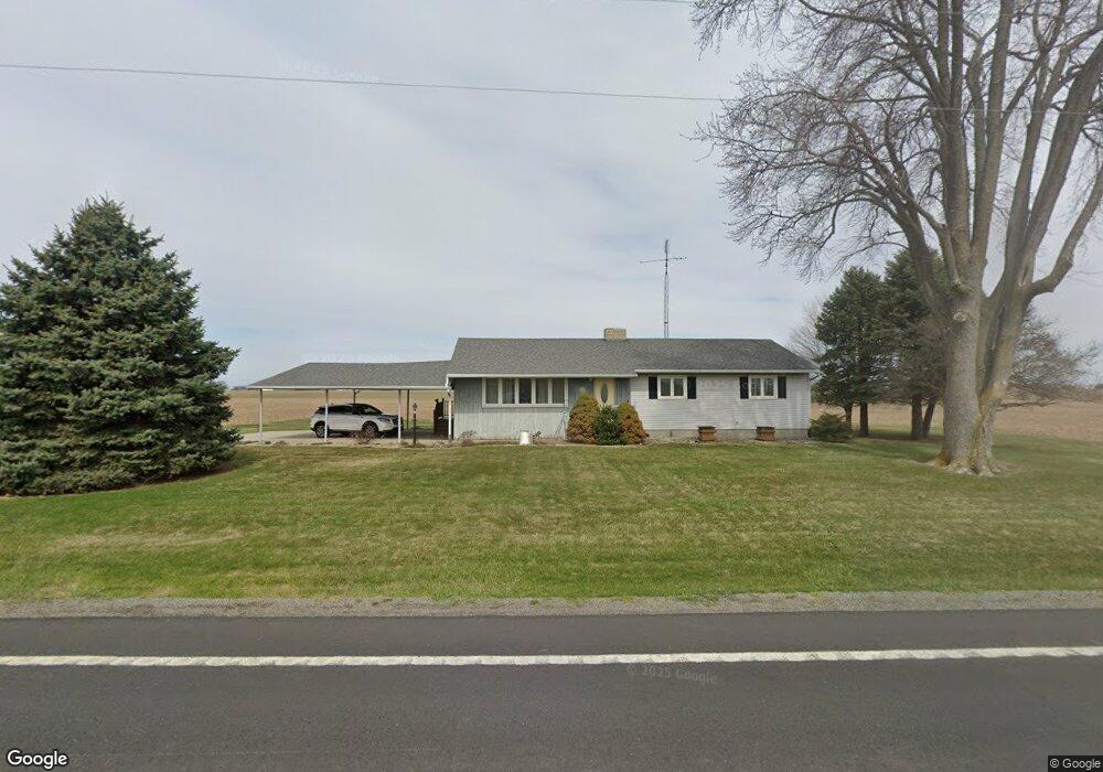
9482 State Route 12 Columbus Grove, OH 45830
Estimated Value: $180,081 - $244,000
3
Beds
1
Bath
1,560
Sq Ft
$141/Sq Ft
Est. Value
About This Home
This home is located at 9482 State Route 12, Columbus Grove, OH 45830 and is currently estimated at $220,520, approximately $141 per square foot. 9482 State Route 12 is a home located in Putnam County with nearby schools including Columbus Grove Elementary School, Columbus Grove Middle School, and Columbus Grove High School.
Ownership History
Date
Name
Owned For
Owner Type
Purchase Details
Closed on
Jun 28, 2012
Sold by
Parker Scott T
Bought by
Harman Sharon L
Current Estimated Value
Purchase Details
Closed on
Nov 15, 2006
Sold by
Schroder Gerald M and Schroder Beatrice C
Bought by
Parker Scott T
Home Financials for this Owner
Home Financials are based on the most recent Mortgage that was taken out on this home.
Original Mortgage
$81,600
Interest Rate
6.33%
Mortgage Type
Purchase Money Mortgage
Create a Home Valuation Report for This Property
The Home Valuation Report is an in-depth analysis detailing your home's value as well as a comparison with similar homes in the area
Home Values in the Area
Average Home Value in this Area
Purchase History
| Date | Buyer | Sale Price | Title Company |
|---|---|---|---|
| Harman Sharon L | $108,000 | Attorney | |
| Parker Scott T | -- | Spencerville Title |
Source: Public Records
Mortgage History
| Date | Status | Borrower | Loan Amount |
|---|---|---|---|
| Previous Owner | Parker Scott T | $81,600 |
Source: Public Records
Tax History Compared to Growth
Tax History
| Year | Tax Paid | Tax Assessment Tax Assessment Total Assessment is a certain percentage of the fair market value that is determined by local assessors to be the total taxable value of land and additions on the property. | Land | Improvement |
|---|---|---|---|---|
| 2024 | $1,341 | $42,220 | $5,600 | $36,620 |
| 2023 | $1,421 | $37,410 | $4,420 | $32,990 |
| 2022 | $1,459 | $37,412 | $4,421 | $32,991 |
| 2021 | $1,336 | $37,410 | $4,420 | $32,990 |
| 2020 | $1,340 | $28,670 | $3,690 | $24,980 |
| 2019 | $1,147 | $32,700 | $4,420 | $28,280 |
| 2018 | $1,142 | $32,700 | $4,420 | $28,280 |
| 2017 | $984 | $32,700 | $4,420 | $28,280 |
| 2016 | $984 | $28,670 | $3,690 | $24,980 |
| 2015 | $989 | $28,670 | $3,690 | $24,980 |
| 2014 | $999 | $28,670 | $3,690 | $24,980 |
| 2013 | $996 | $28,670 | $3,690 | $24,980 |
Source: Public Records
Map
Nearby Homes
- 204 S Broadway St
- 205 S Broadway St
- 209 Willow Bend Dr
- 308 Delphos Rd
- 11059 Ottawa Rd
- 704 Sherman St
- 17429 Road 5
- 208 E Monroe St
- 101 Maplewood Dr
- 00000 Ohio 696
- 000 Ohio 696
- 0000 Ohio 696
- 8160 Columbus Grove-Bluffton Rd
- 147 Elm St
- 7957 Hillville Rd
- 370 S Thomas St
- 148 S Water St
- 1854 S Agner St
- 195 Eastland Dr
- 717 E 2nd St
- 9451 State Route 12
- 9517 State Route 12
- 9390 State Route 12
- 9390 Ohio 12
- 9357 State Route 12
- 9323 State Route 12
- 9662 State Route 12
- 17825 Road 9q
- 9258 State Route 12
- 9736 State Route 12
- 17869 Road 9q
- 9297 State Route 12
- 17887 Road 9q
- 9216 State Route 12
- 17911 Road 9q
- 339 N High St
- 337 N High St
- 335 N High St
- 17963 Road 9q
- 333 N High St