Estimated Value: $188,477 - $201,000
3
Beds
1
Bath
1,167
Sq Ft
$165/Sq Ft
Est. Value
About This Home
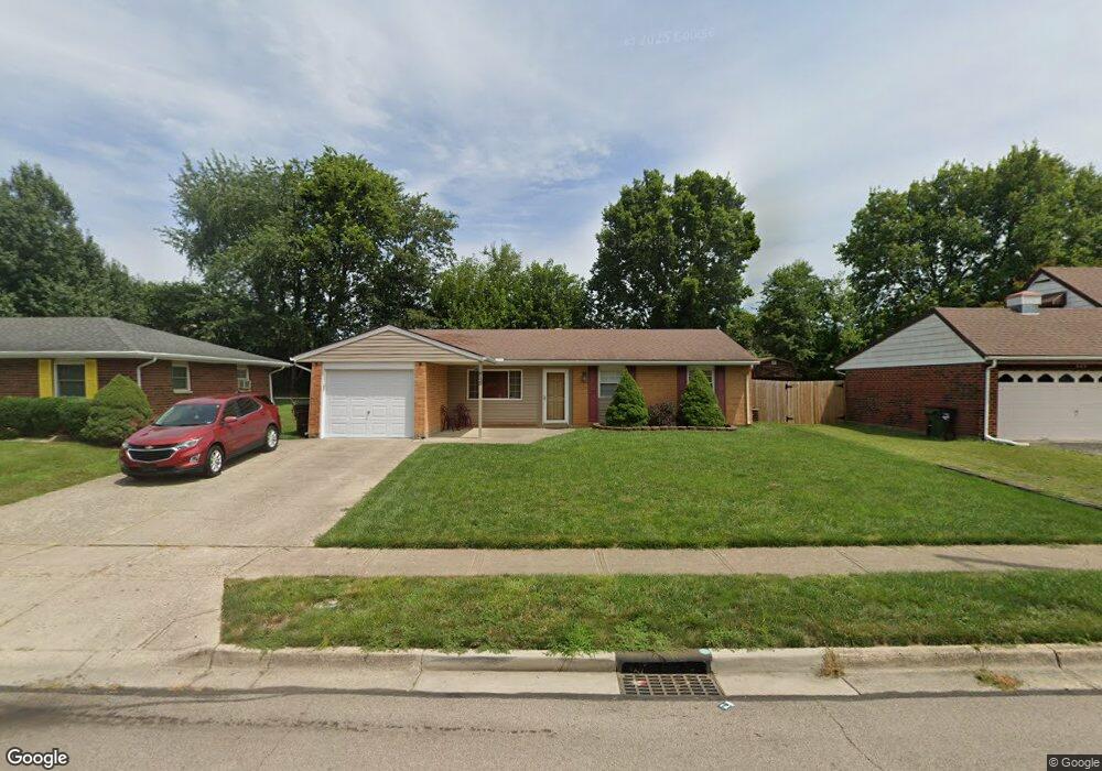
This home is located at 949 Colorado Dr, Xenia, OH 45385 and is currently estimated at $192,119, approximately $164 per square foot. 949 Colorado Dr is a home located in Greene County with nearby schools including Xenia High School, Summit Academy Community School for Alternative Learners - Xenia, and Legacy Christian Academy.
Ownership History
Date
Name
Owned For
Owner Type
Purchase Details
Closed on
May 23, 2025
Sold by
Wilson Laura and Wilson Donald R
Bought by
Wilson Donald R and Wilson Laura
Current Estimated Value
Purchase Details
Closed on
Oct 4, 2010
Sold by
Hsbc Bank Usa National Association
Bought by
Wilson Laura
Purchase Details
Closed on
Jun 1, 2010
Sold by
Rowland Matthew D and Rowland Jennifer A
Bought by
Hsbc Bank Usa National Association
Purchase Details
Closed on
Aug 30, 2000
Sold by
Terry Tegtmeyer and Terry Donna
Bought by
Rowland Matthew D and Rowland Jennifer A
Home Financials for this Owner
Home Financials are based on the most recent Mortgage that was taken out on this home.
Original Mortgage
$70,000
Interest Rate
8.15%
Purchase Details
Closed on
Sep 5, 1995
Sold by
Faul Darrin L
Bought by
Terry and Tegtmeyer Donna
Create a Home Valuation Report for This Property
The Home Valuation Report is an in-depth analysis detailing your home's value as well as a comparison with similar homes in the area
Home Values in the Area
Average Home Value in this Area
Purchase History
| Date | Buyer | Sale Price | Title Company |
|---|---|---|---|
| Wilson Donald R | -- | None Listed On Document | |
| Wilson Laura | $47,000 | Prism Title & Closing Servic | |
| Hsbc Bank Usa National Association | $64,000 | None Available | |
| Rowland Matthew D | $74,000 | -- | |
| Terry | $58,000 | -- |
Source: Public Records
Mortgage History
| Date | Status | Borrower | Loan Amount |
|---|---|---|---|
| Previous Owner | Rowland Matthew D | $70,000 |
Source: Public Records
Tax History Compared to Growth
Tax History
| Year | Tax Paid | Tax Assessment Tax Assessment Total Assessment is a certain percentage of the fair market value that is determined by local assessors to be the total taxable value of land and additions on the property. | Land | Improvement |
|---|---|---|---|---|
| 2024 | $2,006 | $48,120 | $10,680 | $37,440 |
| 2023 | $2,006 | $48,120 | $10,680 | $37,440 |
| 2022 | $1,674 | $34,230 | $6,280 | $27,950 |
| 2021 | $1,697 | $34,230 | $6,280 | $27,950 |
| 2020 | $272 | $34,230 | $6,280 | $27,950 |
| 2019 | $1,352 | $26,820 | $6,240 | $20,580 |
| 2018 | $1,357 | $26,820 | $6,240 | $20,580 |
| 2017 | $1,231 | $26,820 | $6,240 | $20,580 |
| 2016 | $1,231 | $23,890 | $6,240 | $17,650 |
| 2015 | $1,235 | $23,890 | $6,240 | $17,650 |
| 2014 | $1,181 | $23,890 | $6,240 | $17,650 |
Source: Public Records
Map
Nearby Homes
- 1908 Whitt St
- 1107 Arkansas Dr
- 1829 Gayhart Dr
- 1255 Colorado Dr
- 1769 Gayhart Dr
- 2257 Maryland Dr
- 1403 Texas Dr
- 2345 Tennessee Dr
- 1866 Roxbury Dr
- 2499 Jenny Marie Dr
- 2142 Michigan Dr
- 2421 Louisiana Dr
- 2540 Jenny Marie Dr
- 2545 Harmony Dr
- 1778 Arapaho Dr
- 2540 Cornwall Dr
- 1653 Seneca Dr
- 0 Berkshire Dr Unit 942854
- 414 Whisper Ln
- 1618 Navajo Dr
- 933 Colorado Dr
- 963 Colorado Dr
- 921 Colorado Dr
- 973 Colorado Dr
- 2073 Virginia Dr
- 903 Colorado Dr
- 2072 Virginia Dr
- 987 Colorado Dr
- 2074 Mississippi Dr
- 2093 Virginia Dr
- 887 Colorado Dr
- 2092 Virginia Dr
- 2071 Carolina Dr
- 1001 Colorado Dr
- 2092 Mississippi Dr
- 2119 Virginia Dr
- 875 Colorado Dr
- 2116 Virginia Dr
- 2095 Carolina Dr
- 2106 Mississippi Dr