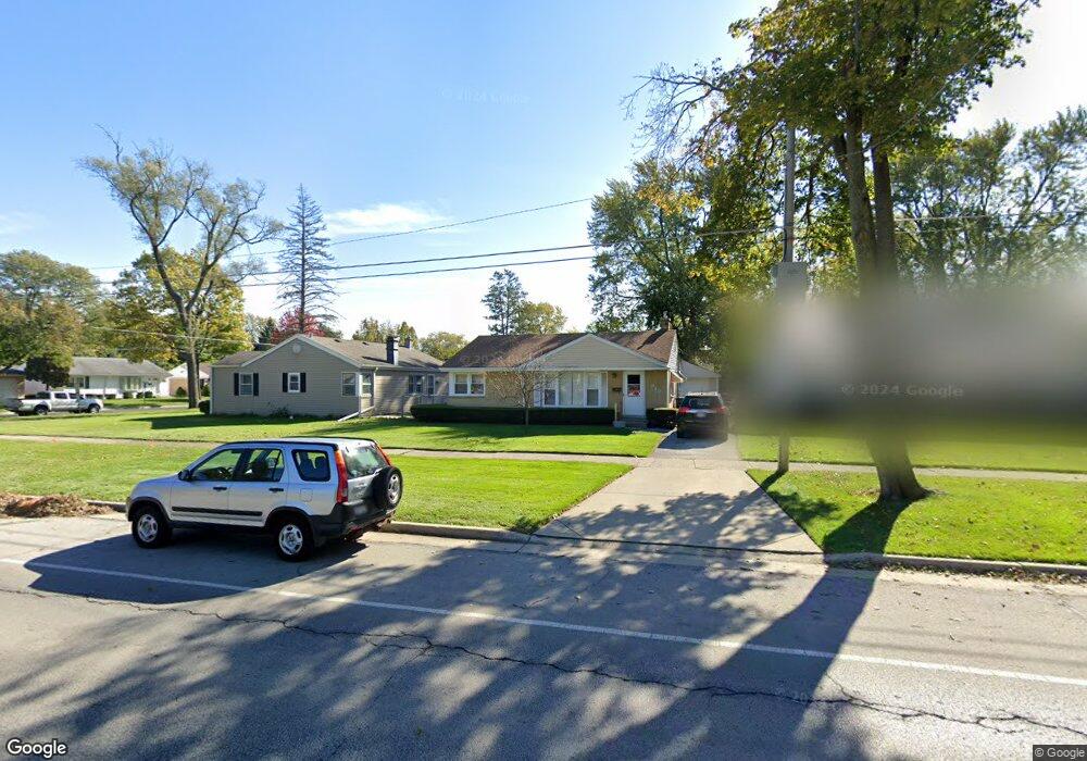
949 E Algonquin Rd Des Plaines, IL 60016
Estimated Value: $345,000 - $391,798
2
Beds
2
Baths
1,249
Sq Ft
$293/Sq Ft
Est. Value
About This Home
This home is located at 949 E Algonquin Rd, Des Plaines, IL 60016 and is currently estimated at $366,200, approximately $293 per square foot. 949 E Algonquin Rd is a home located in Cook County with nearby schools including Forest Elementary School, Algonquin Middle School, and Maine West High School.
Create a Home Valuation Report for This Property
The Home Valuation Report is an in-depth analysis detailing your home's value as well as a comparison with similar homes in the area
Home Values in the Area
Average Home Value in this Area
Tax History
| Year | Tax Paid | Tax Assessment Tax Assessment Total Assessment is a certain percentage of the fair market value that is determined by local assessors to be the total taxable value of land and additions on the property. | Land | Improvement |
|---|---|---|---|---|
| 2025 | $7,036 | $35,000 | $6,844 | $28,156 |
| 2024 | $7,036 | $30,000 | $5,703 | $24,297 |
| 2023 | $6,839 | $30,000 | $5,703 | $24,297 |
| 2022 | $6,839 | $30,000 | $5,703 | $24,297 |
| 2021 | $7,220 | $26,818 | $4,752 | $22,066 |
| 2020 | $7,167 | $26,818 | $4,752 | $22,066 |
| 2019 | $7,186 | $30,133 | $4,752 | $25,381 |
| 2018 | $6,381 | $24,773 | $4,182 | $20,591 |
| 2017 | $6,286 | $24,773 | $4,182 | $20,591 |
| 2016 | $6,190 | $24,773 | $4,182 | $20,591 |
| 2015 | $5,098 | $19,485 | $3,611 | $15,874 |
| 2014 | $5,006 | $19,485 | $3,611 | $15,874 |
| 2013 | $4,864 | $19,485 | $3,611 | $15,874 |
Source: Public Records
Map
Nearby Homes
- 1394 Carol Ln
- 1048 E Walnut Ave
- 1162 W Grant Dr
- 674 E Algonquin Rd
- 1080 Bogart St
- 1205 S Wolf Rd
- 980 W Grant Dr
- 815 E Oakton St Unit 311
- 1122 Alfini Dr
- 886 E Thacker St
- 664 E Oakton St
- 1277 E Thacker St Unit 303
- 1380 Oakwood Ave Unit 306
- 900 Center St Unit 3A
- 505 Forest Ave
- 1107 E Prairie Ave
- 799 Graceland Ave Unit 404A
- 905 Center St Unit B208
- 787 Graceland Ave Unit 202B
- 652 E Prairie Ave
- 941 E Algonquin Rd
- 955 E Algonquin Rd
- 933 E Algonquin Rd
- 1216 Wayne Dr
- 1210 Wayne Dr
- 1224 Wayne Dr
- 925 E Algonquin Rd
- 1234 Wayne Dr
- 917 E Algonquin Rd
- 1185 Webster Ln
- 1240 Wayne Dr
- 930 E Algonquin Rd
- 1207 Webster Ln
- 1225 Webster Ln
- 1233 Webster Ln
- 1248 Wayne Dr
- 1182 Webster Ln
- 1177 Webster Ln
- 909 E Algonquin Rd
- 1243 Webster Ln
Your Personal Tour Guide
Ask me questions while you tour the home.