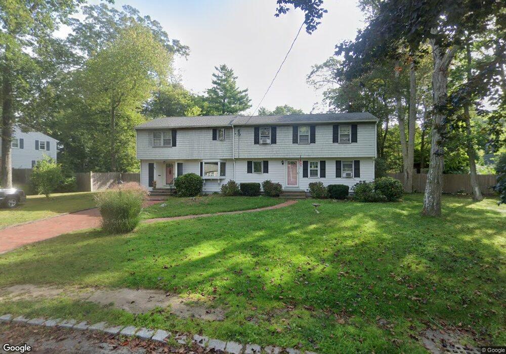
95 Aberdeen Dr Scituate, MA 02066
Estimated Value: $1,129,880 - $1,303,000
5
Beds
3
Baths
2,881
Sq Ft
$427/Sq Ft
Est. Value
About This Home
This home is located at 95 Aberdeen Dr, Scituate, MA 02066 and is currently estimated at $1,229,470, approximately $426 per square foot. 95 Aberdeen Dr is a home located in Plymouth County with nearby schools including Cushing Elementary School, Lester J. Gates Middle School, and Scituate High School.
Ownership History
Date
Name
Owned For
Owner Type
Purchase Details
Closed on
Apr 10, 2009
Sold by
Devine Maura
Bought by
Devine Maura and Devine Eileen
Current Estimated Value
Home Financials for this Owner
Home Financials are based on the most recent Mortgage that was taken out on this home.
Original Mortgage
$417,000
Outstanding Balance
$263,611
Interest Rate
4.94%
Mortgage Type
Purchase Money Mortgage
Estimated Equity
$965,859
Purchase Details
Closed on
May 7, 2008
Sold by
Devine Ruth and Devine Maura
Bought by
Devine Maura
Create a Home Valuation Report for This Property
The Home Valuation Report is an in-depth analysis detailing your home's value as well as a comparison with similar homes in the area
Home Values in the Area
Average Home Value in this Area
Purchase History
| Date | Buyer | Sale Price | Title Company |
|---|---|---|---|
| Devine Maura | -- | -- | |
| Devine Maura | -- | -- |
Source: Public Records
Mortgage History
| Date | Status | Borrower | Loan Amount |
|---|---|---|---|
| Open | Devine Maura | $417,000 |
Source: Public Records
Tax History Compared to Growth
Tax History
| Year | Tax Paid | Tax Assessment Tax Assessment Total Assessment is a certain percentage of the fair market value that is determined by local assessors to be the total taxable value of land and additions on the property. | Land | Improvement |
|---|---|---|---|---|
| 2025 | $8,431 | $843,900 | $374,100 | $469,800 |
| 2024 | $8,367 | $807,600 | $340,100 | $467,500 |
| 2023 | $8,189 | $748,300 | $326,400 | $421,900 |
| 2022 | $8,189 | $648,900 | $295,000 | $353,900 |
| 2021 | $7,821 | $586,700 | $281,000 | $305,700 |
| 2020 | $7,233 | $535,800 | $270,100 | $265,700 |
| 2019 | $7,132 | $519,100 | $264,800 | $254,300 |
| 2018 | $6,889 | $493,800 | $276,100 | $217,700 |
| 2017 | $6,801 | $482,700 | $265,000 | $217,700 |
| 2016 | $6,514 | $460,700 | $243,000 | $217,700 |
| 2015 | $5,890 | $449,600 | $231,900 | $217,700 |
Source: Public Records
Map
Nearby Homes
- 14 Aberdeen Dr
- 9 Kyle Path
- 32 Fairview Ave
- 59 Captain Peirce Rd
- 11 Forest Ln
- 9 Forest Ln Unit 9
- 112 Hollett St
- 54 Woodland Rd
- 16 3 Ring Rd
- 575 First Parish Rd
- 84 Booth Hill Rd
- 8 Trudys Ln
- 2 Windward Ln
- 22 Kings Way
- 26 Mordecai Lincoln Rd
- 116 Old Forge Rd
- 378 Tilden Rd
- 115 Elm St
- 111 Elm St
- 131 Maple St
- 91 Aberdeen Dr
- 94 Aberdeen Dr
- 56 Arborway Dr
- 50 Arborway Dr
- 98 Aberdeen Dr
- 90 Aberdeen Dr
- 83 Aberdeen Dr
- 46 Arborway Dr
- 55 Arborway Dr
- 104 Aberdeen Dr
- 47 Arborway Dr
- 82 Aberdeen Dr
- 5 Bonnie Briar Cir
- 61 Arborway Dr
- 79 Aberdeen Dr
- 108 Aberdeen Dr
- 40 Arborway Dr
- 4 Bonnie Briar Cir
- 41 Arborway Dr
- 8 Bonnie Briar Cir