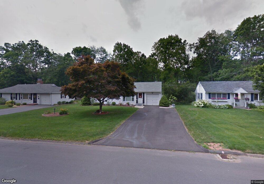
95 Cedar St Wethersfield, CT 06109
Estimated Value: $314,000 - $337,000
3
Beds
1
Bath
984
Sq Ft
$331/Sq Ft
Est. Value
About This Home
This home is located at 95 Cedar St, Wethersfield, CT 06109 and is currently estimated at $326,092, approximately $331 per square foot. 95 Cedar St is a home located in Hartford County with nearby schools including Samuel B. Webb Elementary School, Silas Deane Middle School, and Wethersfield High School.
Ownership History
Date
Name
Owned For
Owner Type
Purchase Details
Closed on
May 31, 2022
Sold by
Levesque Maryann and Levesque Roger
Bought by
Romero Agustin
Current Estimated Value
Home Financials for this Owner
Home Financials are based on the most recent Mortgage that was taken out on this home.
Original Mortgage
$255,290
Outstanding Balance
$237,862
Interest Rate
3.99%
Mortgage Type
FHA
Estimated Equity
$88,230
Purchase Details
Closed on
Apr 30, 2013
Sold by
Levesque Maryann
Bought by
Levesque Maryann and Levesque Roger
Home Financials for this Owner
Home Financials are based on the most recent Mortgage that was taken out on this home.
Original Mortgage
$129,500
Interest Rate
3.64%
Mortgage Type
New Conventional
Purchase Details
Closed on
May 1, 2003
Sold by
Ambrogio Toni
Bought by
Baio Maryann
Purchase Details
Closed on
Jun 1, 2000
Sold by
Begley Neil B and Powers Christine B
Bought by
Ambrogio Toni
Create a Home Valuation Report for This Property
The Home Valuation Report is an in-depth analysis detailing your home's value as well as a comparison with similar homes in the area
Home Values in the Area
Average Home Value in this Area
Purchase History
| Date | Buyer | Sale Price | Title Company |
|---|---|---|---|
| Romero Agustin | $260,000 | None Available | |
| Levesque Maryann | -- | -- | |
| Baio Maryann | $163,500 | -- | |
| Ambrogio Toni | $126,000 | -- |
Source: Public Records
Mortgage History
| Date | Status | Borrower | Loan Amount |
|---|---|---|---|
| Open | Romero Agustin | $255,290 | |
| Previous Owner | Ambrogio Toni | $129,500 | |
| Previous Owner | Ambrogio Toni | $140,000 | |
| Previous Owner | Ambrogio Toni | $22,000 |
Source: Public Records
Tax History
| Year | Tax Paid | Tax Assessment Tax Assessment Total Assessment is a certain percentage of the fair market value that is determined by local assessors to be the total taxable value of land and additions on the property. | Land | Improvement |
|---|---|---|---|---|
| 2025 | $9,142 | $221,780 | $98,000 | $123,780 |
| 2024 | $5,654 | $130,830 | $67,200 | $63,630 |
| 2023 | $5,466 | $130,830 | $67,200 | $63,630 |
| 2022 | $5,374 | $130,830 | $67,200 | $63,630 |
| 2021 | $5,321 | $130,830 | $67,200 | $63,630 |
| 2020 | $5,323 | $130,830 | $67,200 | $63,630 |
| 2019 | $5,330 | $130,830 | $67,200 | $63,630 |
| 2018 | $5,481 | $134,400 | $64,000 | $70,400 |
| 2017 | $5,345 | $134,400 | $64,000 | $70,400 |
| 2016 | $5,180 | $134,400 | $64,000 | $70,400 |
| 2015 | $5,133 | $134,400 | $64,000 | $70,400 |
| 2014 | $4,938 | $134,400 | $64,000 | $70,400 |
Source: Public Records
Map
Nearby Homes
- 273 Forest Dr
- 20 Forest Dr
- 173 Timber Trail
- 129 Goff Rd
- 144 Brown St
- 15 Potter Crossing
- 62 Schoolhouse Crossing
- 295 Ridge Rd Unit 8
- 25 Tinsmith Crossing
- 63 Wells Farm Dr
- 764 Ridge Rd
- 55 Rutledge Rd
- 7 Barrington Dr Unit C
- 1 Bristol St
- 19 Albert Ave
- 1 Brussels Ave
- 42 Dunham St
- 158 Dix Rd
- 146 Dudley Rd
- 519 Prospect St
Your Personal Tour Guide
Ask me questions while you tour the home.