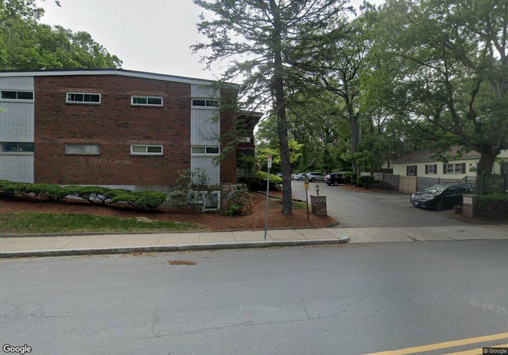
95 Grove St Unit 12 West Roxbury, MA 02132
Upper Washington-Spring Street NeighborhoodEstimated Value: $322,000 - $341,137
2
Beds
1
Bath
605
Sq Ft
$552/Sq Ft
Est. Value
About This Home
This home is located at 95 Grove St Unit 12, West Roxbury, MA 02132 and is currently estimated at $333,784, approximately $551 per square foot. 95 Grove St Unit 12 is a home located in Suffolk County with nearby schools including St Theresa School, Catholic Memorial School, and The Roxbury Latin School.
Ownership History
Date
Name
Owned For
Owner Type
Purchase Details
Closed on
May 31, 2001
Sold by
Eleni Rt
Bought by
Hull Ellen M
Current Estimated Value
Home Financials for this Owner
Home Financials are based on the most recent Mortgage that was taken out on this home.
Original Mortgage
$118,655
Outstanding Balance
$45,033
Interest Rate
7.09%
Mortgage Type
Purchase Money Mortgage
Estimated Equity
$288,751
Purchase Details
Closed on
Jul 22, 1994
Sold by
Mhfa
Bought by
Eleni Rt
Purchase Details
Closed on
Jan 20, 1994
Sold by
Daly Mark B and Mass Hous Fin Agcy
Bought by
Mhfa
Create a Home Valuation Report for This Property
The Home Valuation Report is an in-depth analysis detailing your home's value as well as a comparison with similar homes in the area
Home Values in the Area
Average Home Value in this Area
Purchase History
| Date | Buyer | Sale Price | Title Company |
|---|---|---|---|
| Hull Ellen M | $124,900 | -- | |
| Eleni Rt | $36,000 | -- | |
| Mhfa | $35,000 | -- |
Source: Public Records
Mortgage History
| Date | Status | Borrower | Loan Amount |
|---|---|---|---|
| Open | Mhfa | $118,655 |
Source: Public Records
Tax History Compared to Growth
Tax History
| Year | Tax Paid | Tax Assessment Tax Assessment Total Assessment is a certain percentage of the fair market value that is determined by local assessors to be the total taxable value of land and additions on the property. | Land | Improvement |
|---|---|---|---|---|
| 2025 | $3,304 | $285,300 | $0 | $285,300 |
| 2024 | $3,261 | $299,200 | $0 | $299,200 |
| 2023 | $3,059 | $284,800 | $0 | $284,800 |
| 2022 | $2,894 | $266,000 | $0 | $266,000 |
| 2021 | $2,704 | $253,400 | $0 | $253,400 |
| 2020 | $2,040 | $193,200 | $0 | $193,200 |
| 2019 | $1,900 | $180,300 | $0 | $180,300 |
| 2018 | $1,890 | $180,300 | $0 | $180,300 |
| 2017 | $1,872 | $176,800 | $0 | $176,800 |
| 2016 | $1,851 | $168,300 | $0 | $168,300 |
| 2015 | $1,889 | $156,000 | $0 | $156,000 |
| 2014 | $2,044 | $162,500 | $0 | $162,500 |
Source: Public Records
Map
Nearby Homes
- 115 Grove St Unit 11
- 55 Cottage Rd
- 150 Grove St
- 191 Glenellen Rd
- 231-245 Grove St
- 216 Grove St
- 104 Salman St
- 45 Weymouth Ave
- 5245 Washington St Unit 5
- 2290 Centre St
- 7 Starling St
- 10 Starling St
- 4975 Washington St Unit 311
- 4975 Washington St Unit 305
- 15 Starling St
- 43 Eastwood Circuit
- 4959 Washington St
- 2231 Centre St
- 132 Woodley Ave
- 12 Eagle St
- 95 Grove St Unit 8
- 95 Grove St Unit 11
- 95 Grove St Unit 10
- 95 Grove St Unit 9
- 95 Grove St Unit 8
- 95 Grove St Unit 7
- 95 Grove St Unit 6
- 95 Grove St Unit 5
- 95 Grove St Unit 4
- 95 Grove St Unit 3
- 95 Grove St Unit 1
- 95 Grove St Unit 95, 11
- 95 Grove St Unit 8, 95
- 95 Grove St Unit 6-95
- 99 Grove St Unit 12
- 99 Grove St Unit 11
- 99 Grove St Unit 10
- 99 Grove St Unit 9
- 99 Grove St Unit 8
- 99 Grove St Unit 7