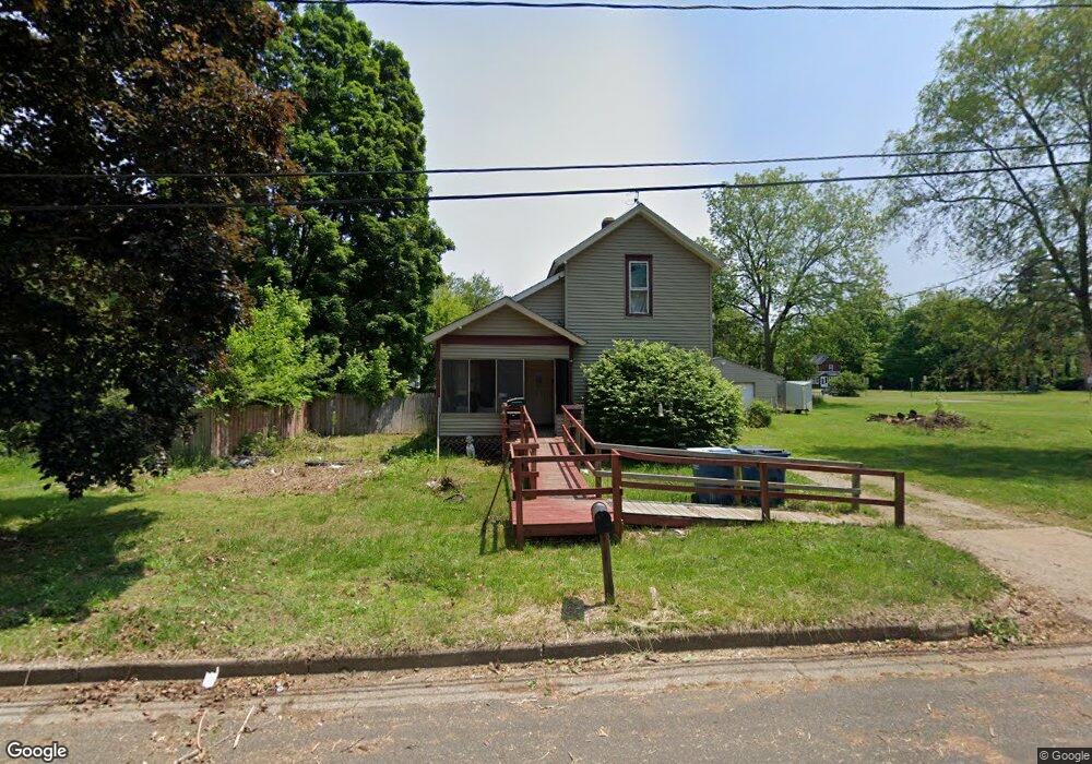
95 Logan St Battle Creek, MI 49015
Central Battle Creek NeighborhoodEstimated Value: $96,000 - $117,741
2
Beds
1
Bath
1,866
Sq Ft
$56/Sq Ft
Est. Value
About This Home
This home is located at 95 Logan St, Battle Creek, MI 49015 and is currently estimated at $104,935, approximately $56 per square foot. 95 Logan St is a home located in Calhoun County with nearby schools including Ann J. Kellogg School, Springfield Middle School, and Battle Creek Central High School.
Ownership History
Date
Name
Owned For
Owner Type
Purchase Details
Closed on
Aug 20, 2014
Sold by
Dennis Billie Joe
Bought by
Wilhelms Judy L
Current Estimated Value
Purchase Details
Closed on
Aug 2, 2011
Sold by
Wilhelms Judy L
Bought by
Dennis Billie Jo
Purchase Details
Closed on
Jun 8, 2006
Sold by
Barry Thomas P
Bought by
Wilhelms Judy L
Purchase Details
Closed on
Jan 29, 1999
Sold by
Barry Thomas P and Barry Michelle L
Bought by
Barry Thomas P and Barry Michelle L
Purchase Details
Closed on
Jan 28, 1999
Bought by
Barry
Purchase Details
Closed on
Jan 23, 1998
Bought by
Equivantage Inc
Purchase Details
Closed on
May 7, 1996
Bought by
Smith ('92 Lc Ff)
Create a Home Valuation Report for This Property
The Home Valuation Report is an in-depth analysis detailing your home's value as well as a comparison with similar homes in the area
Home Values in the Area
Average Home Value in this Area
Purchase History
| Date | Buyer | Sale Price | Title Company |
|---|---|---|---|
| Wilhelms Judy L | -- | None Available | |
| Dennis Billie Jo | -- | None Available | |
| Wilhelms Judy L | $60,000 | Fatic | |
| Barry Thomas P | -- | -- | |
| Barry | $18,500 | -- | |
| Equivantage Inc | $17,000 | -- | |
| Smith ('92 Lc Ff) | $29,900 | -- |
Source: Public Records
Tax History Compared to Growth
Tax History
| Year | Tax Paid | Tax Assessment Tax Assessment Total Assessment is a certain percentage of the fair market value that is determined by local assessors to be the total taxable value of land and additions on the property. | Land | Improvement |
|---|---|---|---|---|
| 2025 | -- | $32,000 | $0 | $0 |
| 2024 | $791 | $26,266 | $0 | $0 |
| 2023 | $730 | $24,398 | $0 | $0 |
| 2022 | $577 | $18,228 | $0 | $0 |
| 2021 | $688 | $16,810 | $0 | $0 |
| 2020 | $648 | $16,215 | $0 | $0 |
| 2019 | $645 | $17,073 | $0 | $0 |
| 2018 | $645 | $14,700 | $1,155 | $13,545 |
| 2017 | $814 | $13,642 | $0 | $0 |
| 2016 | $859 | $18,925 | $0 | $0 |
| 2015 | $1,275 | $18,544 | $5,731 | $12,813 |
| 2014 | $1,275 | $19,842 | $5,731 | $14,111 |
Source: Public Records
Map
Nearby Homes
- 3 Riverside Pkwy
- 1 Grand Blvd
- 15 Marine Dr
- 77 Leitch Dr
- 17 Tennyson Ave
- 32 Territorial Rd E
- 41 Randolph St
- 51 Pauline Ave
- 35 Eldred St
- 57 Boulder St
- 71 Burnham St W
- 127 W Territorial Rd
- 296 Meachem Ave
- 66 Cleveland St
- 137 Fairfield Ave
- 100 Eldred St
- 96 Battle Creek Ave
- 235 Fairfield Ave
- 112 Darragh Dr
- 171 Goguac St W
- 85 Logan St
- 94 Logan St
- 354 Riverside Dr
- 342 Riverside Dr
- 362 Riverside Dr
- 334 Riverside Dr
- 88 Logan St
- 360 Riverside Dr
- 71 Logan St
- 71 Logan St
- 359 Riverside Dr
- 374 Riverside Dr Unit 7
- 374 Riverside Dr
- 150 Territorial Rd E
- 101 Scenery Ave
- 105 Scenery Ave
- 97 Scenery Ave
- 101 Scenery St
- 324 Riverside Dr
- 68 Logan St