
Seller's Agent in 2025
Judith Brady
Berkshire Hathaway HomeServices Commonwealth Real Estate
(339) 225-0535
1 in this area
121 Total Sales
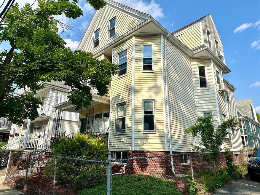
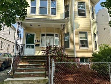
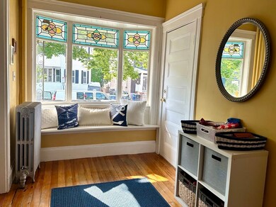
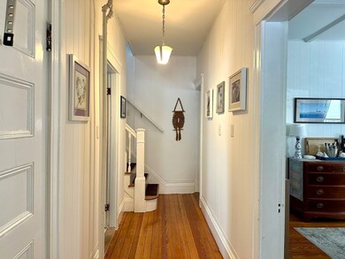
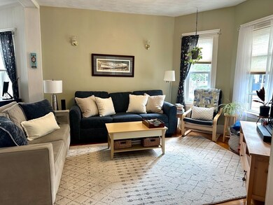
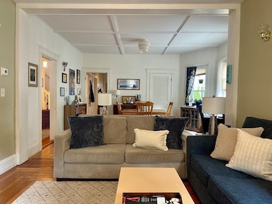
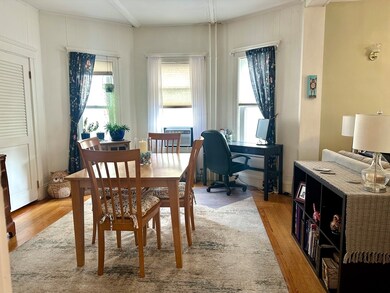
Unbeatable location! This turnkey first floor condo is just 2 blocks from Ball Square and the Somerville Community Path, and just 3/4 of a mile to Davis Square and Tufts. A commuter’s dream with easy access to both the Green and Red lines. Sun-filled with a large open concept living area, this home is warm and inviting. Soaring ceilings, charming stained glass and bay windows with hardwood floors throughout. Updated kitchen with granite countertops and plenty of storage. 2018 bathroom renovation, new dishwasher, washer & dryer. In-unit laundry and private storage in lower level. Lovely layout with 1 bedroom on first floor and 2nd bedroom on 2nd floor. Step out back to an enclosed porch to enjoy your morning coffee or a relaxing evening. Nestled in the heart of Somerville, just minutes from wonderful restaurants, cafes, grocery stores and shops. This is a MUST SEE!
Last Agent to Sell the Property
Berkshire Hathaway HomeServices Commonwealth Real Estate Listed on: 06/12/2025
| Date | Type | Sale Price | Title Company |
|---|---|---|---|
| Condominium Deed | $785,000 | -- | |
| Condominium Deed | $785,000 | -- | |
| Deed | $329,000 | -- | |
| Deed | $329,000 | -- | |
| Deed | $329,000 | -- |
| Date | Status | Loan Amount | Loan Type |
|---|---|---|---|
| Open | $588,750 | New Conventional | |
| Closed | $588,750 | New Conventional | |
| Previous Owner | $219,000 | Purchase Money Mortgage |
| Date | Event | Price | List to Sale | Price per Sq Ft |
|---|---|---|---|---|
| 08/18/2025 08/18/25 | Sold | $785,000 | +1.3% | $720 / Sq Ft |
| 06/15/2025 06/15/25 | Pending | -- | -- | -- |
| 06/12/2025 06/12/25 | For Sale | $775,000 | -- | $711 / Sq Ft |
| Year | Tax Paid | Tax Assessment Tax Assessment Total Assessment is a certain percentage of the fair market value that is determined by local assessors to be the total taxable value of land and additions on the property. | Land | Improvement |
|---|---|---|---|---|
| 2025 | $6,878 | $630,400 | $0 | $630,400 |
| 2024 | $6,498 | $617,700 | $0 | $617,700 |
| 2023 | $6,303 | $609,600 | $0 | $609,600 |
| 2022 | $5,972 | $586,600 | $0 | $586,600 |
| 2021 | $5,848 | $573,900 | $0 | $573,900 |
| 2020 | $5,605 | $555,500 | $0 | $555,500 |
| 2019 | $5,462 | $507,600 | $0 | $507,600 |
| 2018 | $5,322 | $470,600 | $0 | $470,600 |
| 2017 | $5,104 | $437,400 | $0 | $437,400 |
| 2016 | $4,556 | $363,600 | $0 | $363,600 |
| 2015 | $4,335 | $343,800 | $0 | $343,800 |
Seller's Agent in 2025
Judith Brady
Berkshire Hathaway HomeServices Commonwealth Real Estate
(339) 225-0535
1 in this area
121 Total Sales
Buyer's Agent in 2025
Jaclyn Kryzak
Labrava Realty, LLC
(617) 775-4341
1 in this area
17 Total Sales
Source: MLS Property Information Network (MLS PIN)
MLS Number: 73390273
APN: SOME-000027-G000000-000024-000001
Disclaimer: Certain information contained herein is derived from information provided by parties other than Homes.com. All information provided is deemed reliable, but is not guaranteed to be accurate and should be independently verified.
![]() The property listing data and information, or the Images, set forth herein were provided to MLS Property Information Network, Inc. from third party sources, including sellers, lessors and public records, and were compiled by MLS Property Information Network, Inc. The property listing data and information, and the Images, are for the personal, non-commercial use of consumers having a good faith interest in purchasing or leasing listed properties of the type displayed to them and may not be used for any purpose other than to identify prospective properties which such consumers may have a good faith interest in purchasing or leasing. MLS Property Information Network, Inc. and its subscribers disclaim any and all representations and warranties as to the accuracy of the property listing data and information, or as to the accuracy of any of the Images, set forth herein.
The property listing data and information, or the Images, set forth herein were provided to MLS Property Information Network, Inc. from third party sources, including sellers, lessors and public records, and were compiled by MLS Property Information Network, Inc. The property listing data and information, and the Images, are for the personal, non-commercial use of consumers having a good faith interest in purchasing or leasing listed properties of the type displayed to them and may not be used for any purpose other than to identify prospective properties which such consumers may have a good faith interest in purchasing or leasing. MLS Property Information Network, Inc. and its subscribers disclaim any and all representations and warranties as to the accuracy of the property listing data and information, or as to the accuracy of any of the Images, set forth herein.
Ask me questions while you tour the home.