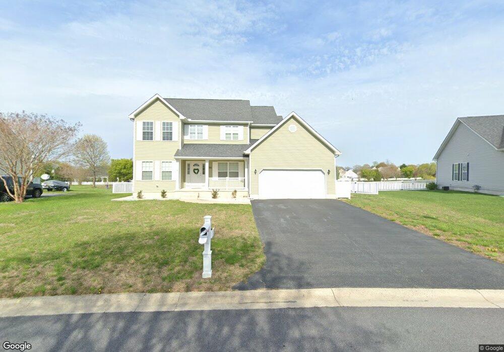
95 Quail Landing Cir Unit A Magnolia, DE 19962
Rising Sun-Lebanon NeighborhoodEstimated Value: $426,000 - $464,000
3
Beds
2
Baths
1,979
Sq Ft
$222/Sq Ft
Est. Value
About This Home
This home is located at 95 Quail Landing Cir Unit A, Magnolia, DE 19962 and is currently estimated at $439,076, approximately $221 per square foot. 95 Quail Landing Cir Unit A is a home located in Kent County with nearby schools including Allen Frear Elementary School, F. Niel Postlethwait Middle School, and Caesar Rodney High School.
Ownership History
Date
Name
Owned For
Owner Type
Purchase Details
Closed on
Apr 17, 2014
Sold by
Middleneck Homes Llc
Bought by
Conner Joshua S
Current Estimated Value
Home Financials for this Owner
Home Financials are based on the most recent Mortgage that was taken out on this home.
Original Mortgage
$252,283
Outstanding Balance
$191,927
Interest Rate
4.36%
Mortgage Type
VA
Estimated Equity
$247,149
Create a Home Valuation Report for This Property
The Home Valuation Report is an in-depth analysis detailing your home's value as well as a comparison with similar homes in the area
Home Values in the Area
Average Home Value in this Area
Purchase History
| Date | Buyer | Sale Price | Title Company |
|---|---|---|---|
| Conner Joshua S | $250,000 | None Available |
Source: Public Records
Mortgage History
| Date | Status | Borrower | Loan Amount |
|---|---|---|---|
| Open | Conner Joshua S | $252,283 |
Source: Public Records
Tax History Compared to Growth
Tax History
| Year | Tax Paid | Tax Assessment Tax Assessment Total Assessment is a certain percentage of the fair market value that is determined by local assessors to be the total taxable value of land and additions on the property. | Land | Improvement |
|---|---|---|---|---|
| 2025 | $2,049 | $376,600 | $82,100 | $294,500 |
| 2024 | $2,049 | $376,600 | $82,100 | $294,500 |
| 2023 | $1,966 | $57,700 | $5,100 | $52,600 |
| 2022 | $1,850 | $57,700 | $5,100 | $52,600 |
| 2021 | $1,869 | $57,700 | $5,100 | $52,600 |
| 2020 | $1,760 | $57,700 | $5,100 | $52,600 |
| 2019 | $1,699 | $57,700 | $5,100 | $52,600 |
| 2018 | $1,676 | $57,700 | $5,100 | $52,600 |
| 2017 | $1,644 | $57,700 | $0 | $0 |
| 2016 | $1,548 | $57,700 | $0 | $0 |
| 2015 | $1,314 | $56,100 | $0 | $0 |
| 2014 | $1,355 | $56,100 | $0 | $0 |
Source: Public Records
Map
Nearby Homes
- 580 Locust Grove Rd
- 38 Planters Run Ct
- 3444 S State St
- 128 Jillian Ct
- 326 Remington Dr
- 279 Remington Dr
- 573 W Birdie Ln
- 284 Remington Dr
- 1810 Windswept Cir
- 265 Remington Dr
- 270 Remington Dr
- 253 Remington Dr
- 239 Remington Dr
- 83 Homestead Dr
- 5 Crossley Dr
- 139 Chase St
- 124 Carriage Blvd
- 113 Carriage Blvd
- 2043 Highland Ave
- HANOVER Plan at Magnolia Estates
- 95 Quail Landing Cir
- 73 Quail Landing Cir
- 105 Quail Landing Cir
- 13 Quail Landing Cir
- 1 Quail Landing Cir
- 19 Quail Landing Cir
- 69 Quail Landing Cir
- 71 Quail Landing Cir
- 21 Quail Landing Cir
- 47 Quail Landing Cir
- 98 Quail Landing Cir
- 121 Quail Landing Cir
- 70 Quail Landing Cir
- 64 Quail Landing Cir
- 126 Quail Landing Cir
- 23 Quail Landing Cir
- 16 Quail Landing Cir
- 18 Quail Landing Cir
- 20 Quail Landing Cir
- 0 Quail Landing Cir