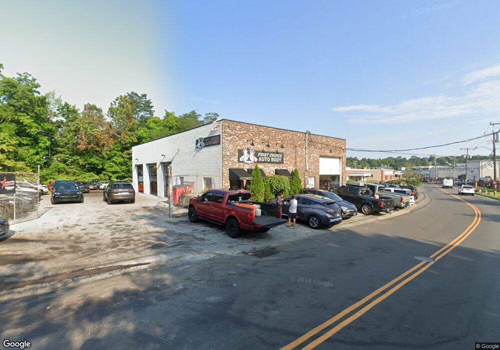
95 Research Dr Stamford, CT 06906
Glenbrook NeighborhoodEstimated Value: $2,200,370
--
Bed
--
Bath
3,796
Sq Ft
$580/Sq Ft
Est. Value
About This Home
This home is located at 95 Research Dr, Stamford, CT 06906 and is currently estimated at $2,200,370, approximately $579 per square foot. 95 Research Dr is a home located in Fairfield County with nearby schools including Julia A. Stark Elementary School, Dolan School, and Stamford High School.
Ownership History
Date
Name
Owned For
Owner Type
Purchase Details
Closed on
Mar 30, 2012
Sold by
Jagodzinski John and Jagodzinski Paula
Bought by
95 Research Drive Llc
Current Estimated Value
Home Financials for this Owner
Home Financials are based on the most recent Mortgage that was taken out on this home.
Original Mortgage
$750,000
Outstanding Balance
$313,114
Interest Rate
3.88%
Mortgage Type
Commercial
Estimated Equity
$1,887,256
Create a Home Valuation Report for This Property
The Home Valuation Report is an in-depth analysis detailing your home's value as well as a comparison with similar homes in the area
Home Values in the Area
Average Home Value in this Area
Purchase History
| Date | Buyer | Sale Price | Title Company |
|---|---|---|---|
| 95 Research Drive Llc | $1,100,000 | -- | |
| 95 Research Drive Llc | $1,100,000 | -- |
Source: Public Records
Mortgage History
| Date | Status | Borrower | Loan Amount |
|---|---|---|---|
| Open | 95 Research Drive Llc | $750,000 | |
| Closed | 95 Research Drive Llc | $750,000 | |
| Previous Owner | 95 Research Drive Llc | $600,000 |
Source: Public Records
Tax History Compared to Growth
Tax History
| Year | Tax Paid | Tax Assessment Tax Assessment Total Assessment is a certain percentage of the fair market value that is determined by local assessors to be the total taxable value of land and additions on the property. | Land | Improvement |
|---|---|---|---|---|
| 2025 | $22,011 | $930,290 | $632,760 | $297,530 |
| 2024 | $21,527 | $930,290 | $632,760 | $297,530 |
| 2023 | $23,127 | $930,290 | $632,760 | $297,530 |
| 2022 | $20,318 | $759,840 | $543,830 | $216,010 |
| 2021 | $20,098 | $759,840 | $543,830 | $216,010 |
| 2020 | $19,581 | $759,840 | $543,830 | $216,010 |
| 2019 | $19,581 | $759,840 | $543,830 | $216,010 |
| 2018 | $18,859 | $759,840 | $543,830 | $216,010 |
| 2017 | $17,334 | $666,680 | $494,450 | $172,230 |
| 2016 | $16,847 | $666,680 | $494,450 | $172,230 |
| 2015 | $16,407 | $666,680 | $494,450 | $172,230 |
| 2014 | $15,860 | $666,680 | $494,450 | $172,230 |
Source: Public Records
Map
Nearby Homes
- 596 Glenbrook Rd Unit 36
- 406 Courtland Ave Unit D
- 30 Maple Tree Ave Unit D
- 30 Lake Dr
- 34 Crescent St Unit 2D
- 88 Maple Tree Ave Unit G
- 35 Maple Tree Ave Unit 6
- 43 Crescent St Unit 11
- 51 Glendale Rd
- 69 Maple Tree Ave Unit 4
- 415 West Ave
- 30 Lenox Ave
- 98 Holmes Ave
- 31 Bellmere Ave
- 88 Pine Hill Ave
- 31 Chatfield St
- 49 Echo Dr N
- 8 Windell Place
- 143 Overbrook Dr
- 78 Elizabeth Ave
- 93 Research Dr
- 113 Research Dr
- 119 Research Dr
- 75 Research Dr
- 650 Glenbrook Rd
- 668 Glenbrook Rd Unit 40
- 668 Glenbrook Rd Unit 39
- 668 Glenbrook Rd Unit 38
- 668 Glenbrook Rd Unit 37
- 668 Glenbrook Rd Unit 36
- 668 Glenbrook Rd Unit 35
- 668 Glenbrook Rd Unit 34
- 668 Glenbrook Rd Unit 33
- 668 Glenbrook Rd Unit 32
- 668 Glenbrook Rd Unit 31
- 668 Glenbrook Rd Unit 30
- 668 Glenbrook Rd Unit 29
- 668 Glenbrook Rd Unit 28
- 668 Glenbrook Rd Unit 27
- 668 Glenbrook Rd Unit 26