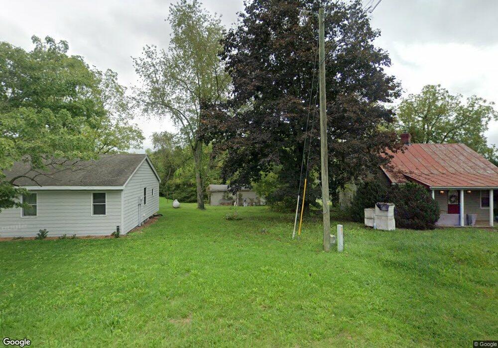
95 Vance Ln Stuarts Draft, VA 24477
Estimated Value: $182,000 - $215,000
2
Beds
1
Bath
911
Sq Ft
$220/Sq Ft
Est. Value
About This Home
This home is located at 95 Vance Ln, Stuarts Draft, VA 24477 and is currently estimated at $200,049, approximately $219 per square foot. 95 Vance Ln is a home located in Augusta County with nearby schools including Guy K. Stump Elementary School, Stuarts Draft Middle School, and Stuarts Draft High School.
Ownership History
Date
Name
Owned For
Owner Type
Purchase Details
Closed on
Nov 5, 2012
Sold by
Dameron Kenneth W and Dameron Norma L
Bought by
Solis David M
Current Estimated Value
Home Financials for this Owner
Home Financials are based on the most recent Mortgage that was taken out on this home.
Original Mortgage
$86,406
Outstanding Balance
$59,311
Interest Rate
3.25%
Mortgage Type
FHA
Estimated Equity
$140,738
Purchase Details
Closed on
Apr 13, 2009
Sold by
Midfirst Bank
Bought by
Dameron Kenneth W and Dameron Norma L
Home Financials for this Owner
Home Financials are based on the most recent Mortgage that was taken out on this home.
Original Mortgage
$49,600
Interest Rate
5.02%
Mortgage Type
New Conventional
Purchase Details
Closed on
Jan 27, 2009
Sold by
Secrist Steve M
Bought by
Midfirst Bank
Create a Home Valuation Report for This Property
The Home Valuation Report is an in-depth analysis detailing your home's value as well as a comparison with similar homes in the area
Home Values in the Area
Average Home Value in this Area
Purchase History
| Date | Buyer | Sale Price | Title Company |
|---|---|---|---|
| Solis David M | $88,000 | Attorney | |
| Dameron Kenneth W | -- | Stewart Title Insurance Co | |
| Midfirst Bank | $63,750 | None Available |
Source: Public Records
Mortgage History
| Date | Status | Borrower | Loan Amount |
|---|---|---|---|
| Open | Solis David M | $86,406 | |
| Previous Owner | Dameron Kenneth W | $49,600 |
Source: Public Records
Tax History Compared to Growth
Tax History
| Year | Tax Paid | Tax Assessment Tax Assessment Total Assessment is a certain percentage of the fair market value that is determined by local assessors to be the total taxable value of land and additions on the property. | Land | Improvement |
|---|---|---|---|---|
| 2025 | $606 | $116,600 | $60,000 | $56,600 |
| 2024 | $606 | $116,600 | $60,000 | $56,600 |
| 2023 | $556 | $88,300 | $35,000 | $53,300 |
| 2022 | $556 | $88,300 | $35,000 | $53,300 |
| 2021 | $556 | $88,300 | $35,000 | $53,300 |
| 2020 | $556 | $88,300 | $35,000 | $53,300 |
| 2019 | $556 | $88,300 | $35,000 | $53,300 |
| 2018 | $518 | $82,186 | $35,000 | $47,186 |
| 2017 | $477 | $82,186 | $35,000 | $47,186 |
| 2016 | $477 | $82,186 | $35,000 | $47,186 |
| 2015 | $497 | $82,186 | $35,000 | $47,186 |
| 2014 | $497 | $82,186 | $35,000 | $47,186 |
| 2013 | $497 | $103,600 | $60,000 | $43,600 |
Source: Public Records
Map
Nearby Homes
- 38 Greenbriar Ln
- 57 Greenbriar Ln
- 114 Jaspers Ln
- 77 Greenway Rd
- 16 Queens Ct
- 87 Falling Rock Dr
- 150 Falling Rock Dr
- 251 Cooper Dr
- 39 Forest Springs Dr
- 253 Forest Springs Dr
- 294 Forest Springs Dr
- 78 Gra Mar Ln
- 378 Forest Springs Dr
- 112 Arrowhead Ln
- 377 Forest Springs Dr
- 31 Hampton Dr
- 878 Patton Farm Rd
- 111 Rutherford Ln
- 1196 Howardsville Turnpike
- 117 Spring Ridge Dr