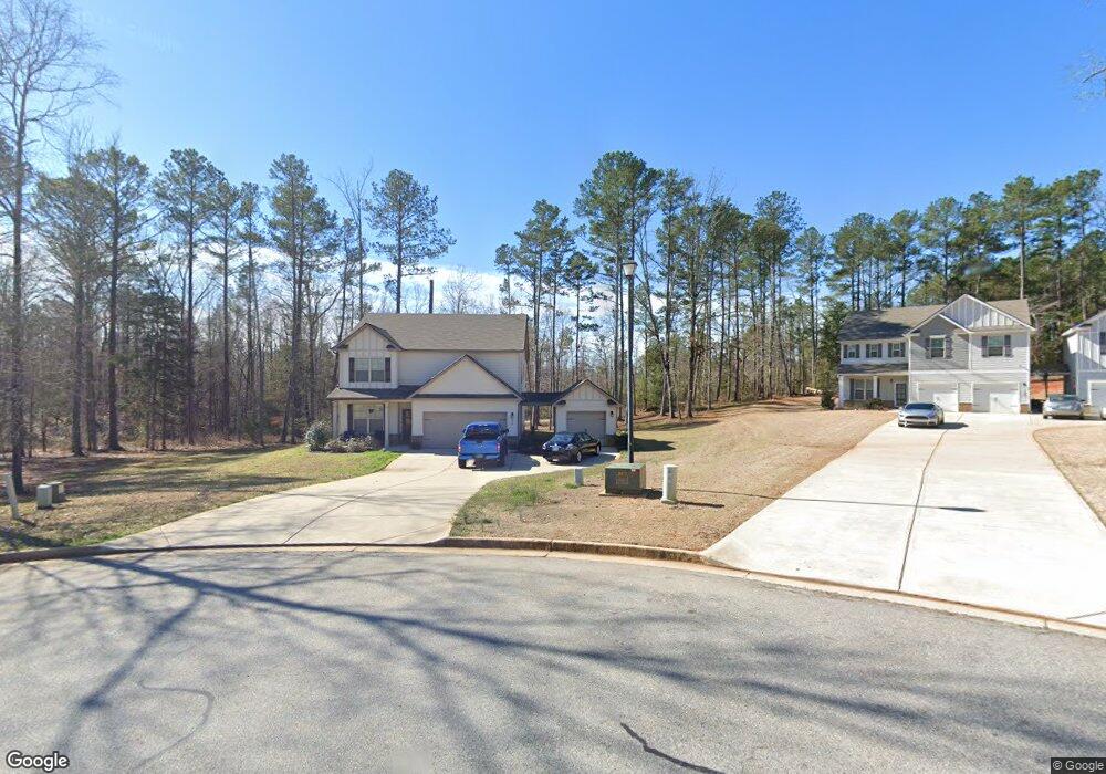
95 Wellbrook Dr Unit 7 Covington, GA 30016
Estimated Value: $332,617 - $390,000
4
Beds
3
Baths
2,304
Sq Ft
$160/Sq Ft
Est. Value
About This Home
This home is located at 95 Wellbrook Dr Unit 7, Covington, GA 30016 and is currently estimated at $368,404, approximately $159 per square foot. 95 Wellbrook Dr Unit 7 is a home located in Newton County with nearby schools including Rocky Plains Elementary School, Indian Creek Middle School, and Alcovy High School.
Ownership History
Date
Name
Owned For
Owner Type
Purchase Details
Closed on
Nov 18, 2021
Sold by
Padfield Brittnie
Bought by
Padfield Brittnie and Padfield Daniel Turette
Current Estimated Value
Home Financials for this Owner
Home Financials are based on the most recent Mortgage that was taken out on this home.
Original Mortgage
$211,000
Outstanding Balance
$192,770
Interest Rate
3.09%
Mortgage Type
New Conventional
Estimated Equity
$175,634
Purchase Details
Closed on
Feb 21, 2019
Sold by
Sunrise Builders Inc
Bought by
Pearson Brittnie Leigh
Home Financials for this Owner
Home Financials are based on the most recent Mortgage that was taken out on this home.
Original Mortgage
$212,106
Interest Rate
5.25%
Mortgage Type
New Conventional
Purchase Details
Closed on
Jun 15, 2017
Bought by
Sunrise Builders Inc
Purchase Details
Closed on
Jul 12, 2016
Sold by
Pommard Llc
Bought by
Mount Eagle Llc
Create a Home Valuation Report for This Property
The Home Valuation Report is an in-depth analysis detailing your home's value as well as a comparison with similar homes in the area
Home Values in the Area
Average Home Value in this Area
Purchase History
| Date | Buyer | Sale Price | Title Company |
|---|---|---|---|
| Padfield Brittnie | -- | -- | |
| Padfield Brittnie | -- | -- | |
| Pearson Brittnie Leigh | $212,106 | -- | |
| Sunrise Builders Inc | $104,000 | -- | |
| Mount Eagle Llc | -- | -- |
Source: Public Records
Mortgage History
| Date | Status | Borrower | Loan Amount |
|---|---|---|---|
| Open | Padfield Brittnie | $211,000 | |
| Previous Owner | Pearson Brittnie Leigh | $212,106 |
Source: Public Records
Tax History Compared to Growth
Tax History
| Year | Tax Paid | Tax Assessment Tax Assessment Total Assessment is a certain percentage of the fair market value that is determined by local assessors to be the total taxable value of land and additions on the property. | Land | Improvement |
|---|---|---|---|---|
| 2024 | $3,504 | $142,200 | $20,400 | $121,800 |
| 2023 | $3,555 | $134,880 | $7,200 | $127,680 |
| 2022 | $2,948 | $112,520 | $7,200 | $105,320 |
| 2021 | $2,533 | $87,400 | $7,200 | $80,200 |
| 2020 | $2,608 | $81,520 | $7,200 | $74,320 |
| 2019 | $2,640 | $77,400 | $7,200 | $70,200 |
| 2018 | $120 | $7,000 | $7,000 | $0 |
| 2017 | $172 | $5,000 | $5,000 | $0 |
| 2016 | $172 | $5,000 | $5,000 | $0 |
| 2015 | $103 | $3,000 | $3,000 | $0 |
| 2014 | $103 | $3,000 | $0 | $0 |
Source: Public Records
Map
Nearby Homes
- 0 Highway 81 S Unit 7670352
- 270 Wellbrook Dr
- 30 Laurel Way
- 15 Granville Ln
- 160 Cross Rd
- 230 Laurel Way
- The Northview Plan at Hampton Place Estates
- The Carrollton Plan at Hampton Place Estates
- The Wendell Plan at Hampton Place Estates
- The Donovan Plan at Hampton Place Estates
- The Kendall Plan at Hampton Place Estates
- The Rosewood Plan at Hampton Place Estates
- The Brookdale Plan at Hampton Place Estates
- The Chadwick Plan at Hampton Place Estates
- 115 Arthurs Ln
- 230 Barcelona Dr
- The Rosewood - Side Entry Plan at Preakness
- The Donovan - Side Entry Plan at Preakness
- The Northview - Side Entry Plan at Preakness
- The Newburgh - Side Entry Plan at Preakness
- 105 Wellbrook Dr Unit 8
- 85 Wellbrook Dr
- 115 Wellbrook Dr Unit 9
- 125 Wellbrook Dr Unit 10
- 120 Wellbrook Dr Unit 55
- 135 Wellbrook Dr Unit 13
- 135 Wellbrook Dr Unit 11
- 130 Wellbrook Dr Unit 54
- 55 Wellbrook Dr
- 145 Wellbrook Dr Unit 12
- 140 Wellbrook Dr Unit 53
- 150 Wellbrook Dr Unit 52
- 155 Wellbrook Dr Unit 13
- 45 Wellbrook Dr Unit 4
- 45 Wellbrook Dr
- 0 Hwy 212 Unit 7596932
- 0 Hwy 212 Unit 7461584
- 0 Hwy 212 Unit 7442004
- 0 Hwy 212 Unit 7369149
- 0 Hwy 212 Unit 7362615