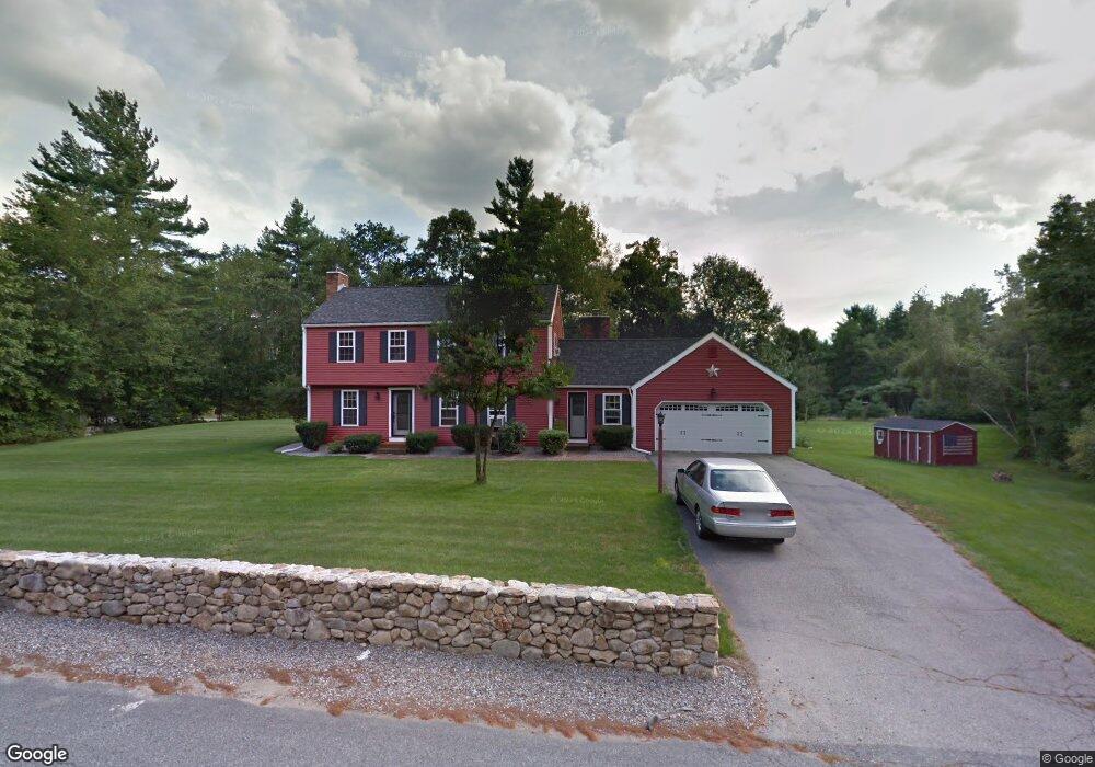
95 Wentworth Dr Bedford, NH 03110
Bedford NeighborhoodEstimated Value: $641,000 - $730,000
4
Beds
3
Baths
1,800
Sq Ft
$387/Sq Ft
Est. Value
About This Home
This home is located at 95 Wentworth Dr, Bedford, NH 03110 and is currently estimated at $695,772, approximately $386 per square foot. 95 Wentworth Dr is a home located in Hillsborough County with nearby schools including Mckelvie Intermediate School, Ross A. Lurgio Middle School, and Bedford High School.
Ownership History
Date
Name
Owned For
Owner Type
Purchase Details
Closed on
Nov 20, 2018
Sold by
Nesbitt Allan R and Nesbitt Sue L
Bought by
Allan R Nesbit Ret
Current Estimated Value
Purchase Details
Closed on
Sep 30, 2003
Sold by
Duffy William J and Duffy Kristin C
Bought by
Nesbitt Allan R and Nesbitt Sue I
Home Financials for this Owner
Home Financials are based on the most recent Mortgage that was taken out on this home.
Original Mortgage
$316,578
Interest Rate
6.29%
Purchase Details
Closed on
Dec 21, 1998
Sold by
Trace Max and Trace Melissa
Bought by
Duffy William J and Duffy Kristin C
Home Financials for this Owner
Home Financials are based on the most recent Mortgage that was taken out on this home.
Original Mortgage
$168,000
Interest Rate
6.85%
Purchase Details
Closed on
May 12, 1997
Sold by
Cornelius Paul E and Cornelius Charlotte D
Bought by
Trace Melissa and Trace Max
Create a Home Valuation Report for This Property
The Home Valuation Report is an in-depth analysis detailing your home's value as well as a comparison with similar homes in the area
Home Values in the Area
Average Home Value in this Area
Purchase History
| Date | Buyer | Sale Price | Title Company |
|---|---|---|---|
| Allan R Nesbit Ret | -- | -- | |
| Nesbitt Allan R | $335,900 | -- | |
| Duffy William J | $210,000 | -- | |
| Trace Melissa | $182,500 | -- |
Source: Public Records
Mortgage History
| Date | Status | Borrower | Loan Amount |
|---|---|---|---|
| Previous Owner | Trace Melissa | $282,000 | |
| Previous Owner | Trace Melissa | $15,000 | |
| Previous Owner | Trace Melissa | $316,578 | |
| Previous Owner | Trace Melissa | $168,000 |
Source: Public Records
Tax History Compared to Growth
Tax History
| Year | Tax Paid | Tax Assessment Tax Assessment Total Assessment is a certain percentage of the fair market value that is determined by local assessors to be the total taxable value of land and additions on the property. | Land | Improvement |
|---|---|---|---|---|
| 2024 | $9,979 | $631,200 | $242,200 | $389,000 |
| 2023 | $9,342 | $631,200 | $242,200 | $389,000 |
| 2022 | $8,488 | $482,300 | $179,400 | $302,900 |
| 2021 | $8,267 | $482,300 | $179,400 | $302,900 |
| 2020 | $7,912 | $395,200 | $130,900 | $264,300 |
| 2019 | $7,489 | $395,200 | $130,900 | $264,300 |
| 2018 | $7,116 | $370,300 | $130,900 | $239,400 |
| 2017 | $6,717 | $370,300 | $130,900 | $239,400 |
| 2016 | $6,776 | $302,900 | $104,400 | $198,500 |
| 2015 | $6,894 | $302,900 | $104,400 | $198,500 |
| 2014 | $6,815 | $302,900 | $104,400 | $198,500 |
| 2013 | $6,649 | $299,900 | $104,400 | $195,500 |
Source: Public Records
Map
Nearby Homes
- 79 Woodward Rd
- 453 Route 101
- 44 McQuade Brook Rd
- 29 Brieann Dr
- 4 Miriam Rd
- 5 Carter Rd
- 2 Baxter Ln
- 10 Winterberry Dr
- 52 Hardy Rd
- 4 Milford St
- 20 Jakes Ln
- 40 Seton Dr
- 276 N Amherst Rd
- 10 Colman Path
- 301 N Amherst Rd
- 258 N Amherst Rd Unit 34
- 16 Summit Rd
- 101 Horace Greeley Rd
- 14 Silver Doe Ln
- 56 Greenfield Pkwy