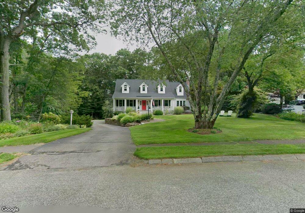
95 York Rd Mansfield, MA 02048
Estimated Value: $901,549 - $1,071,000
4
Beds
3
Baths
2,916
Sq Ft
$341/Sq Ft
Est. Value
About This Home
This home is located at 95 York Rd, Mansfield, MA 02048 and is currently estimated at $995,637, approximately $341 per square foot. 95 York Rd is a home located in Bristol County with nearby schools including Everett W. Robinson Elementary School, Jordan/Jackson Elementary School, and Harold L. Qualters Middle School.
Ownership History
Date
Name
Owned For
Owner Type
Purchase Details
Closed on
Mar 2, 2020
Sold by
Atwil Michael L and Atwil Carol C
Bought by
Michael L Atwil Ft
Current Estimated Value
Purchase Details
Closed on
Sep 1, 1992
Sold by
East Coast Dev Ltd
Bought by
Atwill Michael L and Atwill Carol C
Purchase Details
Closed on
Mar 10, 1992
Sold by
Broderick Corp
Bought by
East Coast Dev Ltd
Create a Home Valuation Report for This Property
The Home Valuation Report is an in-depth analysis detailing your home's value as well as a comparison with similar homes in the area
Home Values in the Area
Average Home Value in this Area
Purchase History
| Date | Buyer | Sale Price | Title Company |
|---|---|---|---|
| Michael L Atwil Ft | -- | None Available | |
| Atwill Michael L | $285,000 | -- | |
| East Coast Dev Ltd | $70,000 | -- |
Source: Public Records
Mortgage History
| Date | Status | Borrower | Loan Amount |
|---|---|---|---|
| Previous Owner | East Coast Dev Ltd | $305,000 | |
| Previous Owner | East Coast Dev Ltd | $100,000 | |
| Previous Owner | East Coast Dev Ltd | $316,000 |
Source: Public Records
Tax History Compared to Growth
Tax History
| Year | Tax Paid | Tax Assessment Tax Assessment Total Assessment is a certain percentage of the fair market value that is determined by local assessors to be the total taxable value of land and additions on the property. | Land | Improvement |
|---|---|---|---|---|
| 2025 | $11,313 | $859,000 | $306,400 | $552,600 |
| 2024 | $11,117 | $823,500 | $269,600 | $553,900 |
| 2023 | $10,852 | $770,200 | $269,600 | $500,600 |
| 2022 | $10,388 | $684,800 | $249,600 | $435,200 |
| 2021 | $2,824 | $678,000 | $226,900 | $451,100 |
| 2020 | $9,887 | $643,700 | $226,900 | $416,800 |
| 2019 | $2,672 | $630,000 | $204,800 | $425,200 |
| 2018 | $2,552 | $609,000 | $195,300 | $413,700 |
| 2017 | $8,486 | $565,000 | $189,800 | $375,200 |
| 2016 | $8,197 | $531,900 | $187,600 | $344,300 |
| 2015 | $8,125 | $524,200 | $187,600 | $336,600 |
Source: Public Records
Map
Nearby Homes
- 4 Buckskin Dr
- 150 Gilbert St
- 24 Maverick Dr
- 255 Mckeon Dr
- 176 Elm St
- 196 Donald Tennant Cir
- 2 Oak St Unit 2D
- 2 Oak St Unit 2A
- 2 Oak St Unit 2B
- 451R Gilbert St
- 11 Landry Ave
- 116 George St
- 450 West St
- 37 Oakleaf Dr
- 115 Westfield Dr
- 406 South St
- 231 Spring St
- 11 Buckthorn Ln
- 57 Vine St
- 16 Treasure Island Rd