950 Laurel Dr Unit 1 Aurora, IL 60506
Edgelawn Randall NeighborhoodEstimated Value: $295,000 - $318,000
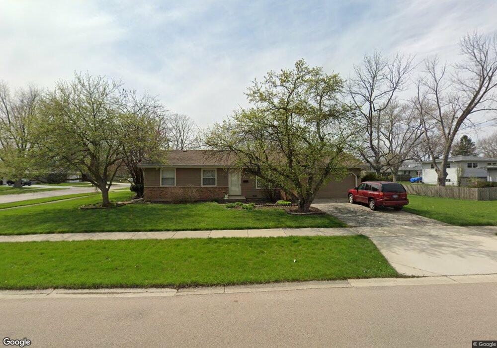
About This Home
This home is located at 950 Laurel Dr Unit 1, Aurora, IL 60506 and is currently estimated at $308,649, approximately $235 per square foot. 950 Laurel Dr Unit 1 is a home located in Kane County with nearby schools including Hall Elementary School, Jefferson Middle School, and West Aurora High School.
Ownership History
We collect this data history from publicly available records. To have your information removed, we recommend requesting removal directly through your county’s website.
Purchase Details
Home Financials for this Owner
Home Financials are based on the most recent Mortgage that was taken out on this home.Home Values in the Area
Average Home Value in this Area
Purchase History
We collect this data history from publicly available records. To have your information removed, we recommend requesting removal directly through your county’s website.
| Date | Buyer | Sale Price | Title Company |
|---|---|---|---|
| $127,000 | First American Title Ins Co |
Mortgage History
We collect this data history from publicly available records. To have your information removed, we recommend requesting removal directly through your county’s website.
| Date | Status | Borrower | Loan Amount |
|---|---|---|---|
| Open | $114,300 |
Tax History
We collect this data history from publicly available records. To have your information removed, we recommend requesting removal directly through your county’s website.
| Year | Tax Paid | Tax Assessment Tax Assessment Total Assessment is a certain percentage of the fair market value that is determined by local assessors to be the total taxable value of land and additions on the property. | Land | Improvement |
|---|---|---|---|---|
| 2024 | $4,366 | $79,625 | $15,912 | $63,713 |
| 2023 | $5,409 | $71,144 | $14,217 | $56,927 |
| 2022 | $5,215 | $64,913 | $12,972 | $51,941 |
| 2021 | $4,874 | $59,342 | $12,077 | $47,265 |
| 2020 | $4,920 | $58,552 | $11,218 | $47,334 |
| 2019 | $4,953 | $56,650 | $10,394 | $46,256 |
| 2018 | $4,533 | $51,407 | $9,614 | $41,793 |
| 2017 | $4,917 | $53,781 | $8,858 | $44,923 |
| 2016 | $4,266 | $46,154 | $7,593 | $38,561 |
| 2015 | -- | $39,118 | $6,529 | $32,589 |
| 2014 | -- | $35,383 | $6,279 | $29,104 |
| 2013 | -- | $34,880 | $6,190 | $28,690 |
Map
- 1976 Robert St
- 1050 Grenada Dr
- 873 Hermitage Dr
- 1950 Heather Dr
- 976 Sapphire Ln
- 991 Sapphire Ln
- 975 Sapphire Ln
- 987 Sapphire Ln
- 1240 Foxcroft Dr
- 1221 Oakleaf Ct
- 1295 Foxcroft Dr
- 1732 Roanoak Ave
- 2221 Mayflower Dr Unit 1
- 1335 Foxcroft Dr
- 888 Shady Ln
- 2418 Courtyard Cir Unit 3
- 2428 Courtyard Cir Unit 3
- 1440 Foxcroft Dr
- 1105 Village Center Pkwy Unit 8
- 348 S Constitution Dr
- 2023 Robert St
- 2013 Robert St Unit 1
- 961 Laurel Dr
- 2010 Richard St Unit 1
- 2010 Richard St
- 1993 Robert St
- 2026 Robert St
- 960 Laurel Dr
- 1990 Richard St
- 2006 Robert St
- 2059 Robert St Unit 1
- 1983 Robert St
- 940 Laurel Dr
- 1996 Robert St
- 2060 Richard St
- 1980 Richard St
- 2060 Robert St Unit 1
- 1986 Robert St Unit 1
- 2069 Robert St Unit 1
- 1973 Robert St Unit 1
Ask me questions while you tour the home.