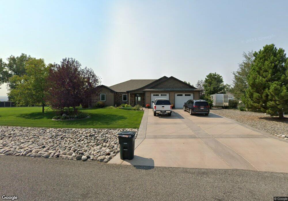
950 Longview Rd Laurel, MT 59044
Estimated Value: $766,000 - $914,000
5
Beds
3
Baths
4,156
Sq Ft
$199/Sq Ft
Est. Value
About This Home
This home is located at 950 Longview Rd, Laurel, MT 59044 and is currently estimated at $825,989, approximately $198 per square foot. 950 Longview Rd is a home with nearby schools including Fred W. Graff School, West School, and Laurel Middle School.
Ownership History
Date
Name
Owned For
Owner Type
Purchase Details
Closed on
May 22, 2018
Sold by
Samuel W Weston T
Bought by
Levesque Rodney D and Levesque Adrienne L
Current Estimated Value
Home Financials for this Owner
Home Financials are based on the most recent Mortgage that was taken out on this home.
Original Mortgage
$454,612
Outstanding Balance
$392,334
Interest Rate
4.5%
Mortgage Type
VA
Estimated Equity
$433,655
Purchase Details
Closed on
Sep 7, 2016
Sold by
Griffith Mark and Griffith Valerie
Bought by
Weston Samuel W and Summers Weston Susan Jane
Purchase Details
Closed on
Mar 19, 2012
Sold by
Foos Clarence A and Foos Naomi
Bought by
Griffith Mark and Griffith Valerie
Create a Home Valuation Report for This Property
The Home Valuation Report is an in-depth analysis detailing your home's value as well as a comparison with similar homes in the area
Home Values in the Area
Average Home Value in this Area
Purchase History
| Date | Buyer | Sale Price | Title Company |
|---|---|---|---|
| Levesque Rodney D | -- | -- | |
| Weston Samuel W | -- | American Title & Escrow | |
| Griffith Mark | -- | None Available |
Source: Public Records
Mortgage History
| Date | Status | Borrower | Loan Amount |
|---|---|---|---|
| Open | Levesque Rodney D | $454,612 |
Source: Public Records
Tax History
| Year | Tax Paid | Tax Assessment Tax Assessment Total Assessment is a certain percentage of the fair market value that is determined by local assessors to be the total taxable value of land and additions on the property. | Land | Improvement |
|---|---|---|---|---|
| 2025 | $4,298 | $767,400 | $110,655 | $656,745 |
| 2024 | $4,298 | $621,300 | $85,262 | $536,038 |
| 2023 | $4,297 | $621,300 | $85,262 | $536,038 |
| 2022 | $3,367 | $521,600 | $0 | $0 |
| 2021 | $3,688 | $521,600 | $0 | $0 |
| 2020 | $3,825 | $524,000 | $0 | $0 |
| 2019 | $3,683 | $524,000 | $0 | $0 |
| 2018 | $3,802 | $466,900 | $0 | $0 |
| 2017 | $3,451 | $466,900 | $0 | $0 |
| 2016 | $3,343 | $458,400 | $0 | $0 |
| 2015 | $3,293 | $458,400 | $0 | $0 |
| 2014 | $2,524 | $191,118 | $0 | $0 |
Source: Public Records
Map
Nearby Homes
- 1031 Fir Ave
- 1104 E 8th St
- 1108 E 8th St
- 1319 Valley Dr
- 605 Date Ave
- 717 E 5th, 506 Alder Ave
- 717 E 5th St
- 1631 Valley Dr
- 601 E 5th St
- 516 Pennsylvania Ave
- 801 E 4th St
- 414 Wyoming Ave
- 110 E 5th St
- 1665 Wild Lupine Ln
- 1254 W Beartooth Dr
- 1216 W 12th Street Cir
- 603 5th Ave
- 1109 10th Ave
- 1735 Lobo Dr
- 1013 W 12th St
- 900 Longview Rd
- 1000 Longview Rd
- 0 Green Bluff Ave
- 895 Longview Rd
- 850 Longview Rd
- 1405 Green Bluff Ave
- 1301 Alder Ave
- 1415 Alder Ave
- 1115 Longview Rd
- 980 Rockfork Cir
- 000 Longview Rd
- 0 Longview Rd
- 1000 Rockfork Cir
- 1440 Green Bluff Ave
- 1030 Longview Rd
- 750 Longview Rd
- 1119 Longview Rd
- 0 Rockfork Cir
- 1455 Green Bluff Ave
- 975 Rockfork Cir
Your Personal Tour Guide
Ask me questions while you tour the home.