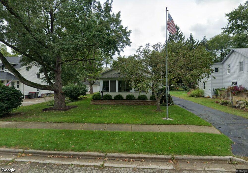
950 Riverside Dr Lowell, MI 49331
Estimated Value: $239,000 - $267,000
2
Beds
2
Baths
1,100
Sq Ft
$232/Sq Ft
Est. Value
About This Home
This home is located at 950 Riverside Dr, Lowell, MI 49331 and is currently estimated at $255,426, approximately $232 per square foot. 950 Riverside Dr is a home located in Kent County with nearby schools including Bushnell Elementary School, Cherry Creek Elementary School, and Lowell Middle School.
Ownership History
Date
Name
Owned For
Owner Type
Purchase Details
Closed on
Aug 27, 2015
Sold by
Marian K Schneider Trust
Bought by
Leah L Vredenburg Trust
Current Estimated Value
Purchase Details
Closed on
Dec 28, 2012
Sold by
Schneider Marian K
Bought by
Schneider Marian K
Purchase Details
Closed on
Apr 14, 2003
Sold by
Schneider Philip H and Schneider Marian K
Bought by
Schneider Philip H and Schneider Marian K
Purchase Details
Closed on
Aug 28, 1977
Bought by
Schneider P and Schneider Marian K Trust
Create a Home Valuation Report for This Property
The Home Valuation Report is an in-depth analysis detailing your home's value as well as a comparison with similar homes in the area
Home Values in the Area
Average Home Value in this Area
Purchase History
| Date | Buyer | Sale Price | Title Company |
|---|---|---|---|
| Leah L Vredenburg Trust | $105,600 | Chicago Title | |
| Schneider Marian K | -- | None Available | |
| Schneider Philip H | -- | -- | |
| Schneider P | $20,000 | -- |
Source: Public Records
Tax History
| Year | Tax Paid | Tax Assessment Tax Assessment Total Assessment is a certain percentage of the fair market value that is determined by local assessors to be the total taxable value of land and additions on the property. | Land | Improvement |
|---|---|---|---|---|
| 2025 | $2,416 | $126,800 | $0 | $0 |
| 2024 | $24 | $99,100 | $0 | $0 |
| 2023 | $2,731 | $90,300 | $0 | $0 |
| 2022 | $2,620 | $81,900 | $0 | $0 |
| 2021 | $2,546 | $74,100 | $0 | $0 |
| 2020 | $2,110 | $67,200 | $0 | $0 |
| 2019 | $2,478 | $61,700 | $0 | $0 |
| 2018 | $2,425 | $59,200 | $0 | $0 |
| 2017 | $3,314 | $51,900 | $0 | $0 |
| 2016 | $3,242 | $46,500 | $0 | $0 |
| 2015 | -- | $46,500 | $0 | $0 |
| 2013 | -- | $45,300 | $0 | $0 |
Source: Public Records
Map
Nearby Homes
- 913 N Monroe St
- 622 N Washington St
- 517 Elm St SE
- 723 N Washington St
- 607 N Washington St
- 418 Elm St SE
- 829 N Jefferson St
- 705 N Jefferson St
- 118 N Hudson St SE
- 1080 N Washington St SE
- 1040 N Washington Rd
- 517 Front St
- 222 S Division St
- 780 Bowes Rd
- 926 E Main St
- 1751 Gee Dr SE
- 913 Clark St Unit 7
- 320 Roberta Jayne Dr
- 2066 Conservation Trail Unit 13
- 1800 W Main St Unit 105
- 948 Riverside Dr
- 956 Riverside Dr
- 937 N Hudson St SE
- 937 N Hudson St
- 964 Riverside Dr
- 961 N Hudson St
- 928 Riverside Dr
- 923 N Hudson St
- 923 N Hudson St SE
- 924 Riverside Dr
- 1004 Riverside Dr
- 950 N Hudson St
- 934 N Hudson St
- 325 Hunt St
- 928 N Hudson St
- 990 N Hudson St
- 990 N Hudson St SE
- 911 N Hudson St SE
- 924 N Hudson St SE
- 924 N Hudson St
Your Personal Tour Guide
Ask me questions while you tour the home.