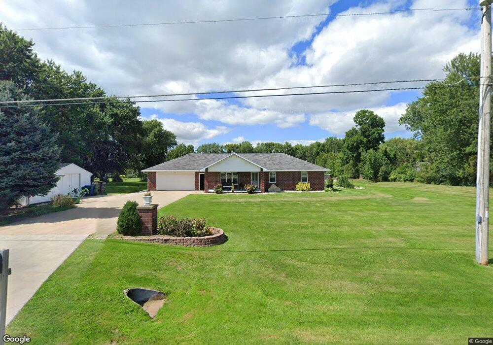
950 Washington St Wrightstown, WI 54180
Estimated Value: $307,000 - $547,000
Studio
--
Bath
--
Sq Ft
47,437
Sq Ft Lot
About This Home
This home is located at 950 Washington St, Wrightstown, WI 54180 and is currently estimated at $391,609. 950 Washington St is a home located in Brown County with nearby schools including Wrightstown Elementary School, Wrightstown Middle School, and Wrightstown High School.
Ownership History
Date
Name
Owned For
Owner Type
Purchase Details
Closed on
May 28, 2003
Sold by
Socha Beverly R
Bought by
Collar Allan F and Collar Lori A
Current Estimated Value
Home Financials for this Owner
Home Financials are based on the most recent Mortgage that was taken out on this home.
Original Mortgage
$120,000
Interest Rate
5.71%
Mortgage Type
Purchase Money Mortgage
Create a Home Valuation Report for This Property
The Home Valuation Report is an in-depth analysis detailing your home's value as well as a comparison with similar homes in the area
Home Values in the Area
Average Home Value in this Area
Purchase History
| Date | Buyer | Sale Price | Title Company |
|---|---|---|---|
| Collar Allan F | $150,000 | Title Serv |
Source: Public Records
Mortgage History
| Date | Status | Borrower | Loan Amount |
|---|---|---|---|
| Closed | Collar Allan F | $120,000 |
Source: Public Records
Tax History
| Year | Tax Paid | Tax Assessment Tax Assessment Total Assessment is a certain percentage of the fair market value that is determined by local assessors to be the total taxable value of land and additions on the property. | Land | Improvement |
|---|---|---|---|---|
| 2024 | $3,900 | $279,200 | $43,200 | $236,000 |
| 2023 | $4,215 | $279,200 | $43,200 | $236,000 |
| 2022 | $4,332 | $186,900 | $32,400 | $154,500 |
| 2021 | $4,188 | $186,900 | $32,400 | $154,500 |
| 2020 | $4,110 | $186,900 | $32,400 | $154,500 |
| 2019 | $3,871 | $186,900 | $32,400 | $154,500 |
| 2018 | $3,626 | $186,900 | $32,400 | $154,500 |
| 2017 | $3,299 | $162,100 | $28,000 | $134,100 |
| 2016 | $3,432 | $162,100 | $28,000 | $134,100 |
| 2015 | $3,567 | $162,100 | $28,000 | $134,100 |
| 2014 | $3,379 | $162,100 | $28,000 | $134,100 |
| 2013 | $3,379 | $162,100 | $28,000 | $134,100 |
Source: Public Records
Map
Nearby Homes
- 30 Golden Wheat Ln
- 735 Park St
- 361 Main St
- 109 Nicole Ln
- 548 Nicole Ln
- 421 Fawnwood Ct
- 269 Kerrigan Dr
- 113 Beckerae Ct
- 248 Kerrigan Dr
- 278 Kerrigan Dr
- 309 Louise Dr
- 110 Beckerae Ct
- 308 Kerrigan Dr
- 287 Kerrigan Dr
- 263 Kerrigan Dr
- 215 Theunis Dr
- 115 Theunis Dr
- 302 Kerrigan Dr
- 119 Main St
- 217 Patricia Ln
Your Personal Tour Guide
Ask me questions while you tour the home.