Estimated Value: $359,035 - $487,000
3
Beds
2
Baths
1,598
Sq Ft
$251/Sq Ft
Est. Value
About This Home
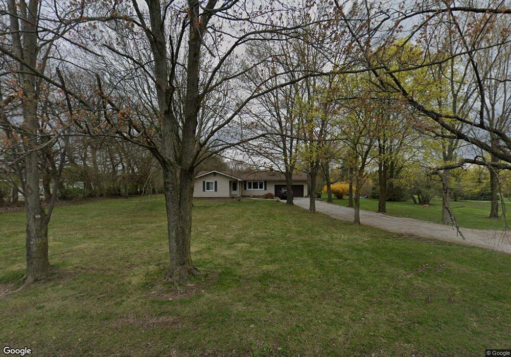
This home is located at 9500 N Platt Rd, Milan, MI 48160 and is currently estimated at $401,259, approximately $251 per square foot. 9500 N Platt Rd is a home located in Washtenaw County with nearby schools including Harvest Elementary School, Heritage School, and Saline Middle School.
Ownership History
Date
Name
Owned For
Owner Type
Purchase Details
Closed on
Jul 14, 2015
Sold by
Goring Tara and Goring Todd D
Bought by
Goring Tara and Goring Todd D
Current Estimated Value
Home Financials for this Owner
Home Financials are based on the most recent Mortgage that was taken out on this home.
Original Mortgage
$198,000
Outstanding Balance
$154,227
Interest Rate
3.83%
Mortgage Type
New Conventional
Estimated Equity
$247,032
Purchase Details
Closed on
Oct 3, 2003
Sold by
Vandevender Joyce M and Vandevender Claude
Bought by
Goring Todd D and Hill Tara
Home Financials for this Owner
Home Financials are based on the most recent Mortgage that was taken out on this home.
Original Mortgage
$242,500
Interest Rate
6.43%
Mortgage Type
Purchase Money Mortgage
Purchase Details
Closed on
Dec 22, 1999
Sold by
Goetz Michael A
Bought by
Stoinoff Kevin
Create a Home Valuation Report for This Property
The Home Valuation Report is an in-depth analysis detailing your home's value as well as a comparison with similar homes in the area
Home Values in the Area
Average Home Value in this Area
Purchase History
| Date | Buyer | Sale Price | Title Company |
|---|---|---|---|
| Goring Tara | -- | -- | |
| Goring Todd D | $250,000 | -- | |
| Stoinoff Kevin | $39,000 | -- |
Source: Public Records
Mortgage History
| Date | Status | Borrower | Loan Amount |
|---|---|---|---|
| Open | Goring Tara | $198,000 | |
| Previous Owner | Goring Todd D | $242,500 |
Source: Public Records
Tax History Compared to Growth
Tax History
| Year | Tax Paid | Tax Assessment Tax Assessment Total Assessment is a certain percentage of the fair market value that is determined by local assessors to be the total taxable value of land and additions on the property. | Land | Improvement |
|---|---|---|---|---|
| 2025 | $3,402 | $164,500 | $0 | $0 |
| 2024 | $2,923 | $149,900 | $0 | $0 |
| 2023 | $2,789 | $137,800 | $0 | $0 |
| 2022 | $3,294 | $128,500 | $0 | $0 |
| 2021 | $3,199 | $122,900 | $0 | $0 |
| 2020 | $3,159 | $122,000 | $0 | $0 |
| 2019 | $3,077 | $115,900 | $115,900 | $0 |
| 2018 | $3,015 | $113,500 | $0 | $0 |
| 2017 | $2,879 | $111,200 | $0 | $0 |
| 2016 | $2,417 | $84,700 | $0 | $0 |
| 2015 | -- | $84,500 | $0 | $0 |
| 2014 | -- | $81,900 | $0 | $0 |
| 2013 | -- | $81,900 | $0 | $0 |
Source: Public Records
Map
Nearby Homes
- 9069 Emerson Dr
- 9037 Rogers Dr
- 9006 Carter Dr
- 60 Timber Ridge Ct
- 201 Judd Rd
- 10160 Ridgeline Dr
- 8450 Carpenter Rd
- 9935 White Tail Dr
- 9931 White Tail Dr
- 290 Shelby Ct Unit 6
- 0 Crane Unit 25051778
- 762 Sutton Ct
- 6081 Lincolnshire Dr
- 758 Sutton Ct
- 4657 Schmitt Ct
- 754 Sutton Ct
- 3833 Pat St
- 3811 Pat St
- Decker Plan at Fosdick Glen of Saline - Toll Brothers at Fosdick Glen
- The Yorkshire Plan at Fosdick Glen of Saline - Fosdick Glen Of Saline
- 9506 N Platt Rd
- 9478 N Platt Rd
- 9464 N Platt Rd
- 9424 N Platt Rd
- 9565 N Platt Rd
- 9541 N Platt Rd
- 9501 N Platt Rd
- 9595 N Platt Rd
- 9617 N Platt Rd
- 9640 Platt Rd
- 9320 N Platt Rd
- 9652 N Platt Rd
- 9640 N Platt Rd
- 9639 N Platt Rd
- 9384 N Platt Rd
- 9298 N Platt Rd
- 9690 N Platt Rd
- 3121 Lutz Dr
- 3071 Lutz Dr
- 9280 N Platt Rd