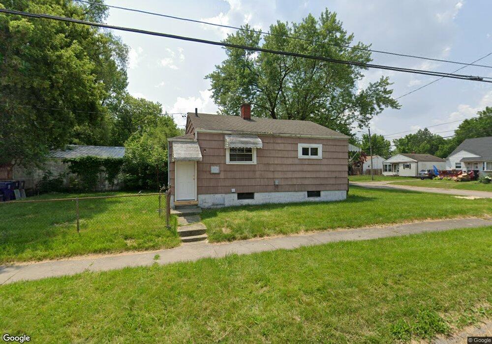
951 Hubbard Ave Flint, MI 48503
Mannhall Park NeighborhoodEstimated Value: $43,000 - $58,345
2
Beds
1
Bath
690
Sq Ft
$72/Sq Ft
Est. Value
About This Home
This home is located at 951 Hubbard Ave, Flint, MI 48503 and is currently estimated at $49,336, approximately $71 per square foot. 951 Hubbard Ave is a home located in Genesee County with nearby schools including Durant-Tuuri-Mott Elementary School, St. Paul Lutheran School, and First Flint Seventh-day Adventist Christian School.
Ownership History
Date
Name
Owned For
Owner Type
Purchase Details
Closed on
Feb 6, 2025
Sold by
Flint River Properties Llc
Bought by
Bishop Carrion International Llc
Current Estimated Value
Purchase Details
Closed on
Jan 12, 2016
Sold by
Zerka Milad and Zerka Georgette
Bought by
Flint River Properties Llc
Purchase Details
Closed on
Feb 26, 2003
Sold by
Hud
Bought by
Zerka Milad
Purchase Details
Closed on
Jun 13, 2002
Sold by
Michigan State Hsng Development Authorit
Bought by
Hud
Purchase Details
Closed on
Aug 22, 2001
Sold by
Norris Barbara K
Bought by
Michigan State Housing Development Autho
Purchase Details
Closed on
Oct 27, 2000
Sold by
Walker R W Walker and Walker A Walker K
Bought by
Norris Barbara K
Create a Home Valuation Report for This Property
The Home Valuation Report is an in-depth analysis detailing your home's value as well as a comparison with similar homes in the area
Home Values in the Area
Average Home Value in this Area
Purchase History
| Date | Buyer | Sale Price | Title Company |
|---|---|---|---|
| Bishop Carrion International Llc | $42,500 | First American Title | |
| Flint River Properties Llc | -- | Attorney | |
| Zerka Milad | $35,021 | Sargents Title Company | |
| Hud | -- | -- | |
| Michigan State Housing Development Autho | $50,632 | -- | |
| Norris Barbara K | $50,000 | Sargents Abstract & Title Co |
Source: Public Records
Tax History Compared to Growth
Tax History
| Year | Tax Paid | Tax Assessment Tax Assessment Total Assessment is a certain percentage of the fair market value that is determined by local assessors to be the total taxable value of land and additions on the property. | Land | Improvement |
|---|---|---|---|---|
| 2025 | $807 | $18,000 | $0 | $0 |
| 2024 | $755 | $18,300 | $0 | $0 |
| 2023 | $744 | $16,100 | $0 | $0 |
| 2022 | $0 | $13,000 | $0 | $0 |
| 2021 | $750 | $11,100 | $0 | $0 |
| 2020 | $698 | $9,900 | $0 | $0 |
| 2019 | $688 | $9,000 | $0 | $0 |
| 2018 | $661 | $9,000 | $0 | $0 |
| 2017 | $646 | $0 | $0 | $0 |
| 2016 | $642 | $0 | $0 | $0 |
| 2015 | -- | $0 | $0 | $0 |
| 2014 | -- | $0 | $0 | $0 |
| 2012 | -- | $8,300 | $0 | $0 |
Source: Public Records
Map
Nearby Homes
- 976 Barney Ave
- 996 Barney Ave
- 960 Mann Ave
- 916 Mann Ave
- 1017 Stocker Ave
- 960 Salisbury Ave
- 1010 Hughes Ave
- 1122 Stocker Ave
- 3413 Augusta St
- 1217 Barney Ave
- 2913 Gibson St
- 1202 Knapp Ave
- 911 Hughes Ave
- 3821 W Court St
- 1308 Barney Ave
- 3801 Augusta St
- 3414 Van Buren Ave
- 959 Tacken St
- 1318 Knapp Ave
- 3921 Joyner St
- 955 Hubbard Ave
- 959 Hubbard Ave
- 952 Barney Ave
- 956 Barney Ave
- 949 Hubbard Ave
- 963 Hubbard Ave
- 960 Barney Ave
- 948 Barney Ave
- 964 Barney Ave
- 952 Hubbard Ave
- 967 Hubbard Ave
- 956 Hubbard Ave
- 945 Hubbard Ave
- 960 Hubbard Ave
- 968 Barney Ave
- 948 Hubbard Ave
- 940 Barney Ave
- 964 Hubbard Ave
- 971 Hubbard Ave
- 939 Hubbard Ave