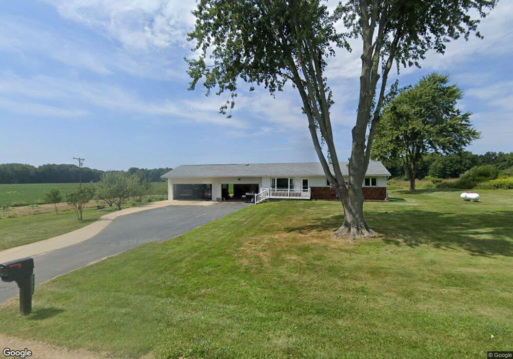
9511 11 Mile Rd Ceresco, MI 49033
Estimated Value: $246,314 - $420,000
3
Beds
2
Baths
1,312
Sq Ft
$245/Sq Ft
Est. Value
About This Home
This home is located at 9511 11 Mile Rd, Ceresco, MI 49033 and is currently estimated at $320,829, approximately $244 per square foot. 9511 11 Mile Rd is a home located in Calhoun County with nearby schools including Harper Creek Middle School and Harper Creek High School.
Ownership History
Date
Name
Owned For
Owner Type
Purchase Details
Closed on
Oct 22, 2024
Sold by
Ankley Brian G
Bought by
Ankley Brian G and Watson Barbara
Current Estimated Value
Purchase Details
Closed on
Nov 16, 2009
Sold by
Lutz Calvin E and Lutz Warranty Deed In Wesley J
Bought by
Ankley Brian G and Cruse Celesta A
Home Financials for this Owner
Home Financials are based on the most recent Mortgage that was taken out on this home.
Original Mortgage
$125,510
Interest Rate
5.05%
Mortgage Type
New Conventional
Purchase Details
Closed on
Jun 23, 2008
Sold by
Lutz Wesley J
Bought by
Lutz Wesley J
Create a Home Valuation Report for This Property
The Home Valuation Report is an in-depth analysis detailing your home's value as well as a comparison with similar homes in the area
Home Values in the Area
Average Home Value in this Area
Purchase History
| Date | Buyer | Sale Price | Title Company |
|---|---|---|---|
| Ankley Brian G | -- | None Listed On Document | |
| Ankley Brian G | $123,000 | Chicago Title | |
| Lutz Wesley J | -- | None Available |
Source: Public Records
Mortgage History
| Date | Status | Borrower | Loan Amount |
|---|---|---|---|
| Previous Owner | Ankley Brian G | $125,510 |
Source: Public Records
Tax History Compared to Growth
Tax History
| Year | Tax Paid | Tax Assessment Tax Assessment Total Assessment is a certain percentage of the fair market value that is determined by local assessors to be the total taxable value of land and additions on the property. | Land | Improvement |
|---|---|---|---|---|
| 2025 | $16 | $105,100 | $0 | $0 |
| 2024 | $1,736 | $94,800 | $0 | $0 |
| 2023 | $2,292 | $89,200 | $0 | $0 |
| 2022 | $2,292 | $84,100 | $0 | $0 |
| 2021 | $2,302 | $79,300 | $0 | $0 |
| 2020 | $2,260 | $71,500 | $0 | $0 |
| 2019 | $0 | $68,600 | $0 | $0 |
| 2018 | $0 | $66,000 | $15,900 | $50,100 |
| 2017 | $0 | $66,100 | $0 | $0 |
| 2016 | $0 | $64,900 | $0 | $0 |
| 2015 | -- | $64,800 | $16,590 | $48,210 |
| 2014 | -- | $63,200 | $16,590 | $46,610 |
Source: Public Records
Map
Nearby Homes
- 10047 11 Mile Rd
- 10660 D Dr S
- 11445 F Dr S
- 11506 11 Mile Rd
- V/L 10 Mile Rd
- 9304 I Dr S
- 8295 D Dr S
- 6703 Oak Grove Rd
- 14880 C Dr S
- 11253 Wildwood Dr
- 275 Battle Creek St
- 12460 Beadle Lake Rd
- V/L Cedar Lake
- 5055 12 1 2 Mile Rd
- 0 15 1 2 Mile Rd Unit 25024661
- 13028 Harper Crossing
- 14 Blue Stone Ridge
- 6185 Willow Run Dr
- 11349 6 Mile Rd
- 1375 Woodland Beach