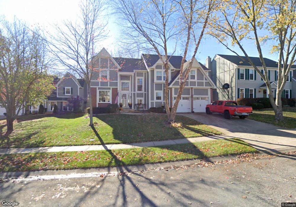
9515 W 129th St Overland Park, KS 66213
Nottingham NeighborhoodEstimated Value: $548,000 - $573,396
4
Beds
4
Baths
3,148
Sq Ft
$179/Sq Ft
Est. Value
About This Home
This home is located at 9515 W 129th St, Overland Park, KS 66213 and is currently estimated at $563,849, approximately $179 per square foot. 9515 W 129th St is a home located in Johnson County with nearby schools including Cottonwood Point Elementary School, Oxford Middle, and Blue Valley Northwest High School.
Ownership History
Date
Name
Owned For
Owner Type
Purchase Details
Closed on
Jan 6, 2001
Sold by
Boyle William L and Boyle Brenda C
Bought by
Weyforth F Griffin and Fitzhenry Weyforth Kathleen
Current Estimated Value
Home Financials for this Owner
Home Financials are based on the most recent Mortgage that was taken out on this home.
Original Mortgage
$179,150
Interest Rate
6.97%
Create a Home Valuation Report for This Property
The Home Valuation Report is an in-depth analysis detailing your home's value as well as a comparison with similar homes in the area
Home Values in the Area
Average Home Value in this Area
Purchase History
| Date | Buyer | Sale Price | Title Company |
|---|---|---|---|
| Weyforth F Griffin | -- | Kansas Title |
Source: Public Records
Mortgage History
| Date | Status | Borrower | Loan Amount |
|---|---|---|---|
| Previous Owner | Weyforth F Griffin | $179,150 |
Source: Public Records
Tax History Compared to Growth
Tax History
| Year | Tax Paid | Tax Assessment Tax Assessment Total Assessment is a certain percentage of the fair market value that is determined by local assessors to be the total taxable value of land and additions on the property. | Land | Improvement |
|---|---|---|---|---|
| 2024 | $5,120 | $50,140 | $11,244 | $38,896 |
| 2023 | $5,267 | $50,600 | $11,244 | $39,356 |
| 2022 | $4,499 | $42,504 | $11,244 | $31,260 |
| 2021 | $4,462 | $39,951 | $9,777 | $30,174 |
| 2020 | $4,566 | $40,606 | $8,145 | $32,461 |
| 2019 | $4,506 | $39,227 | $6,515 | $32,712 |
| 2018 | $4,206 | $35,892 | $6,515 | $29,377 |
| 2017 | $3,805 | $31,912 | $5,674 | $26,238 |
| 2016 | $3,606 | $30,222 | $5,674 | $24,548 |
| 2015 | $3,476 | $29,026 | $5,674 | $23,352 |
| 2013 | -- | $26,404 | $5,674 | $20,730 |
Source: Public Records
Map
Nearby Homes
- 12823 Connell Dr
- 12907 Connell Dr
- 12906 Wedd St
- 13168 Carter St
- 9139 W 131st Place
- 10416 W 131st St
- 13163 Kessler St
- 9608 W 132nd Terrace
- 13211 Farley St
- 9117 W 125th Terrace
- 13416 W 178th St
- 13408 W 178th St
- 8957 W 125th Terrace
- 12510 Knox St
- 12506 Knox St
- 10438 W 125th Terrace
- 12229 Carter St
- 9424 W 122nd St
- 12221 Farley St
- 9505 W 122nd St
- 9601 W 129th St
- 9511 W 129th St
- 12919 Carter St
- 12915 Carter St
- 9605 W 129th St
- 12923 Carter St
- 9507 W 129th St
- 9514 W 129th St
- 12911 Carter St
- 9510 W 129th St
- 9600 W 129th St
- 9609 W 129th St
- 12927 Carter St
- 9503 W 129th St
- 9506 W 129th St
- 9502 W 129th St
- 9604 W 129th St
- 9602 W 128th Terrace
- 12938 Carter St
- 12931 Carter St