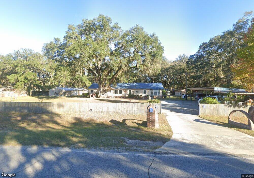
952 Dunlevie Rd Allenhurst, GA 31301
Estimated Value: $239,000 - $263,808
2
Beds
2
Baths
1,672
Sq Ft
$148/Sq Ft
Est. Value
About This Home
This home is located at 952 Dunlevie Rd, Allenhurst, GA 31301 and is currently estimated at $248,202, approximately $148 per square foot. 952 Dunlevie Rd is a home located in Liberty County with nearby schools including Frank Long Elementary School, Lewis Frasier Middle School, and Liberty County High School.
Ownership History
Date
Name
Owned For
Owner Type
Purchase Details
Closed on
Jan 9, 2015
Sold by
Flack Elzaja J
Bought by
Flack Kornelia B and Flack Elzaja W
Current Estimated Value
Purchase Details
Closed on
May 29, 1985
Bought by
Flack Elzajia Washington
Purchase Details
Closed on
Jun 15, 1984
Bought by
Harris Harlon Hugh
Purchase Details
Closed on
Feb 27, 1978
Bought by
Hoard Ronald and Hoard Nancy
Create a Home Valuation Report for This Property
The Home Valuation Report is an in-depth analysis detailing your home's value as well as a comparison with similar homes in the area
Home Values in the Area
Average Home Value in this Area
Purchase History
| Date | Buyer | Sale Price | Title Company |
|---|---|---|---|
| Flack Kornelia B | -- | -- | |
| Flack Elzajia Washington | $7,000 | -- | |
| Harris Harlon Hugh | $6,500 | -- | |
| Hoard Ronald | -- | -- |
Source: Public Records
Tax History Compared to Growth
Tax History
| Year | Tax Paid | Tax Assessment Tax Assessment Total Assessment is a certain percentage of the fair market value that is determined by local assessors to be the total taxable value of land and additions on the property. | Land | Improvement |
|---|---|---|---|---|
| 2024 | $1,137 | $73,916 | $3,838 | $70,078 |
| 2023 | $1,137 | $68,518 | $3,838 | $64,680 |
| 2022 | $1,066 | $59,394 | $3,070 | $56,324 |
| 2021 | $1,013 | $49,084 | $3,070 | $46,014 |
| 2020 | $993 | $49,084 | $3,070 | $46,014 |
| 2019 | $1,340 | $49,462 | $3,070 | $46,392 |
| 2018 | $1,296 | $49,462 | $3,070 | $46,392 |
| 2017 | $1,641 | $49,839 | $3,070 | $46,769 |
| 2016 | $1,296 | $49,839 | $3,070 | $46,769 |
| 2015 | $1,290 | $49,131 | $2,362 | $46,769 |
| 2014 | $1,290 | $37,311 | $2,362 | $34,949 |
| 2013 | -- | $41,456 | $2,548 | $38,908 |
Source: Public Records
Map
Nearby Homes
- 996 Dunlevie Rd
- 100 Mccumber Dr
- 480 Mccumber Dr
- 7.22 AC Dunlevie Rd
- 166 Stephanie Dr
- 619 Mccumber Dr
- 1600 Dunlevie Rd Unit 16
- 534 Deer Meadow Way
- 685 Deer Meadow Way
- 256 Deer Meadow Way
- 1118 Buckhead Loop
- 684 Deer Meadow Way
- 514 Deer Meadow Way
- 554 Deer Meadow Way
- 704 Deer Meadow Way
- 575 Deer Meadow Way
- 593 Deer Meadow Way
- 662 Deer Meadow Way
- 374 Deer Meadow Way
- 663 Deer Meadow Way