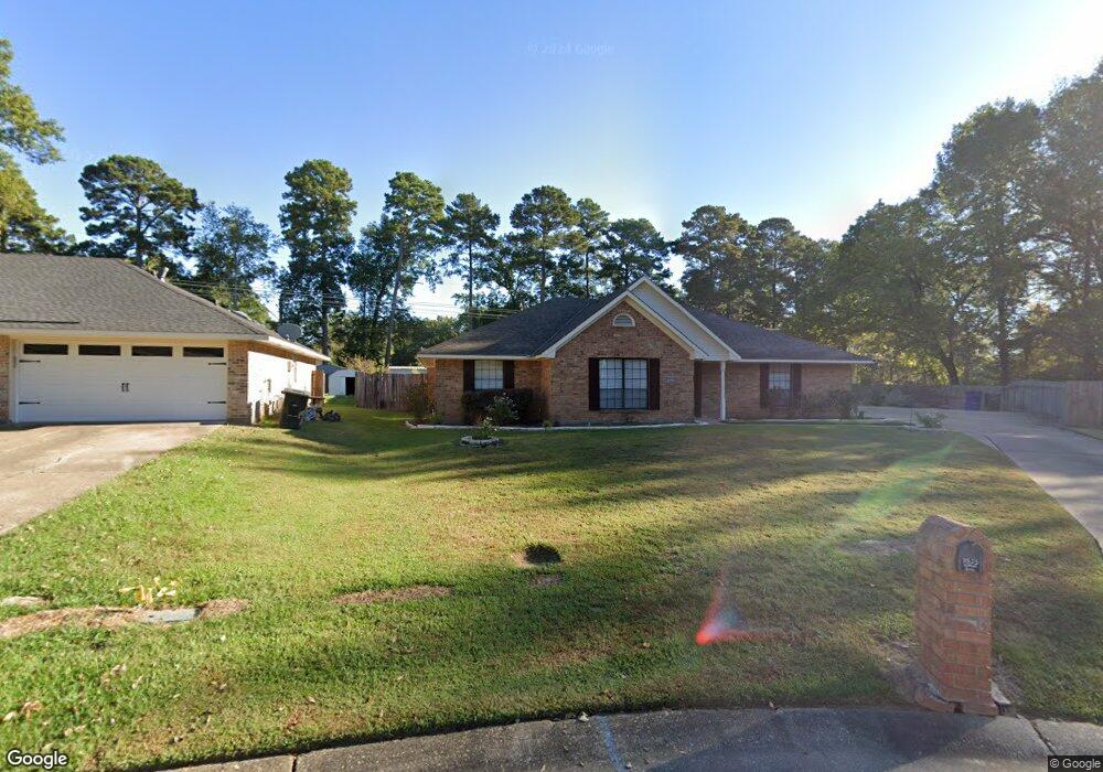
9525 Lytham Dr Shreveport, LA 71129
Pines Road NeighborhoodEstimated Value: $212,775 - $229,000
3
Beds
2
Baths
1,629
Sq Ft
$137/Sq Ft
Est. Value
About This Home
This home is located at 9525 Lytham Dr, Shreveport, LA 71129 and is currently estimated at $222,694, approximately $136 per square foot. 9525 Lytham Dr is a home located in Caddo Parish with nearby schools including Fairfield Magnet School, Judson Fundamental Elementary School, and South Highlands Elementary.
Ownership History
Date
Name
Owned For
Owner Type
Purchase Details
Closed on
Jan 23, 2011
Sold by
Baldwin David James and Baldwin Cynthia Harju
Bought by
Washington David J
Current Estimated Value
Home Financials for this Owner
Home Financials are based on the most recent Mortgage that was taken out on this home.
Original Mortgage
$160,930
Interest Rate
3.34%
Mortgage Type
FHA
Create a Home Valuation Report for This Property
The Home Valuation Report is an in-depth analysis detailing your home's value as well as a comparison with similar homes in the area
Home Values in the Area
Average Home Value in this Area
Purchase History
| Date | Buyer | Sale Price | Title Company |
|---|---|---|---|
| Washington David J | -- | None Available |
Source: Public Records
Mortgage History
| Date | Status | Borrower | Loan Amount |
|---|---|---|---|
| Closed | Washington David J | $160,930 |
Source: Public Records
Tax History Compared to Growth
Tax History
| Year | Tax Paid | Tax Assessment Tax Assessment Total Assessment is a certain percentage of the fair market value that is determined by local assessors to be the total taxable value of land and additions on the property. | Land | Improvement |
|---|---|---|---|---|
| 2024 | $2,114 | $13,559 | $1,972 | $11,587 |
| 2023 | $1,982 | $12,436 | $1,878 | $10,558 |
| 2022 | $1,982 | $12,436 | $1,878 | $10,558 |
| 2021 | $1,952 | $12,436 | $1,878 | $10,558 |
| 2020 | $1,952 | $12,436 | $1,878 | $10,558 |
| 2019 | $1,970 | $12,183 | $1,878 | $10,305 |
| 2018 | $603 | $12,183 | $1,878 | $10,305 |
| 2017 | $2,001 | $12,183 | $1,878 | $10,305 |
| 2015 | $689 | $12,813 | $1,878 | $10,935 |
| 2014 | $589 | $12,010 | $1,880 | $10,130 |
| 2013 | -- | $12,010 | $1,880 | $10,130 |
Source: Public Records
Map
Nearby Homes
- 9416 E Heatherstone Dr
- 9440 Castlebrook Dr
- 5613 N Heatherstone Dr
- 0 Industrial Rd
- 9317 Newcastle Blvd
- 5610 Kenilworth Cir
- 9319 Lytham Dr
- 9305 Castlebrook Dr
- 9430 Ashmont St
- 4816 Honeysuckle Ln
- 5614 Red Pine
- 0 Flournoy Lucas Unit 20855337
- 0 Flournoy Lucas Unit 20855352
- 0 Flournoy Lucas Unit 20855345
- 0 Flournoy Lucas Unit 20855355
- 9219 Green Forest Rd
- 9124 Hearth Ln
- 8882 Cromwell Dr
- Montana Plan at New Castle Pines
- Jefferson w/ Bonus Plan at New Castle Pines
- 9521 Lytham Dr
- 9526 Lytham Dr
- 9520 Castlebrook Dr
- 9517 Lytham Dr
- 9516 Castlebrook Dr
- 9524 Lytham Dr
- 9524 Castlebrook Dr
- 9513 Lytham Dr
- 9512 Castlebrook Dr
- 9520 Lytham Dr
- 9516 Lytham Dr
- 9508 Castlebrook Dr
- 9509 Lytham Dr
- 9437 E Heatherstone Dr
- 9512 Lytham Dr
- 9504 Castlebrook Dr
- 9508 Lytham Dr
- 9505 Lytham Dr
- 9433 E Heatherstone Dr
- 9515 Castlebrook Dr