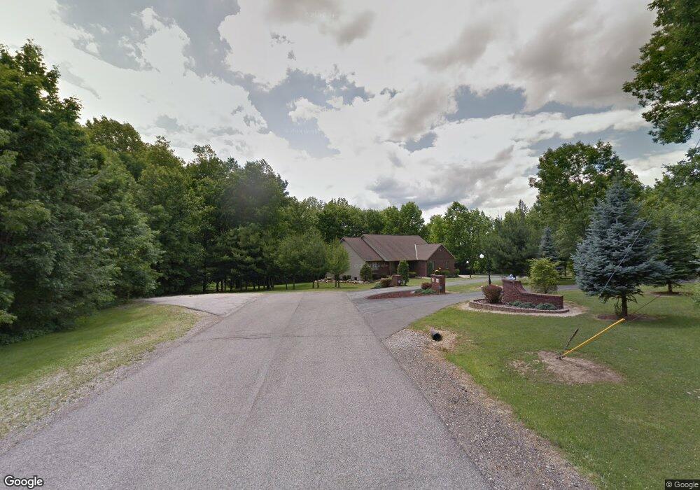
953 Freeway Cir Mansfield, OH 44903
Estimated Value: $95,000 - $157,000
Studio
2
Baths
--
Sq Ft
0.83
Acres
About This Home
This home is located at 953 Freeway Cir, Mansfield, OH 44903 and is currently estimated at $129,333. 953 Freeway Cir is a home located in Richland County with nearby schools including Madison High School, St. Peter's Elementary/Montessori School, and St. Peter's Junior High / High School.
Ownership History
Date
Name
Owned For
Owner Type
Purchase Details
Closed on
Feb 20, 2009
Sold by
Osgar Michael R and Osgar Tiffany J
Bought by
Osgar Michael R and Osgar Tiffany J
Current Estimated Value
Home Financials for this Owner
Home Financials are based on the most recent Mortgage that was taken out on this home.
Original Mortgage
$11,000
Outstanding Balance
$7,965
Interest Rate
5.14%
Mortgage Type
Credit Line Revolving
Estimated Equity
$121,368
Purchase Details
Closed on
Apr 18, 2001
Sold by
Pamer Joseph A
Bought by
Osgar Michael R
Home Financials for this Owner
Home Financials are based on the most recent Mortgage that was taken out on this home.
Original Mortgage
$141,500
Interest Rate
6.5%
Mortgage Type
New Conventional
Purchase Details
Closed on
Aug 27, 1991
Sold by
Pamer Joseph A
Bought by
Pamer Joseph A
Create a Home Valuation Report for This Property
The Home Valuation Report is an in-depth analysis detailing your home's value as well as a comparison with similar homes in the area
Home Values in the Area
Average Home Value in this Area
Purchase History
| Date | Buyer | Sale Price | Title Company |
|---|---|---|---|
| Osgar Michael R | -- | Attorney | |
| Osgar Michael R | $9,000 | -- | |
| Pamer Joseph A | $1,300 | -- |
Source: Public Records
Mortgage History
| Date | Status | Borrower | Loan Amount |
|---|---|---|---|
| Open | Osgar Michael R | $11,000 | |
| Open | Osgar Michael R | $148,000 | |
| Closed | Osgar Michael R | $141,500 |
Source: Public Records
Tax History
| Year | Tax Paid | Tax Assessment Tax Assessment Total Assessment is a certain percentage of the fair market value that is determined by local assessors to be the total taxable value of land and additions on the property. | Land | Improvement |
|---|---|---|---|---|
| 2024 | $410 | $9,560 | $9,560 | $0 |
| 2023 | $419 | $9,560 | $9,560 | $0 |
| 2022 | $438 | $8,910 | $8,910 | $0 |
| 2021 | $444 | $8,910 | $8,910 | $0 |
| 2020 | $419 | $8,910 | $8,910 | $0 |
| 2019 | $395 | $7,560 | $7,560 | $0 |
| 2018 | $391 | $7,560 | $7,560 | $0 |
| 2017 | $384 | $7,560 | $7,560 | $0 |
| 2016 | $306 | $5,860 | $5,860 | $0 |
| 2015 | $289 | $5,860 | $5,860 | $0 |
| 2014 | $288 | $5,860 | $5,860 | $0 |
| 2012 | $139 | $6,040 | $6,040 | $0 |
Source: Public Records
Map
Nearby Homes
- 1715 Mansfield Lucas Rd
- 0 Woodville Rd Unit Lot 14952, 14953
- 0 Woodville Rd Unit Lot 14954, 14955
- 0 Woodville Rd Unit Lot 14956, 14957,
- 2420 Mansfield Washington Rd
- 794 Mansfield Washington Rd
- 716 Mansfield Washington Rd
- 0 State Route 39 & I-71 Southeast Quadrant
- 0 State Route 39 & I-71 Northeast Quadrant
- 1599 S Main St
- 50 Lilac Ct E
- 65 Logan Rd
- 537 Woodville Rd
- 33 Rambleside Dr
- 104 Elmridge Rd
- 1851 State Route 39
- 1290 Bonnie Dr
- 430 Beethoven St
- 519 S Diamond St
- 1179 Burkwood Rd
- 965 Freeway Cir
- 989 Freeway Cir
- 959 Freeway Cir
- 1001 Freeway Cir
- 1015 Freeway Cir
- 1440 Sandy Ln
- 1724 Denzler Cir
- 1030 Freeway Cir
- 1405 Sandy Ln
- 1035 Freeway Cir
- 1344 Sandy Ln
- 1311 Sandy Ln
- 1350 Sandy Ln
- 1425 Sandy Ln
- 1441 Sandy Ln
- 1694 Mansfield Lucas Rd
- 1260 Washington North Rd
- 1714 Mansfield Lucas Rd
- 1272 Washington North Rd
- 1455 Sandy Ln
Your Personal Tour Guide
Ask me questions while you tour the home.